MyTopo
Tylersburg Pennsylvania US Topo Map
Couldn't load pickup availability
Also explore the Tylersburg Forest Service Topo of this same quad for updated USFS data
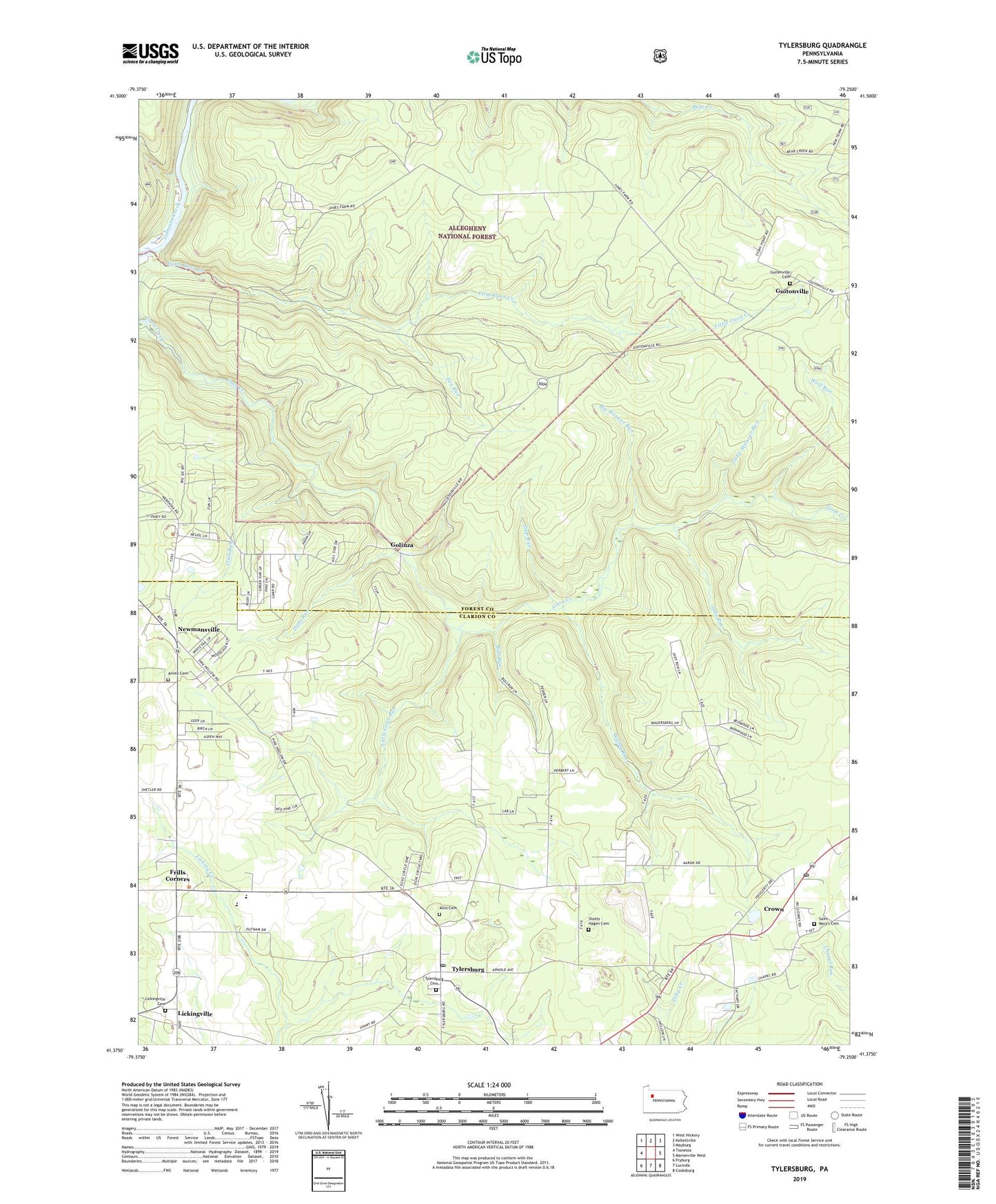
2023 topographic map quadrangle Tylersburg in the state of Pennsylvania. Scale: 1:24000. Based on the newly updated USGS 7.5' US Topo map series, this map is in the following counties: Forest, Clarion. The map contains contour data, water features, and other items you are used to seeing on USGS maps, but also has updated roads and other features. This is the next generation of topographic maps. Printed on high-quality waterproof paper with UV fade-resistant inks.
Quads adjacent to this one:
West: Tionesta
Northwest: West Hickory
North: Kellettville
Northeast: Mayburg
East: Marienville West
Southeast: Cooksburg
South: Lucinda
Southwest: Fryburg
This map covers the same area as the classic USGS quad with code o41079d3.
Contains the following named places: Allio Cemetery, Amity Cemetery, Armitage Newmansville Airport, Big Weaver Run, Bull Run, Crown, Crown Census Designated Place, Crown Post Office, Crown Pumping Station, Dans Run, Farmington Township School, Flynn School, Fox Run, Frills Corners, Golinza, Guitenville Cemetery, Guitonville, Haskill Station, Irish Run, Judy Run, Kerr School, Lickingville, Lickingville Cemetery, Little Coon Creek, Little Coon Run, Little Weaver Run, Love School, Newmansville, North Clarion High School, Saint Mary's Cemetery, Saint Marys School, Shotts - Hagen Cemetery, Shotts School, State Game Lands Number 24, Township of Green, Tylersburg, Tylersburg Cemetery, Tylersburg Census Designated Place, Tylersburg Post Office, Walley Run, Wolf Run, Young Hill School, Zipp Run, ZIP Codes: 16353, 16361