
MyTopo
Williamsport SE Pennsylvania US Topo Map
Couldn't load pickup availability
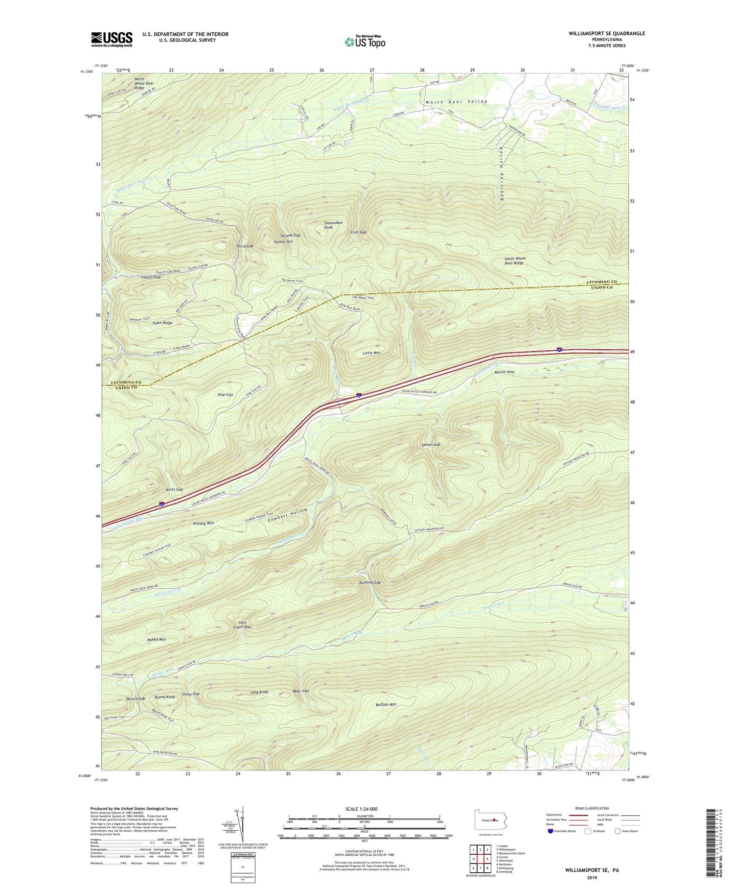
2019 topographic map quadrangle Williamsport SE in the state of Pennsylvania. Scale: 1:24000. Based on the newly updated USGS 7.5' US Topo map series, this map is in the following counties: Union, Lycoming. The map contains contour data, water features, and other items you are used to seeing on USGS maps, but also has updated roads and other features. This is the next generation of topographic maps. Printed on high-quality waterproof paper with UV fade-resistant inks.
Quads adjacent to this one:
West: Carroll
Northwest: Linden
North: Williamsport
Northeast: Montoursville South
East: Allenwood
Southeast: Lewisburg
South: Mifflinburg
Southwest: Hartleton
Contains the following named places: Bear Gap, Bear Gap Trail, Beartrap Hollow, Buck Path Trail, Buffalo Mountain, Buffalo Mountain Trail, Clark Trail, Cowbell Hollow, Cowbell Hollow Trail, Fawn Ridge, First Gap, Fourth Gap, Glen Cabin Gap, Glen Cabin Trail, Grosses Gap Trail, Hoffa Trail, Kettle Hole, Kettle Hole Trail, Keystone Camp, Kurtz Gap, Kurtz Gap Trail, Lake Trail, Lick Run, Lick Run Trail, Little Mountain, Long Knob, Lyman Gap, Lyman Gap Trail, Metzger Trail, Mile Run, Mile Run Camp, Mile Run Trail, Milton Camp, Mud Hole Trail, Pine Flat, Pine Flat Trail, Potato Hill, Round Knob, Running Gap, Sand Spring Camp, Sand Spring Run, Second Gap, Second Gap Trail, Sheet Iron Trail, Shoemaker Knob, South White Deer Ridge, Spruce Gap, Stony Gap, Third Gap, Third Gap Trail, Top Mountain Trail, Township of Washington, Webster Trail, ZIP Code: 17810


