MyTopo
Yauhannah South Carolina US Topo Map
Couldn't load pickup availability
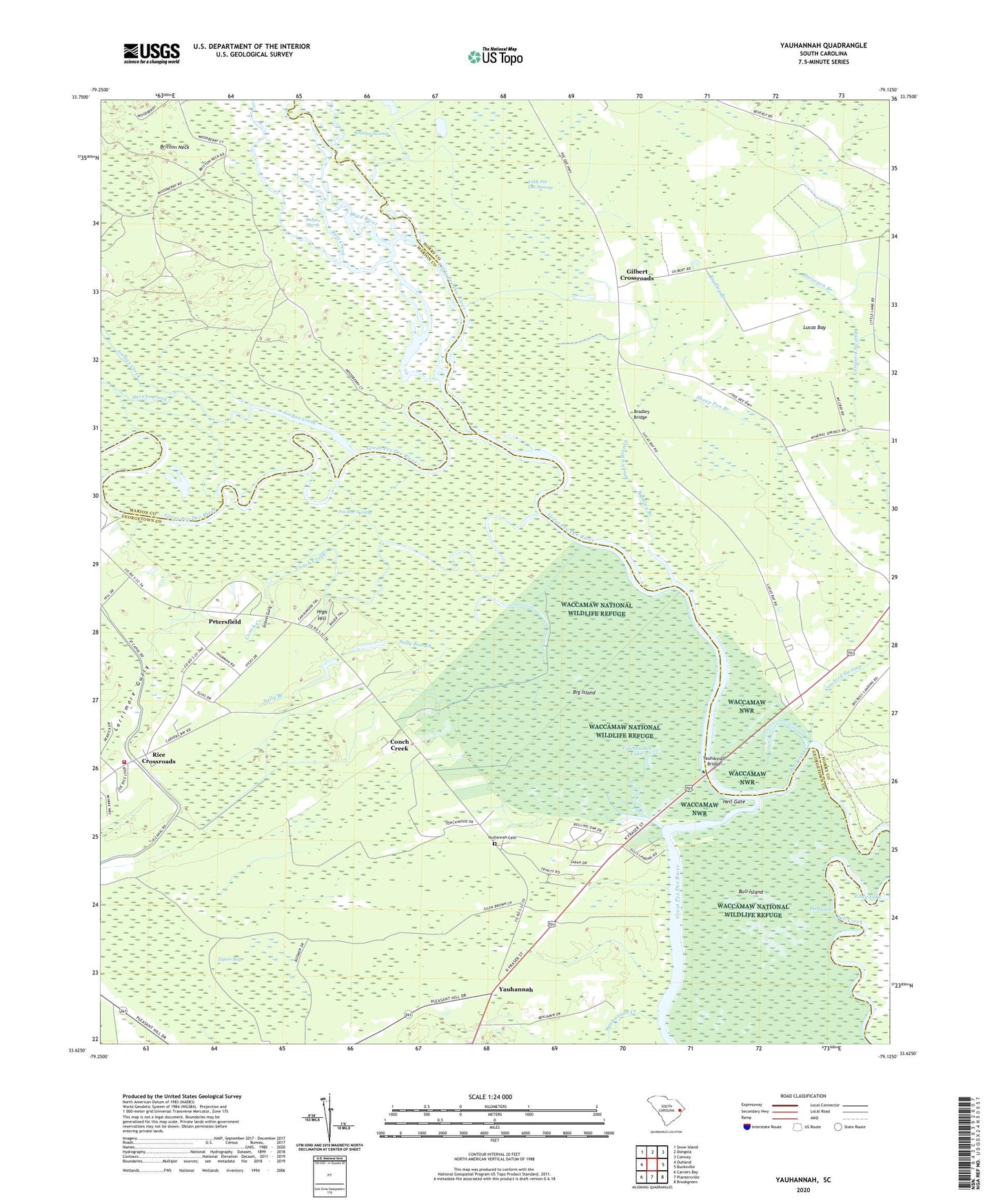
2024 topographic map quadrangle Yauhannah in the state of South Carolina. Scale: 1:24000. Based on the newly updated USGS 7.5' US Topo map series, this map is in the following counties: Georgetown, Horry, Marion. The map contains contour data, water features, and other items you are used to seeing on USGS maps, but also has updated roads and other features. This is the next generation of topographic maps. Printed on high-quality waterproof paper with UV fade-resistant inks.
Quads adjacent to this one:
West: Outland
Northwest: Snow Island
North: Dongola
Northeast: Conway
East: Bucksville
Southeast: Brookgreen
South: Plantersville
Southwest: Carvers Bay
This map covers the same area as the classic USGS quad with code o33079f2.
Contains the following named places: Big Island, Black Lake, Bradley Branch, Bradley Bridge, Conch Creek, Cowford Swamp, Dead River, Eddy Lake, Georgetown Fire Department Station 14, Gilbert Crossroads, Gravel Gully, Gravel Gully Church, Gravel Gully School, Hell Gate, High Hill, Horsepen Branch, Inland School, Jacobs Creek, Jiles Creek, Jordan Creek, Jordan Lake, Larrimore Gully, Little Pee Dee River, Lucas Bay, Lucas Bay Plantation, Parker Landing, Pee Dee Park, Pee Dee Swamp, Petersfield, Port Harrelson Ferry, Rice Crossroads, Rockingham Church, Russ Creek, Russ Lake, Saint Joseph Church, Sally Branch, Sanders Landing, Sheep Pen Branch, Trinity Church, Tupelo Bay, Yahany Ferry, Yauhannah, Yauhannah Bridge, Yauhannah Cemetery, Yauhannah Church, Yauhannah Creek, Yauhannah Forest Fire Tower, Yauhannah Lake