MyTopo
Clubhouse Crossroads South Carolina US Topo Map
Couldn't load pickup availability
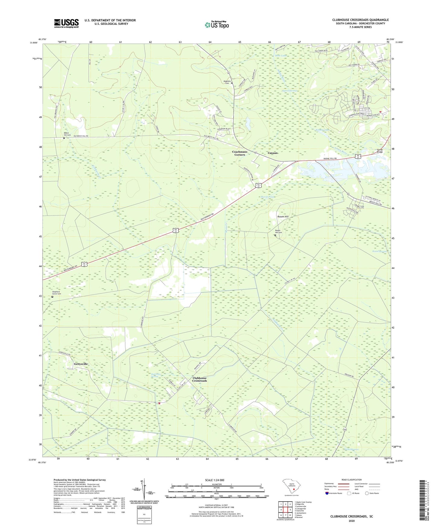
2020 topographic map quadrangle Clubhouse Crossroads in the state of South Carolina. Scale: 1:24000. Based on the newly updated USGS 7.5' US Topo map series, this map is in the following counties: Dorchester. The map contains contour data, water features, and other items you are used to seeing on USGS maps, but also has updated roads and other features. This is the next generation of topographic maps. Printed on high-quality waterproof paper with UV fade-resistant inks.
Quads adjacent to this one:
West: Cottageville
Northwest: Maple Cane Swamp
North: Ridgeville
Northeast: Summerville
East: Stallsville
Southeast: Ravenel
South: Osborn
Southwest: Jacksonboro
Contains the following named places: Beech Hill Cemetery, Beech Hill Church, Beech Hill School, Bobs Lake, Buck Dam Swamp, Canaan, Canaan School, Canaan United Methodist Church, Clubhouse Crossroads, Coachmans Corners, Dorchester County Fire Department Ponds Station 11, Drayton Dam, Faith Church, Gettysville, Givhans Alternative School, Knightsville Church, Magnolia Cemetery, Marsh Pond, Negro Lake, Rosom Hill, Rosom Hill Cemetery, Sand Hill Church, Sand Hill School, Sandhill Volunteer Fire Department Number 1, Schultz Lake, Scotts Creek, Shepherd Grove Cemetery, Shepherd Grove Church, Shepherd Grove School, Slands Bridge, The Forks, Waringville, Winwright