
MyTopo
Crocketville South Carolina US Topo Map
Couldn't load pickup availability
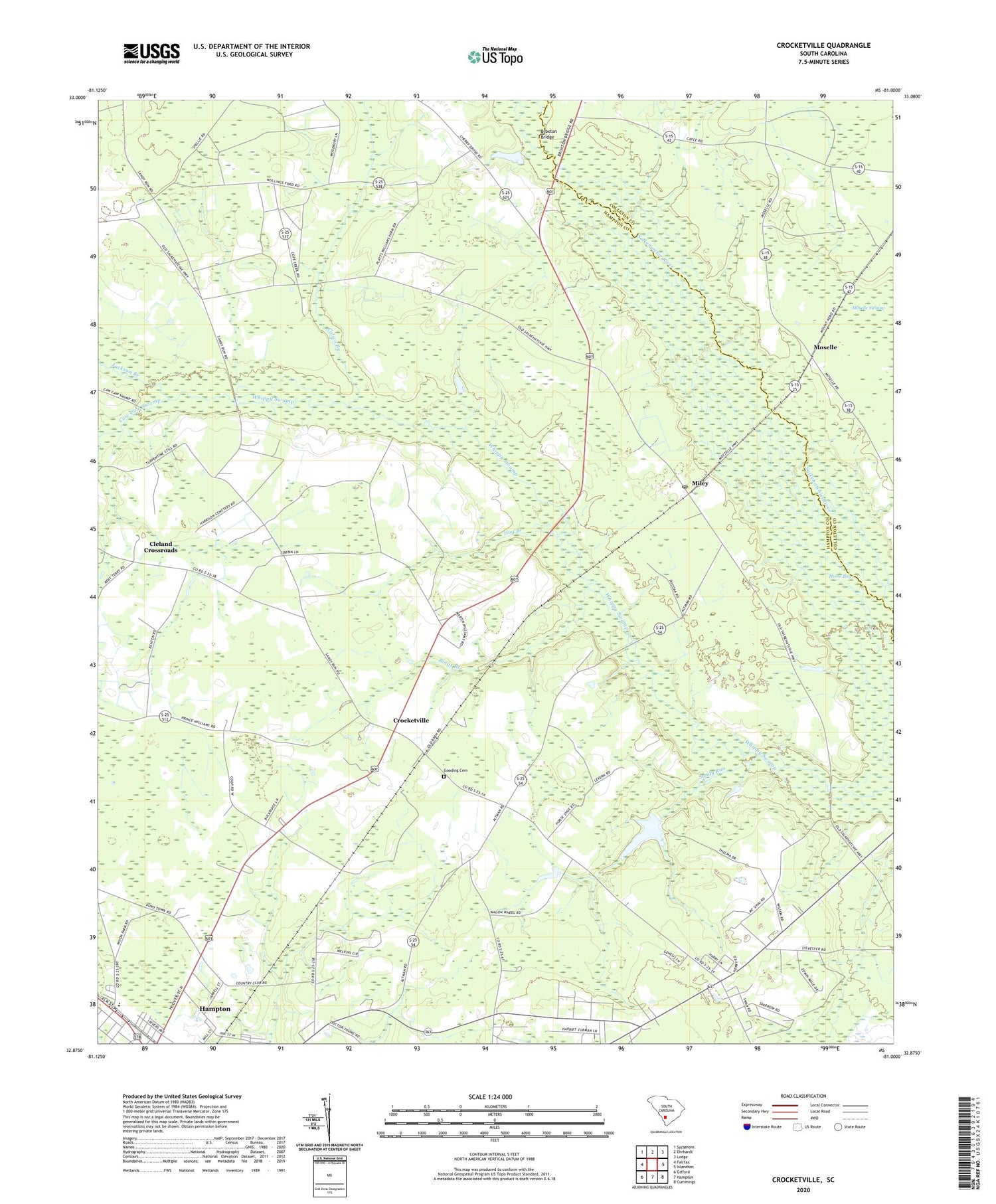
2020 topographic map quadrangle Crocketville in the state of South Carolina. Scale: 1:24000. Based on the newly updated USGS 7.5' US Topo map series, this map is in the following counties: Hampton, Colleton. The map contains contour data, water features, and other items you are used to seeing on USGS maps, but also has updated roads and other features. This is the next generation of topographic maps. Printed on high-quality waterproof paper with UV fade-resistant inks.
Quads adjacent to this one:
West: Fairfax
Northwest: Sycamore
North: Ehrhardt
Northeast: Lodge
East: Islandton
Southeast: Cummings
South: Hampton
Southwest: Gifford
Contains the following named places: Ben Hazel Primary School, Bethlehem Church, Bings Branch, Broxton Bridge, Calico Branch, Caw Caw Swamp, Cedar Grove School, Cleland Crossroads, Cleland School, Crocketville, Crocketville Post Office, Dry Swamp School, Enon Church, God of Prophesy Church, Gooding Cemetery, Grace Baptist Church, Hampton Industrial Park, Harmony Church, Hay School, Hickory Grove Church, Hickory Grove School, Hog Branch, Jackson Branch, Jenny and Platts Sawmill, Kinards Pond, Lone Star School, Maulding Millpond, Miley, Miley Church of God, Miley Post Office, Moselle, Mount Pleasant Church, New Hope School, Platts School, Poor Hope Church, Saint Paul Church, Saint Paul School, Sanders Branch School, Sandy Branch Church, Sandy Run, Sandy Run Baptist Church, Sandy Run School, Shady Grove Church, Sinai Church, Sky City Plaza Shopping Center, South Carolina Noname 25016 D-2597 Dam, West End Shopping Center, Wymans School, ZIP Code: 29924


