MyTopo
Cummings South Carolina US Topo Map
Couldn't load pickup availability
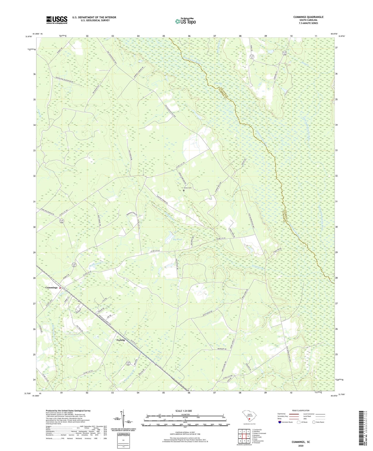
2024 topographic map quadrangle Cummings in the state of South Carolina. Scale: 1:24000. Based on the newly updated USGS 7.5' US Topo map series, this map is in the following counties: Hampton, Colleton. The map contains contour data, water features, and other items you are used to seeing on USGS maps, but also has updated roads and other features. This is the next generation of topographic maps. Printed on high-quality waterproof paper with UV fade-resistant inks.
Quads adjacent to this one:
West: Hampton
Northwest: Crocketville
North: Islandton
Northeast: Sniders Crossroads
East: Black Creek
Southeast: Yemassee
South: McPhersonville
Southwest: Grays
This map covers the same area as the classic USGS quad with code o32080g8.
Contains the following named places: Annie Laurie Church, Antioch Church, Antioch School, Big Pond, Broadwater School, Crews Cemetery, Cummings, Deep Branch Church, Deep Creek, Fechtig, Hampton Fire Department Station 90, Holiness Church, Horse Bay, Huggin Oak Church of God, Huggins Oak School, Jerusalem Church, Jerusalem School, Little Salkehatchie River, Mount Olive Church, Ricepatch Creek, Rocky Branch School, Saint Johns School, Salkehatchie River, South Carolina Noname 25012 D-2599 Dam, Tennants Branch, Tram Road School, Varntown