MyTopo
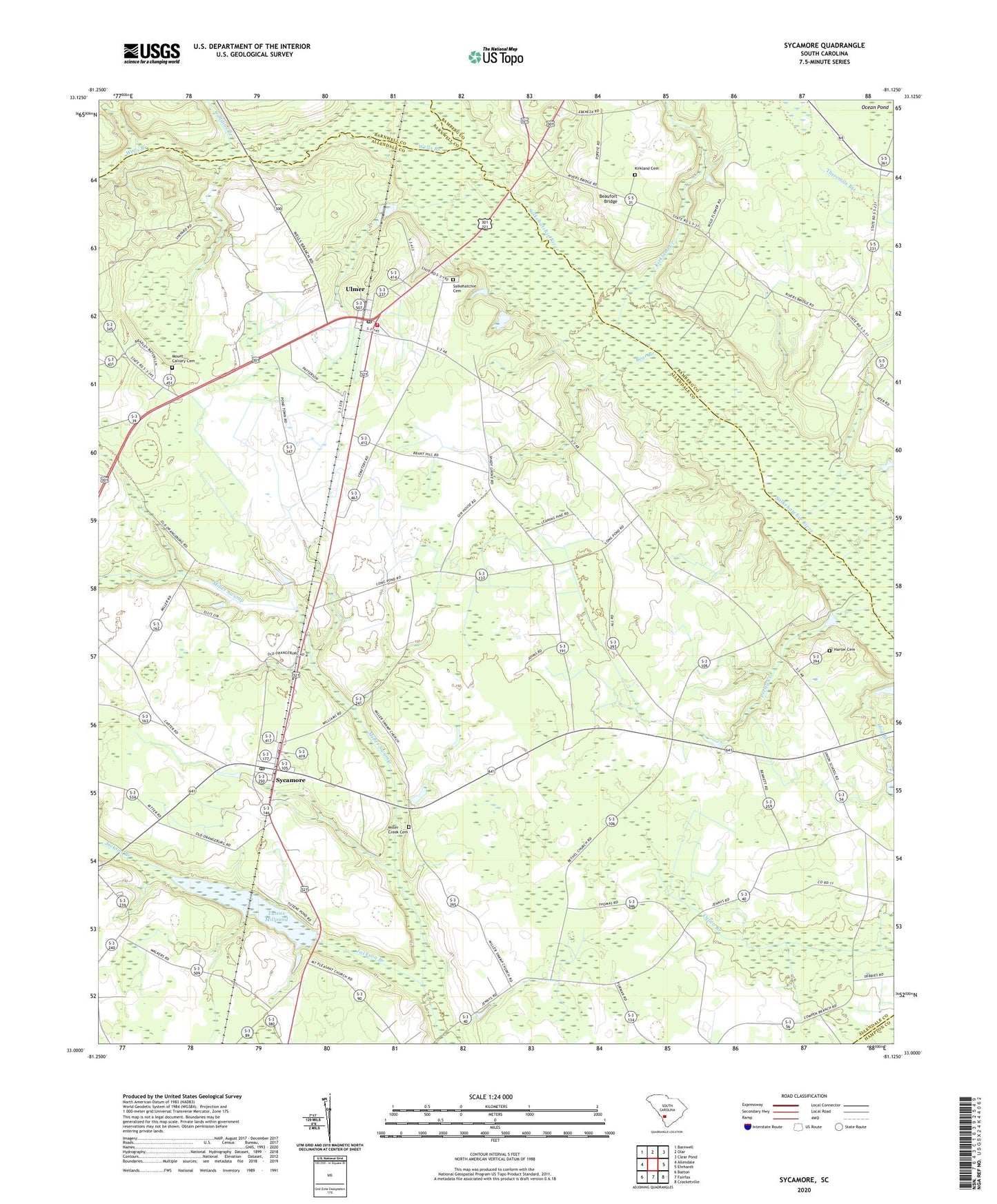
Sycamore South Carolina US Topo Map
Couldn't load pickup availability
2024 topographic map quadrangle Sycamore in the state of South Carolina. Scale: 1:24000. Based on the newly updated USGS 7.5' US Topo map series, this map is in the following counties: Allendale, Bamberg, Barnwell, Hampton. The map contains contour data, water features, and other items you are used to seeing on USGS maps, but also has updated roads and other features. This is the next generation of topographic maps. Printed on high-quality waterproof paper with UV fade-resistant inks.
Quads adjacent to this one:
West: Allendale
Northwest: Barnwell
North: Olar
Northeast: Clear Pond
East: Ehrhardt
Southeast: Crocketville
South: Fairfax
Southwest: Barton
This map covers the same area as the classic USGS quad with code o33081a2.
Contains the following named places: Allendale County Law Enforcement Center, Allendale Fire Department Station 300, Bear Branch, Beaufort Bridge, Bethel Church, Bufords Bridge, Caddins Branch, Cones Store, Copes Mill, Ebenezer Baptist Church, Harmony Church, Harmony School, Harter Cemetery, Kirkland Cemetery, Kirkland Creek, Mennonite Church, Miller Creek Cemetery, Miller Swamp, Miller Swamp Church, Mizpah Church, Mount Calvary Cemetery, Mount Calvary Church, Mount Calvary School, Mount Joy Church, Mount Pleasant Church, Ocean Pond, Phillips Airstrip, Pretty Creek, Saint Nicholas Church, Salkehatchie Cemetery, Salkehatchie Church, Shady Grove School, Sycamore, Sycamore Division, Sycamore Post Office, Town of Sycamore, Town of Ulmer, Tuten, Tutens Mill Pond Dam D-2569, Tutens Millpond, Ulmer, Ulmer Post Office, Ulmers Lookout Tower, Union School, Weekleys Store, Wells Branch, ZIP Code: 29849