MyTopo
Fairfax South Carolina US Topo Map
Couldn't load pickup availability
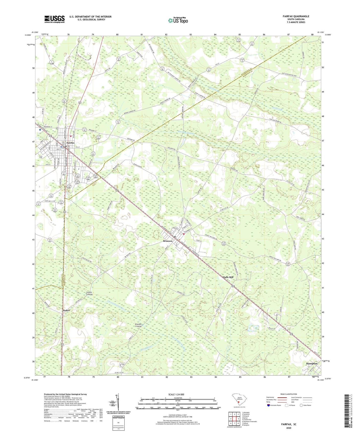
2024 topographic map quadrangle Fairfax in the state of South Carolina. Scale: 1:24000. Based on the newly updated USGS 7.5' US Topo map series, this map is in the following counties: Hampton, Allendale. The map contains contour data, water features, and other items you are used to seeing on USGS maps, but also has updated roads and other features. This is the next generation of topographic maps. Printed on high-quality waterproof paper with UV fade-resistant inks.
Quads adjacent to this one:
West: Barton
Northwest: Allendale
North: Sycamore
Northeast: Ehrhardt
East: Crocketville
Southeast: Hampton
South: Gifford
Southwest: Solomons Crossroads
This map covers the same area as the classic USGS quad with code o32081h2.
Contains the following named places: Allendale County Hospital, Allendale Fire Department Station 200, Beech Branch, Blood Hill Creek, Brandon Crossing, Brunson, Brunson Baptist Church, Brunson Division, Brunson Elementary School, Brunson Post Office, Brunson Town Hall, Camp Christian, Dukes, Fairfax, Fairfax Elementary School, Fairfax Police Department, Fairfax Post Office, Halls Mill, Hampton, Hampton Fire Department Station 10, Harrison Sawmill, Jackson Branch Church, Jackson Branch School, Lovetts Crossing, Macedonia Church, Macedonia School, Mount Carmel Holiness Church, Penn Branch School, Pond Town, Prince William Church, Prince William School, Prince WIlliam School, Rentz Fish Pond D-2600 Dam, Richardson Crossroads, Rock Hill Church, Second Baptist Church, Stumpy Pond Church, Stumpy Pond School, Town of Brunson, Town of Fairfax, Youngs School, ZIP Code: 29911