MyTopo
Cross Hill South Carolina US Topo Map
Couldn't load pickup availability
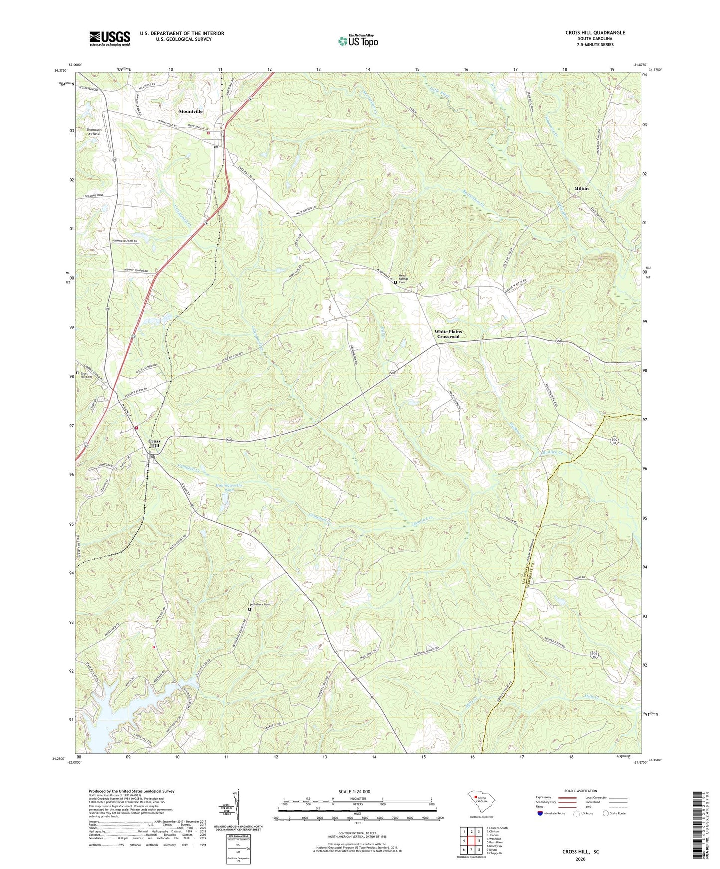
2020 topographic map quadrangle Cross Hill in the state of South Carolina. Scale: 1:24000. Based on the newly updated USGS 7.5' US Topo map series, this map is in the following counties: Laurens, Newberry. The map contains contour data, water features, and other items you are used to seeing on USGS maps, but also has updated roads and other features. This is the next generation of topographic maps. Printed on high-quality waterproof paper with UV fade-resistant inks.
Quads adjacent to this one:
West: Waterloo
Northwest: Laurens South
North: Clinton
Northeast: Joanna
East: Bush River
Southeast: Chappells
South: Dyson
Southwest: Ninety Six
Contains the following named places: Beaverdam Creek, Bethabara Cemetery, Bethabara Church, Black Gate, Black Mill, Campbell Creek, Coggins School, Cross Hill, Cross Hill Baptist Church, Cross Hill Cemetery, Cross Hill Community Fire Department Cross Hill Station 1, Cross Hill Division, Cross Hill Police Department, First Baptist Church, Greenwood, Head Springs Associate Reformed Pres Church, Head Springs Cemetery, Hollingsworth Pond Dam D-2995, Hollingworths Pond, Laurens County Emergency Medical Services Station 4, Laurens County Fire Department Cross Hill Station 2, Laurens County Fire Department Mountville, Liberty Springs Presbyterian Church, Midway School, Mill Creek, Milton, Mount Pleasant Church, Mount Presbyterian Church, Mountville, Mountville Baptist Church, Mountville Census Designated Place, North Campbell Creek, North Creek, Piedmont Church, Piedmont School, Simmons Creek, Spring Grove, Thomason Airfield, Town of Cross Hill, Watkins Creek, White Plains Crossroad, Zion Hill Church, ZIP Codes: 29332, 29370