MyTopo
Waterloo South Carolina US Topo Map
Couldn't load pickup availability
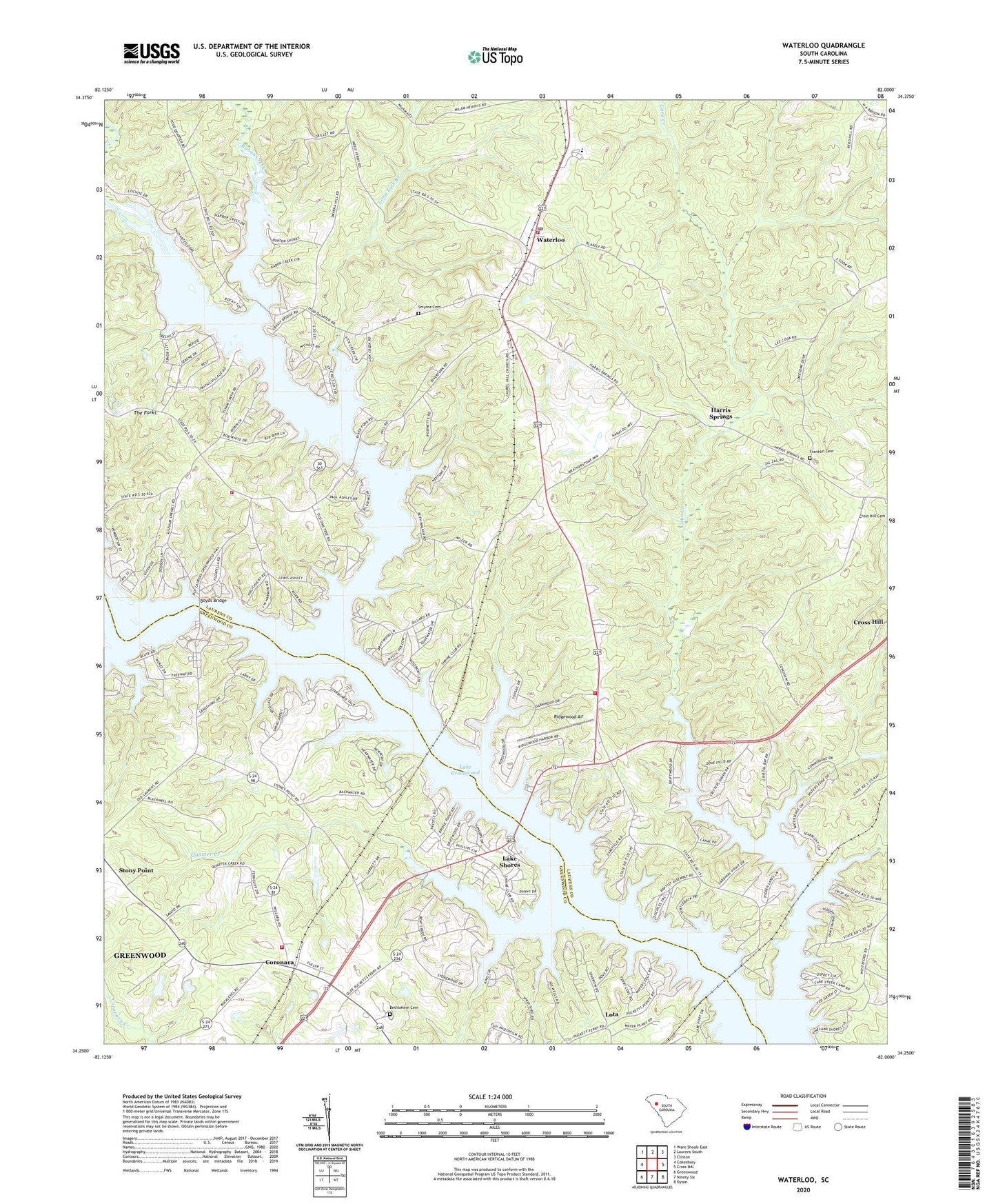
2024 topographic map quadrangle Waterloo in the state of South Carolina. Scale: 1:24000. Based on the newly updated USGS 7.5' US Topo map series, this map is in the following counties: Laurens, Greenwood. The map contains contour data, water features, and other items you are used to seeing on USGS maps, but also has updated roads and other features. This is the next generation of topographic maps. Printed on high-quality waterproof paper with UV fade-resistant inks.
Quads adjacent to this one:
West: Cokesbury
Northwest: Ware Shoals East
North: Laurens South
Northeast: Clinton
East: Cross Hill
Southeast: Dyson
South: Ninety Six
Southwest: Greenwood
This map covers the same area as the classic USGS quad with code o34082c1.
Contains the following named places: Andersons Mill, Balls Mill, Bethlehem Cemetery, Bethlehem Church, Boyds Bridge, Boyds Mill, Camp Branch, Cane Creek, Collins Lakeside Village, Coronaca, Coronaca Baptist Church, Coronaca Census Designated Place, Coronaca Volunteer Fire Department Station 50, Franklin Cemetery, Good Hope Church, Harris Springs, Isle of Pines, Lake Greenwood, Lake Shores, Lakeside Church, Lakeview Church, Laurel Hill Church, Laurens County Fire Department Cross Hill Station 4, Laurens County Fire Department Waterloo, Laurens County Fire Department Waterloo Station 2, Long Lick Branch, Lota, Mount Zion Church, Mount Zion School, Neilus Ferry, Niswongers Mill, Old Puckett Ferry, Pine Land Shores, Quarter Creek, Rabon Creek, Reedy River, Ridgewood Air, Rosemont School, Smyrna Cemetery, Smyrna Church, South Carolina Noname 24008 D-1264 Dam, The Forks, Town of Waterloo, Waterloo, Waterloo United Methodist Church, Youngs Ferry, ZIP Code: 29384