MyTopo
Chappells South Carolina US Topo Map
Couldn't load pickup availability
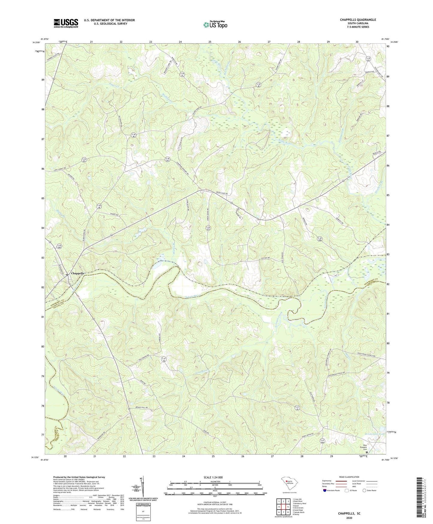
2024 topographic map quadrangle Chappells in the state of South Carolina. Scale: 1:24000. Based on the newly updated USGS 7.5' US Topo map series, this map is in the following counties: Newberry, Saluda, Greenwood. The map contains contour data, water features, and other items you are used to seeing on USGS maps, but also has updated roads and other features. This is the next generation of topographic maps. Printed on high-quality waterproof paper with UV fade-resistant inks.
Quads adjacent to this one:
West: Dyson
Northwest: Cross Hill
North: Bush River
Northeast: Newberry West
East: Silverstreet
Southeast: Denny
South: Saluda North
Southwest: Good Hope
This map covers the same area as the classic USGS quad with code o34081b7.
Contains the following named places: Branch Hill Church, Chappells, Chappells Division, Crossroads Church, Dan Watkins School, Davenport Branch, Ellis, Halfway Swamp Creek, Hope Union School, Little River Church, Mechanic Creek, Mill Creek, Mount Enon Church, Mount Nebo Church, Mount Zion Church, Mudlick Creek, Old Town Ferry, Oldtown, Pages Creek, Pine Pleasant Cemetery, Pine Pleasant Church, Ridge Spring School, Sandy Run Creek, Sharps Branch, Stephens Branch, Terrapin Creek, Turners Branch, ZIP Codes: 29037, 29145