
MyTopo
Drake South Carolina US Topo Map
Couldn't load pickup availability
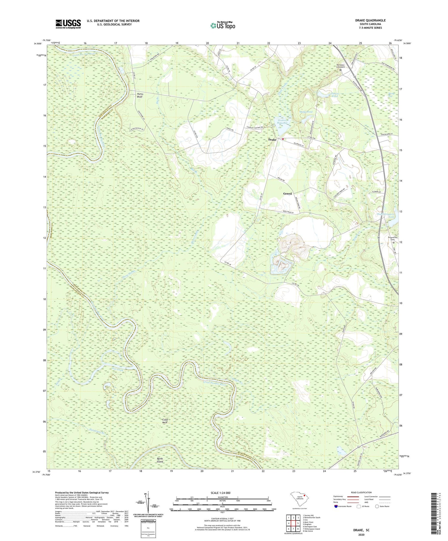
2020 topographic map quadrangle Drake in the state of South Carolina. Scale: 1:24000. Based on the newly updated USGS 7.5' US Topo map series, this map is in the following counties: Marlboro, Darlington. The map contains contour data, water features, and other items you are used to seeing on USGS maps, but also has updated roads and other features. This is the next generation of topographic maps. Printed on high-quality waterproof paper with UV fade-resistant inks.
Quads adjacent to this one:
West: Mont Clare
Northwest: Society Hill
North: Bennettsville South
Northeast: Clio
East: Bingham
Southeast: Oak Grove
South: Witherspoon Island
Southwest: Darlington East
Contains the following named places: Antioch Church, Argyle, Big Branch, Blenheim Division, Blenheim Fire Department Drake Station, Blenheim School, Brownsville Cemetery, Brownsville Church, Brownsville School, Cedar Falls Church, Culps Neck, Dailys Pond, Drake, Drake School, Drakes Millpond, Drakes Pond, Flat Creek, Genoa, Hugh Driggers Pond, Hunts Bluff, Hunts Bluff School, Key School, Mossy Bay, Muddy Creek, Parnassus, Parnassus Church, Parnassus Graveyard, Parnassus School, Pleasant Hill Church, Poston Pond, Rogers Creek, South Carolina Noname 35006 Dam, South Carolina Noname 35007 D-3459 Dam, South Carolina Noname 35030 D-3458 Dam, South Carolina Noname 35034 D-2947 Dam, Three Creeks, ZIP Code: 29516


