MyTopo
Society Hill South Carolina US Topo Map
Couldn't load pickup availability
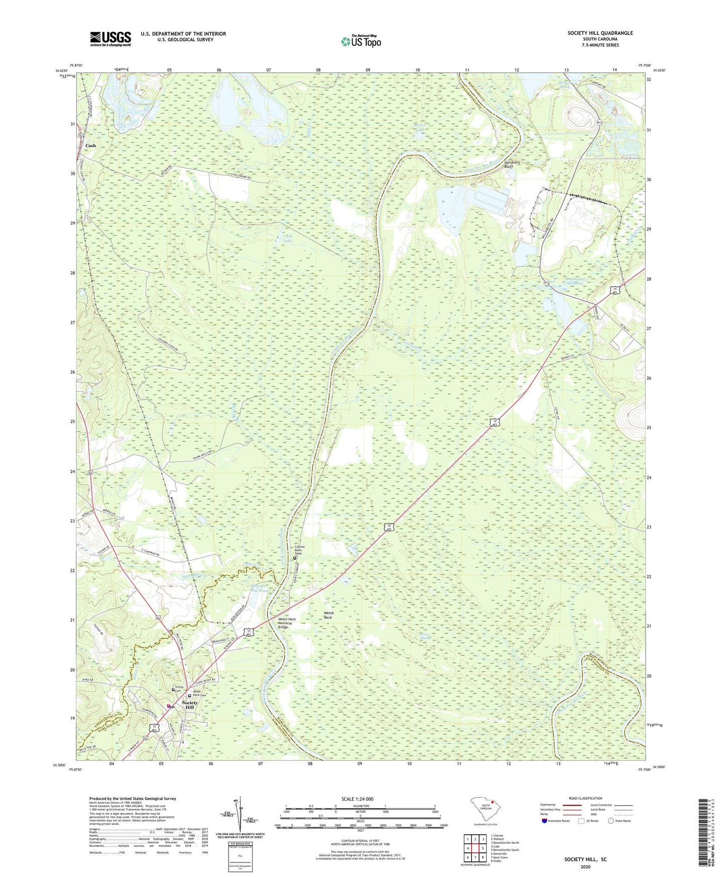
2024 topographic map quadrangle Society Hill in the state of South Carolina. Scale: 1:24000. Based on the newly updated USGS 7.5' US Topo map series, this map is in the following counties: Marlboro, Chesterfield, Darlington. The map contains contour data, water features, and other items you are used to seeing on USGS maps, but also has updated roads and other features. This is the next generation of topographic maps. Printed on high-quality waterproof paper with UV fade-resistant inks.
Quads adjacent to this one:
West: Cash
Northwest: Cheraw
North: Wallace
Northeast: Bennettsville North
East: Bennettsville South
Southeast: Drake
South: Mont Clare
Southwest: Dovesville
This map covers the same area as the classic USGS quad with code o34079e7.
Contains the following named places: Becker Pond, Becker Pond Dam D-3449, Boggy Branch, Cash Lake, Cashs Depot, Cedar Creek, Colonel Kolbs Tomb, Crooked Creek, Darlington County Fire District Station 11, Davis Field, Dyers Hill, Dyers Hill Church, Dyers Hill School, Evans Mill, Gardners Bluff, Goose Marsh, Harris Creek School, Hugh Creek, Klopman Mill Pond, Linton School, Mares Lake, Mathesons Mill, Mathesons Millpond, Naked Creek, Noname 16028 D-3538 Dam, Plumfield Landing, Reedys Branch, Rosenwald School, Saint Davids Academy, Saint Marks Church, Saint Marks School, Society Hill, Society Hill Police Department, Society Hill Rescue Squad, Sparks Ferry, Spot Mill Creek, Town of Society Hill, Trinity Cemetery, Trinity Episcopal Church, Welch Neck Memorial Bridge, Welsh Neck, Welsh Neck Baptist Church, Welsh Neck Cemetery