MyTopo
Leesburg South Carolina US Topo Map
Couldn't load pickup availability
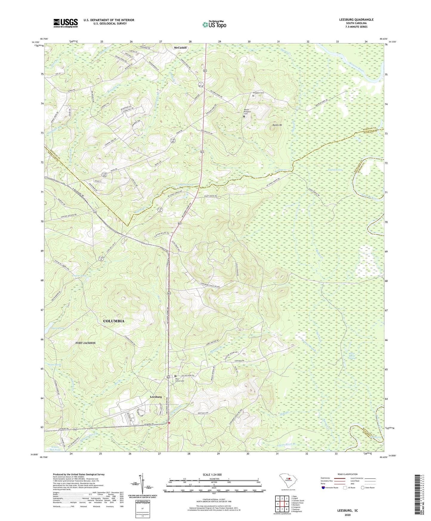
2024 topographic map quadrangle Leesburg in the state of South Carolina. Scale: 1:24000. Based on the newly updated USGS 7.5' US Topo map series, this map is in the following counties: Richland, Kershaw, Sumter. The map contains contour data, water features, and other items you are used to seeing on USGS maps, but also has updated roads and other features. This is the next generation of topographic maps. Printed on high-quality waterproof paper with UV fade-resistant inks.
Quads adjacent to this one:
West: Messers Pond
Northwest: Elgin
North: Lugoff
Northeast: Camden South
East: Rembert
Southeast: Wedgefield
South: Eastover
Southwest: Congaree
This map covers the same area as the classic USGS quad with code o34080a6.
Contains the following named places: Beaver Creek, Bee Branch, Burndown House, Cedar Creek, Chaver Pond, Colonels Creek Church, Concord Church, Concord School, Dabney Pond Church, Daley Branch, Davis Pond, Dobys Mill, Dunns Mount, English, English Pond, English Swamp, Gafney Point School, Jumping Run Creek, Leesburg, Leesburg Branch, Leesburg Fire Department Station 31, Leesburg School, Livingston Lodge, Madraw Branch, McCaskill, McCaskill Creek, Meadow View, Moke Branch, Mount Pilgrim Church, Mount Prospect Cemetery, Mount Prospect Church, Oak Grove Church, Otter Lake, Otterslide Branch, Pigeon Roost Branch, Pilgrim Church, Pine Grove Cemetery, Pine Grove Church, Pine Grove School, Progressive Church, Prospect Cemetery, Prospect Church, Raglins Creek, Rununder Branch, Scuffletown School, Shady Grove School, Sloan Branch, Spears Creek, Texas School, White Marsh Swamp, Wilson Mill Pond D-0594 Dam, WWDM-FM (Sumter), Zion Hill School