MyTopo
Solomons Crossroads South Carolina US Topo Map
Couldn't load pickup availability
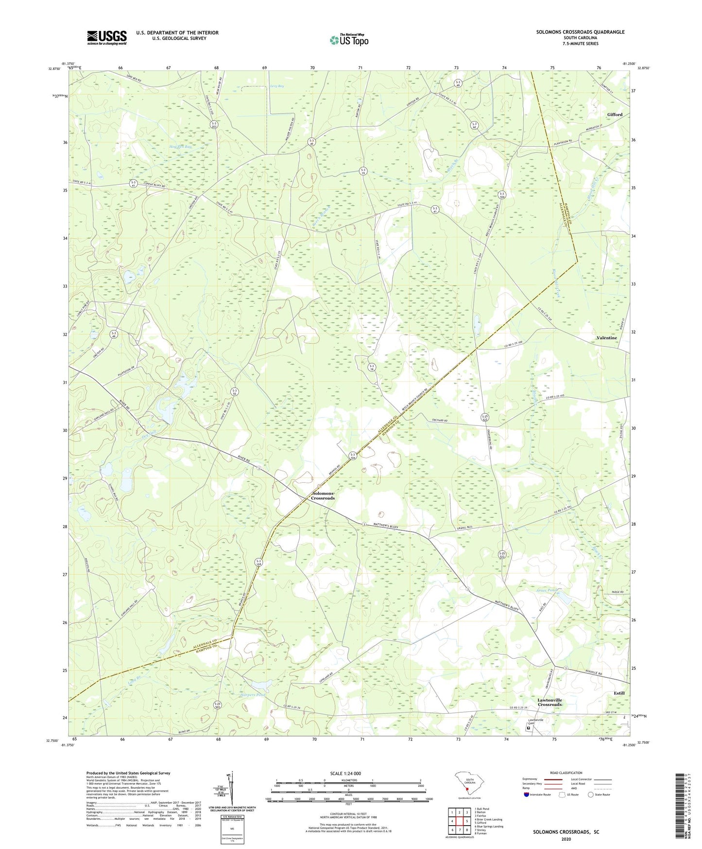
2024 topographic map quadrangle Solomons Crossroads in the state of South Carolina. Scale: 1:24000. Based on the newly updated USGS 7.5' US Topo map series, this map is in the following counties: Allendale, Hampton. The map contains contour data, water features, and other items you are used to seeing on USGS maps, but also has updated roads and other features. This is the next generation of topographic maps. Printed on high-quality waterproof paper with UV fade-resistant inks.
Quads adjacent to this one:
West: Brier Creek Landing
Northwest: Bull Pond
North: Barton
Northeast: Fairfax
East: Gifford
Southeast: Furman
South: Shirley
Southwest: Blue Springs Landing
This map covers the same area as the classic USGS quad with code o32081g3.
Contains the following named places: Arnes Pond, Badger Pond D-2571 Dam, Beech Branch Church, Bethlehem Church, Cherry Hill School, Clifton Baptist Church, Cypress Pond Church, Estill Middle School, Goodwill Church, Goodwill School, Grotan Plantation, Harpers Pond, Haskel Pond Dam D-2570, Hog Pen Bay, Kenyon Church, King Creek School, Lawtonville Cemetery, Lawtonville Crossroads, Luray Fire Tower, Middle School, Peeples, Saint James Church, Solomons Cross Roads School, Solomons Crossroads, Solomons Store, South Carolina Noname 25009 D-2594 Dam, South Carolina Noname 25010 D-2595 Dam, Springfield Church, Still School, Thompson Chapel, Thompson School, Union Church, Valentine, Valentine Church, Venison Hunt Club, Williams Store, Winthrop Club, ZIP Code: 29932