MyTopo
Butlers Bay South Carolina US Topo Map
Couldn't load pickup availability
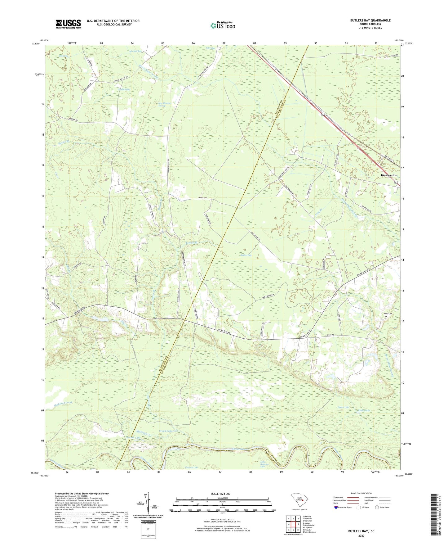
2024 topographic map quadrangle Butlers Bay in the state of South Carolina. Scale: 1:24000. Based on the newly updated USGS 7.5' US Topo map series, this map is in the following counties: Clarendon, Williamsburg, Berkeley. The map contains contour data, water features, and other items you are used to seeing on USGS maps, but also has updated roads and other features. This is the next generation of topographic maps. Printed on high-quality waterproof paper with UV fade-resistant inks.
Quads adjacent to this one:
West: Jordan
Northwest: Manning
North: Foreston
Northeast: Workman
East: Greeleyville
Southeast: Saint Stephen
South: Pineville
Southwest: Eadytown
This map covers the same area as the classic USGS quad with code o33080e1.
Contains the following named places: Broad Lake, Buck Bay, Butlers Bay, Doctor Branch, Doctor Hole, Franks Lake, Green Hill Church, Highland Creek, Hog Meadow Swamp, Hunter School, Islanded Bay, Keels Cemetery, Little Lake, Little Solomon Lake, Long Branch, Long Branch Church, Mill Branch, Mount Hope Swamp, Oak Grove Church, Pine Grove Church, Riggs Pond, Riggs Pond Dam D-3507, Saint Johns School, Saint Lukes Church, Sandhill Bay, Santee Rosenwald School, Tarkiln Branch, Tiger Bay, Torkiln Branch, ZIP Code: 29056