MyTopo
Friendship South Carolina US Topo Map
Couldn't load pickup availability
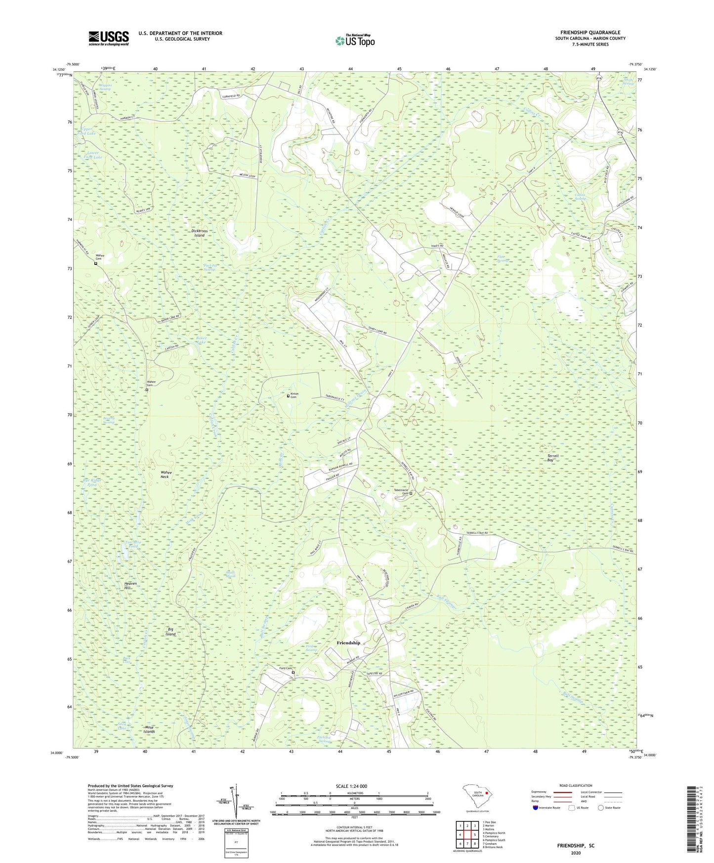
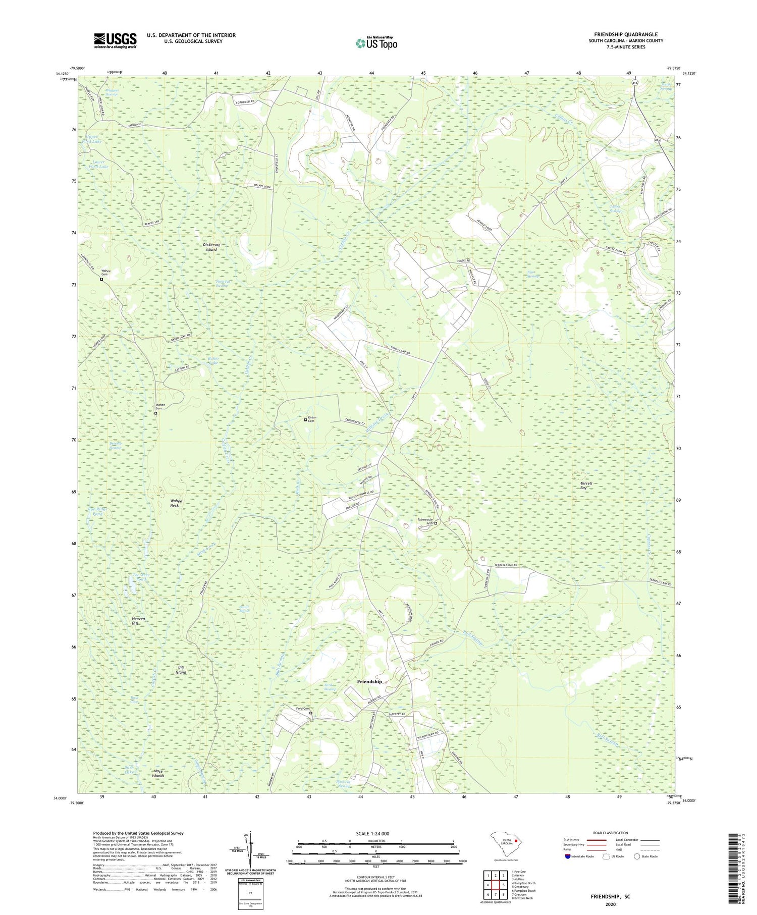
2020 topographic map quadrangle Friendship in the state of South Carolina. Scale: 1:24000. Based on the newly updated USGS 7.5' US Topo map series, this map is in the following counties: Marion. The map contains contour data, water features, and other items you are used to seeing on USGS maps, but also has updated roads and other features. This is the next generation of topographic maps. Printed on high-quality waterproof paper with UV fade-resistant inks.
Quads adjacent to this one:
West: Pamplico North
Northwest: Pee Dee
North: Marion
Northeast: Mullins
East: Centenary
Southeast: Brittons Neck
South: Gresham
Southwest: Pamplico South
Contains the following named places: Baker Lake, Beverly Swamp, Big Island, Buck Cove, Centenary Division, Collins Creek, Collins Swamp, Dickerson Island, Flat Swamp, Ford Cemetery, Ford Swamp, Friendship, Friendship Church, Heaven Hill, Kirton Cemetery, Long Lake, Lower Ford Lake, Marion Gresham Lookout Tower, Millrace Drain, Mink Creek, Mose Islands, Pitch Pot Swamp, Rye Ridge Pond, Saint Paul School, Saint Timothy Church, Sara Lake, Small Marsh, Tabernacle, Tabernacle Cemetery, Tabernacle Church, Tabernacle School, Ten Acre Pond, Terrell Bay, Upper Ford Lake, Wahee Cemetery, Wahee Church, Wahee Neck, Weeping Willow Church, Weeping Willow School