MyTopo
Great Falls South Carolina US Topo Map
Couldn't load pickup availability
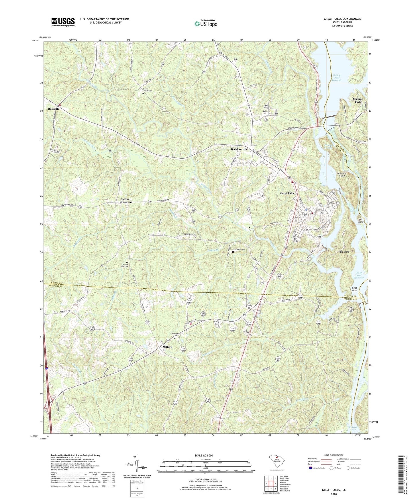
2020 topographic map quadrangle Great Falls in the state of South Carolina. Scale: 1:24000. Based on the newly updated USGS 7.5' US Topo map series, this map is in the following counties: Chester, Fairfield, Lancaster. The map contains contour data, water features, and other items you are used to seeing on USGS maps, but also has updated roads and other features. This is the next generation of topographic maps. Printed on high-quality waterproof paper with UV fade-resistant inks.
Quads adjacent to this one:
West: Stover
Northwest: Richburg
North: Fort Lawn
Northeast: Lancaster
East: Lancaster SE
Southeast: Liberty Hill
South: Flint Hill
Southwest: Winnsboro
Contains the following named places: Allens Mill, Bear Creek, Beaverdam Creek, Beckhamville, Bethesda Cemetery, Bethesda Church, Big Island, Browns - Strouds Cemetery, Caldwell Crossroad, Camp Creek, Cedar Creek Power Plant, Cedar Creek Reservoir, Church of Prophecy, Dearborn-Great Falls Dam, Debutary Creek, Duncan Creek Watershed Number Five, Ebenezer Church, Fairfield County Fire Department Mitford, Farrars Landing, Fishing Creek, Fishing Creek Dam, Fishing Creek Lake, Fishing Creek Power Plant, Fishing Creek Reservoir, Goat Island, Great Falls, Great Falls and Dearborn Power Plants, Great Falls Branch Chester County Library, Great Falls Division, Great Falls Elementary School, Great Falls Fire Department, Great Falls High School, Great Falls Middle School, Great Falls of Catawba, Great Falls Police Department, Great Falls Rescue Squad, Great Falls Reservoir, Great Falls-Dearborn Dam, Great Falls-Dearborn Reservoir, Gunthorne Cemetery, Heath Chapel, Hill Island, Hodges Branch, Kingsburys Ferry, Lackys Island, Little Rocky Creek, Masseys Mill, McDowell Island, Mitford, Mitford Church, Mitford School, Mount Zion Cemetery, Mount Zion Church, Mountain Island, Nitrolee, Pickett Island, Pine Grove Church, Pleasant Grove Church, Republic Golf Course, Republic Mills, Riverside Club House, Rocky Creek, Rocky Creek-Cedar Creek Dam, Rocky Creek-Cedar Creek Reservoir, Rossville, Rossville Church, Rossville Fire Department, Rossville School, Rossvillle Community Center, South Carolina Noname 20020 D-0532 Dam, South Carolina Noname 30005 D-2985 Dam, Springs Park, Town of Great Falls, Turkey Branch, Varnadores Store, ZIP Code: 29055