MyTopo
Iva South Carolina US Topo Map
Couldn't load pickup availability
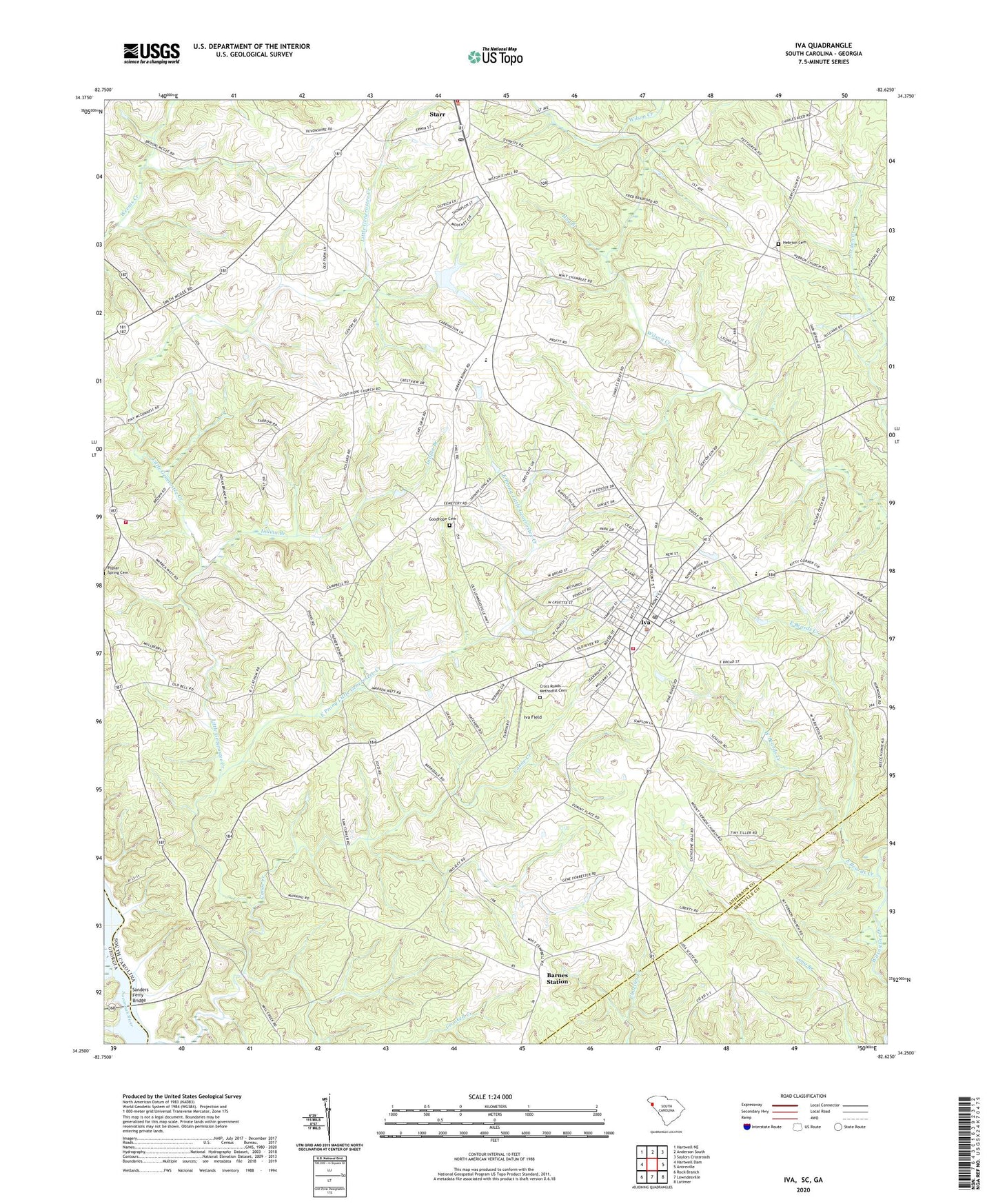
2024 topographic map quadrangle Iva in the state of South Carolina. Scale: 1:24000. Based on the newly updated USGS 7.5' US Topo map series, this map is in the following counties: Anderson, Abbeville, Elbert. The map contains contour data, water features, and other items you are used to seeing on USGS maps, but also has updated roads and other features. This is the next generation of topographic maps. Printed on high-quality waterproof paper with UV fade-resistant inks.
Quads adjacent to this one:
West: Hartwell Dam
Northwest: Hartwell NE
North: Anderson South
Northeast: Saylors Crossroads
East: Antreville
Southeast: Latimer
South: Lowndesville
Southwest: Rock Branch
This map covers the same area as the classic USGS quad with code o34082c6.
Contains the following named places: Anderson County Fire Department Iva Station 10, Anderson County Fire Department Starr Station 4, Anderson County Fire Station Grove, Barnes Church, Barnes School, Barnes Station, Baskin Pond Dam D-3120, Buck Nellis Church, Canoe Creek, Craft Mill, Crescent High School, Crooked Creek, Cross Roads Methodist Cemetery, Crossroads Church, Deep Step Creek, East Beards Creek, East Prong Little Generostee Creek, Generostee Church, Generostee School, Good Hope Church, Good Hope School, Goodhope Cemetery, Goodhope Church, Hebrion Cemetery, Hebrion Church, Hog Branch, Indian Branch, Iva, Iva Baptist Church, Iva Division, Iva Elementary School, Iva Field, Iva Police Department, Iva Post Office, Iva Rescue Squad Ambulance Service, Liberty Center School, Liberty School, Moffitsville, Mount Vernon Church, Pine Gap Holiness Church, Pleasant Grove Baptist Church, Pleasant Grove School, Poplar Spring Church, Sanders Ferry Bridge, Silver Hill School, Starr Post Office, Town of Iva, Union Baptist Church, West Beards Creek, ZIP Code: 29655