MyTopo
Holly Springs South Carolina US Topo Map
Couldn't load pickup availability
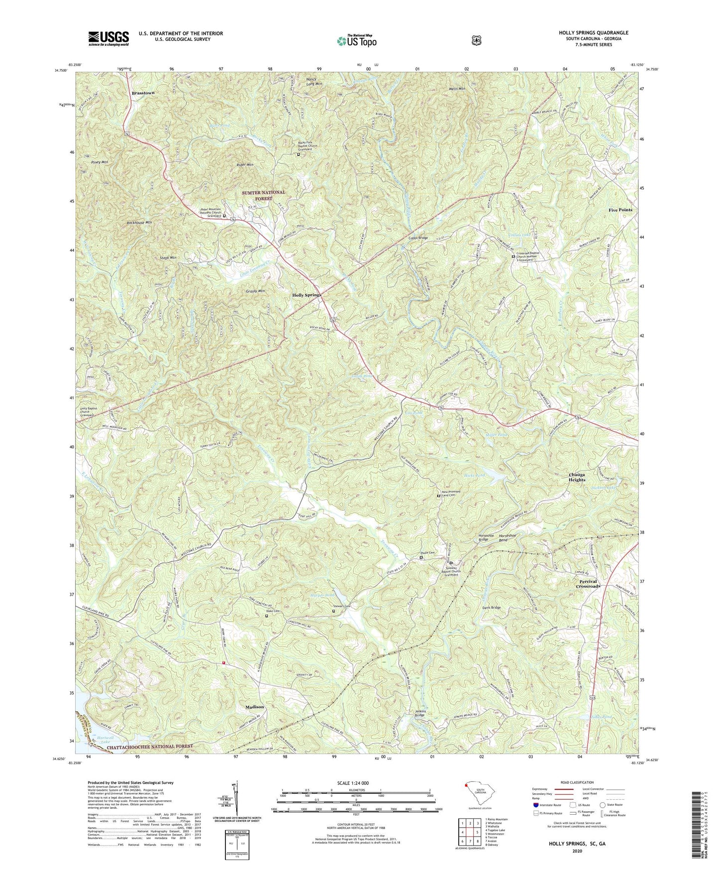
2020 topographic map quadrangle Holly Springs in the state of South Carolina. Scale: 1:24000. Based on the newly updated USGS 7.5' US Topo map series, this map is in the following counties: Oconee, Stephens. The map contains contour data, water features, and other items you are used to seeing on USGS maps, but also has updated roads and other features. This is the next generation of topographic maps. Printed on high-quality waterproof paper with UV fade-resistant inks.
Quads adjacent to this one:
Northwest: Rainy Mountain
North: Whetstone
Northeast: Walhalla
East: Westminster
Southeast: Oakway
South: Avalon
Southwest: Toccoa
Contains the following named places: Barton Creek, Big Branch, Brasstown, Butts Pond, Calvary Church, Chauga Heights, Church Campground, Cleveland Fire Department Oconee County Station 10, Cleveland School, Cobbs Bridge, Collins Lake, Corinth Baptist Church, Cox Pond, Crossroad Baptist Church Number 2, Crossroad Baptist Church Number 2 Graveyard, Davis Bridge, Devils Fork Creek, Dickson Lake, Duke Cemetery, East Toxaway Creek, Emmanuel Church, Findley Branch, Grassy Mountain, Gryer Branch, Harbin, Harper Pond, Harper Pond Dam D-1661, Hicks Pond, Hicks Pond Dam D-1659, Holly Springs, Holly Springs Baptist Church Graveyard, Holly Springs Church, Holly Springs School, Hopewell Church, Horse Shoe, Horseshoe Bend, Horseshoe Bridge, Humphreys Mill, Jenkins Bridge, Johns Pond, Kings Mill, Little Longnose Creek, Little Toxaway Creek, Madison, Miller Pond, Muddy Creek, Nancy Long Mountain, New Promised Land Cemetery, New Promised Land Church, Percival Crossroads, Piney Mountain, Pitts Mill, Poole Cemetery, Ramsey Creek, Rider Mountain, Rider Mountain Church, Rider Mountain Holiness Church Graveyard, Rockhouse Mountain, Rocky Fork, Rocky Fork Baptist Church, Rocky Fork Baptist Church Graveyard, Smith Pond, Snead Mill, Sourwood Branch, Steps Mountain, Stewart Cemetery, Toxaway Baptist Church, Toxaway Baptist Church Graveyard, Toxaway Church, Toxaway Creek, Travelers Rest Church, Unity Baptist Church Graveyard, Welcome Baptist Church Graveyard, Welcome Church, Wells Mountain, West Toxaway Creek, Westminster Division, ZIP Code: 29693