MyTopo
Westminster South Carolina US Topo Map
Couldn't load pickup availability
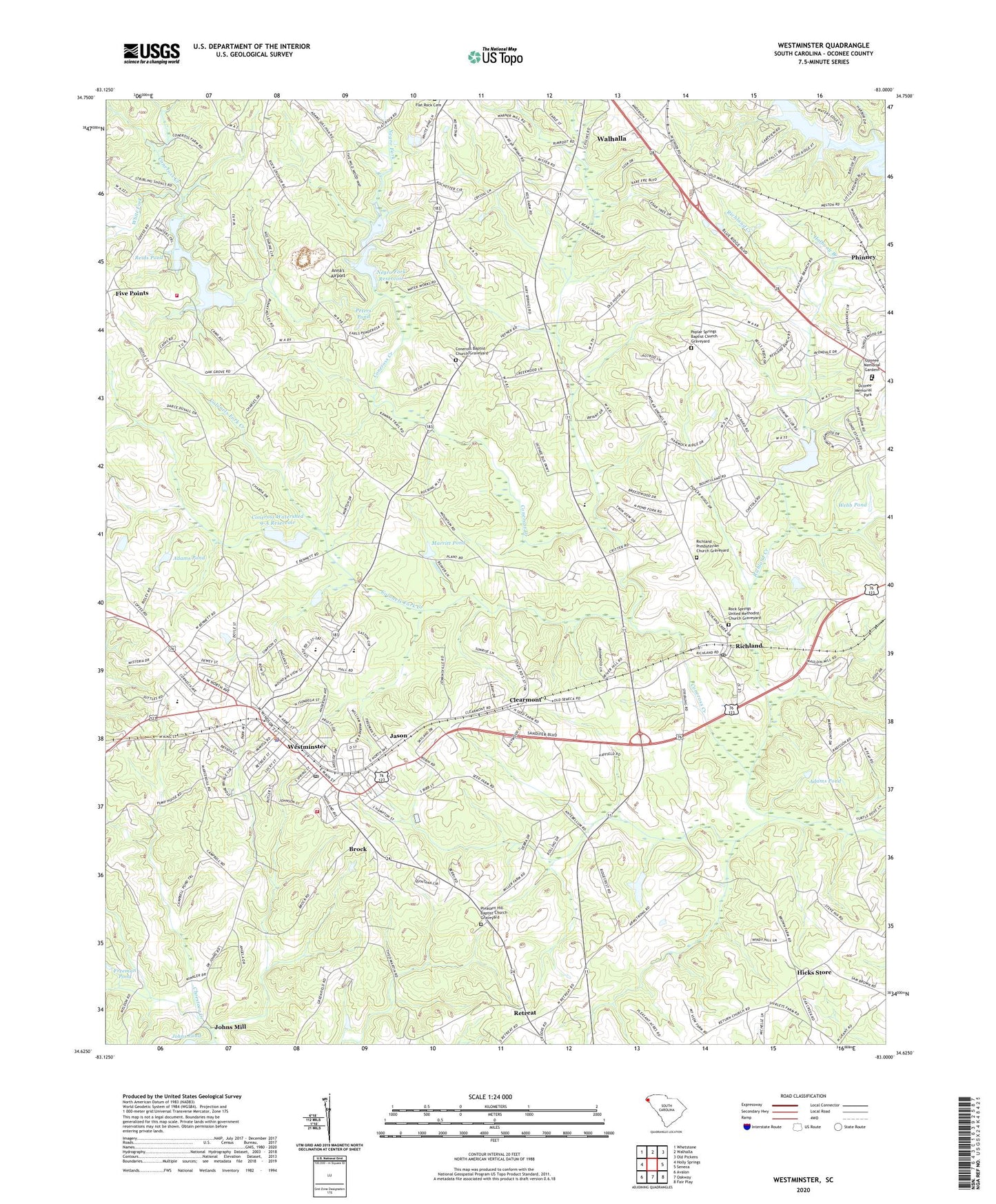
2024 topographic map quadrangle Westminster in the state of South Carolina. Scale: 1:24000. Based on the newly updated USGS 7.5' US Topo map series, this map is in the following counties: Oconee. The map contains contour data, water features, and other items you are used to seeing on USGS maps, but also has updated roads and other features. This is the next generation of topographic maps. Printed on high-quality waterproof paper with UV fade-resistant inks.
Quads adjacent to this one:
West: Holly Springs
Northwest: Whetstone
North: Walhalla
Northeast: Old Pickens
East: Seneca
Southeast: Fair Play
South: Oakway
Southwest: Avalon
This map covers the same area as the classic USGS quad with code o34083f1.
Contains the following named places: Adams Pond, Adams Pond Dam D-1654, Anna's Airport, Avondale, Bethel Church, Blue Ridge Church, Blue Ridge School, Brock, Cheohee Baptist Church, City of Westminster, Clairmont School, Clearmont, Clearmont Baptist Church, Colonels Fork Creek, Coneross Baptist Church, Coneross Baptist Church Graveyard, Coneross Creek D-1654 Dam, Coneross Creek Reservoir, Coneross Creek WCD Dam Number 21 D-1656, Coneross Creek WCD Dam Number Eight D-1653, Coneross Watershed 21 Reservoir, Coneross Watershed 9-A Reservoir, Conneross, County Country Club Pond Dam D-1658, Duke Power Dam, Eastminster, Five Points, Freedom Church, Freeman Pond, Freeman Pond Dam D-1662, Halfway Branch, Heritage Memorial Gardens, Hicks Store, Hillcrest School, Jason, John Wesley Methodist Episcopal Church, Johns Mill, Johns Pond Dam D-1663, Marritt Pond, Negro Fork, Negro Fork Reservoir, Oak Grove School, Oconee Country Club, Oconee County Rural Fire Department, Oconee County Rural Fire Department Westminster, Oconee Estates, Oconee Memorial Park, Oponee Memorial Gardens, Peters Pond, Phinney, Pleasant Hill Baptist Church, Pleasant Hill Baptist Church Graveyard, Poplar Springs Baptist Church, Poplar Springs Baptist Church Graveyard, Poplar Springs Ridge, Reids Pond, Retreat, Retreat Baptist Church, Retreat School, Return School, Richland, Richland Church, Richland Creek, Richland Post Office, Richland Presbyterian Church Graveyard, Richland School, Ridgeland Estates, Rock Springs Church, Rock Springs United Methodist Church Graveyard, Saint Matthew Baptist Church, Walhalla Filtration Point, Webb Pond, Webbs Pond Dam D-1657, West Union Church, Westminster, Westminster Baptist Church, Westminster Branch Library, Westminster City Hall, Westminster Elementary School, Westminster Fire Department Oconee County Emergency Services, Westminster Middle School, Westminster Police Department, Westminster Post Office, Westminster Presbyterian Church, Westminster Preschool, Westminster Public School, Westminster School, Westminster United Methodist Church, Westminster Wesleyan Church, WGOG-AM (Walhalla), White Fork, Wrights Siding, Zion School