MyTopo
Jefferson NE South Carolina US Topo Map
Couldn't load pickup availability
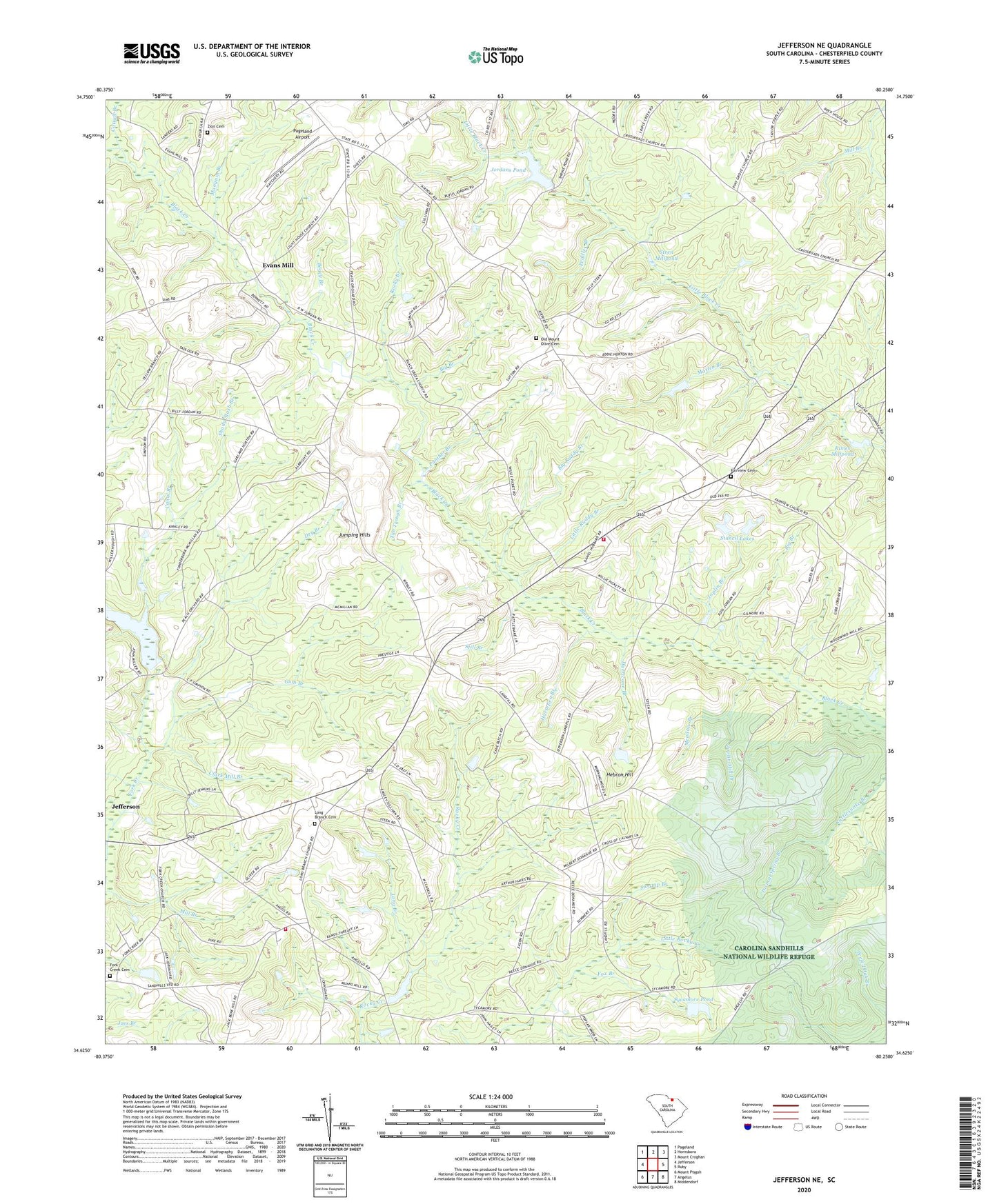
2024 topographic map quadrangle Jefferson NE in the state of South Carolina. Scale: 1:24000. Based on the newly updated USGS 7.5' US Topo map series, this map is in the following counties: Chesterfield. The map contains contour data, water features, and other items you are used to seeing on USGS maps, but also has updated roads and other features. This is the next generation of topographic maps. Printed on high-quality waterproof paper with UV fade-resistant inks.
Quads adjacent to this one:
West: Jefferson
Northwest: Pageland
North: Hornsboro
East: Ruby
Southeast: Middendorf
South: Angelus
Southwest: Mount Pisgah
This map covers the same area as the classic USGS quad with code o34080f3.
Contains the following named places: Antioch Church, Antioch School, Bethlehem Cemetery, Bethlehem Church, Big Branch, Big Ruddy Branch, Black Creek Cemetery, Black Creek Church, Black Creek School, Bogey Branch, Canal Branch, Cattail Branch, Center Grove Church, Center Grove School, Center School, Clark Mill Branch, Clark School, Cotton Patch Branch, Crawford Pond Dam D-1824, Cross of Calvary Church, Dismal Spring Branch, Dry Branch, Evans Mill, Fairview Cemetery, Fairview Church, Fork Creek Cemetery, Fork Creek Church, Fox Branch, Graves Millpond, Gum Branch, Hebron Hill, Horsepen Branch, Hurricane Branch, Jefferson Division, Joplin Branch, Joplin Mill Branch, Jordan Mill, Jordans Pond, Jumping Hills, Knight Mill Pond Dam D-3176, Leaird Pond Dam D-3179, Little Ruddy Branch, Long Branch, Long Branch Baptist Church, Long Branch Cemetery, Mangum Branch, Martin Branch, Martin Pond Dam D-3178, McLeod Pond Dam D-3175, McMillan Mill, Meadow Branch, Meeting House Pond Dam D-1825, Nicey Grove Church Cemetery, Nicy Grove Church, Oak Grove Church, Oak Grove Church Cemetery, Old Mount Olive Cemetery, Pageland Airport, Panther Branch, Peddler Branch, Piney Grove Baptist Church, Piney Grove Church, Piney Grove Church Cemetery, Rimes Millpond, Road Branch Cemetery, Road Branch Church, Road Branch School, Rocky Branch, Rocky Creek Church, Rogers Pond Dam D-1828, Sandhill Volunteer Fire Department Station 1, Sandhill Volunteer Fire Department Station 4, Shady Slash Branch, Silver Run, South Carolina Noname 13044 D-3177 Dam, Stancil Lakes, Steen Mill, Steen Millpond, Still Branch, Swamp Branch, Sycamore Pond, Sycamore Pond Dam D-3180, Tan Trough Branch, Welshs Mill, Zion Cemetery, Zion Church, Zion School, ZIP Code: 29727