MyTopo
Hornsboro South Carolina US Topo Map
Couldn't load pickup availability
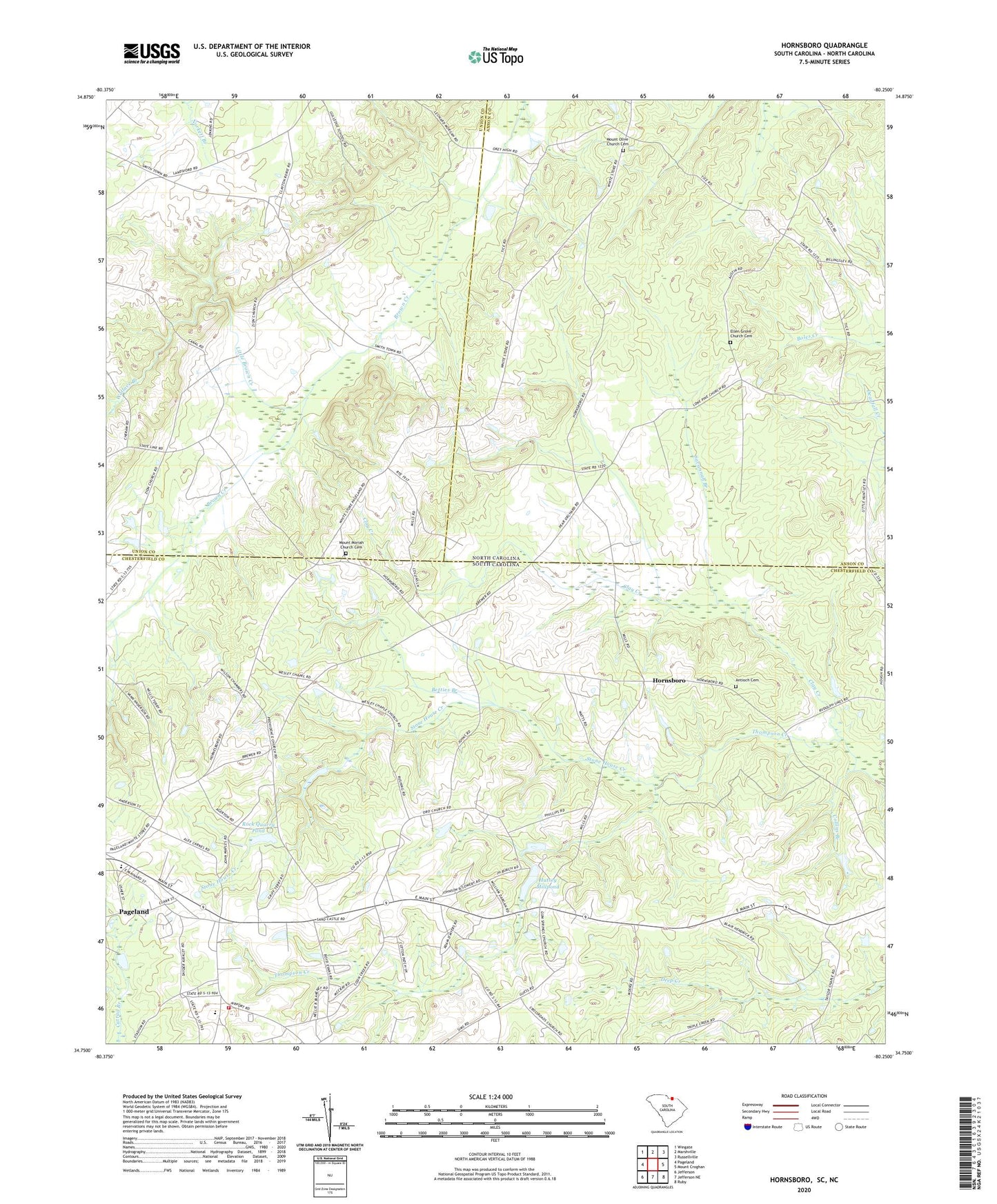
2024 topographic map quadrangle Hornsboro in the states of South Carolina, North Carolina. Scale: 1:24000. Based on the newly updated USGS 7.5' US Topo map series, this map is in the following counties: Chesterfield, Anson, Union. The map contains contour data, water features, and other items you are used to seeing on USGS maps, but also has updated roads and other features. This is the next generation of topographic maps. Printed on high-quality waterproof paper with UV fade-resistant inks.
Quads adjacent to this one:
West: Pageland
Northwest: Wingate
North: Marshville
Northeast: Russellville
Southeast: Ruby
South: Jefferson NE
Southwest: Jefferson
This map covers the same area as the classic USGS quad with code o34080g3.
Contains the following named places: Antioch Cemetery, Antioch Church, Betties Branch, Center Grove Baptist Church Cemetery, Center Grove Church, Center School, Central High School, Chamber Grove Church, Clay Creek, Collins Branch, Ellen Grove Church, Ellen Grove Church Cemetery, Guess, Gum Spring Baptist Church, Gum Springs Baptist Cemetery, Hershey Mill, High Point Fire Department Eastside, Hornsboro, Hursey Millpond Dam D-3173, Hutsey Millpond, Jordan Pond Dam D-1820, Little Brown Creek, Mangums, Maynards, Mount Moriah Church, Mount Moriah Church Cemetery, Mount Olive Church, Mount Olive Church Cemetery, Oro Church, Oro Methodist Cemetery, Oro School, Providence Baptist Cemetery, Providence Baptist Church, Rivers Pond Dam D-3174, Rock Quarry Pond, Salem Methodist Church Cemetery, Salem Missionary Baptist Church, Savannah Branch, Stone House Creek, Union Hill Church, Wallace Branch, Wesley Chapel, Wesley Methodist Chapel Cemetery, Winzo School, WMAP-FM (Pageland), ZIP Code: 28133