MyTopo
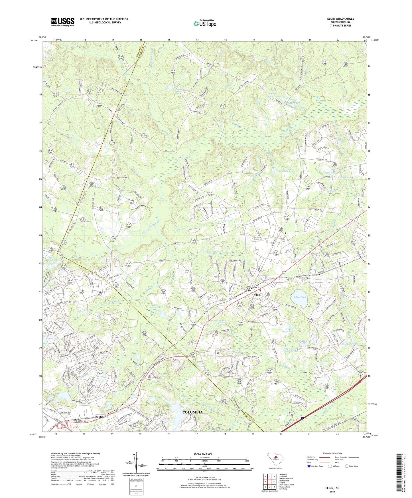
Elgin South Carolina US Topo Map
Couldn't load pickup availability
2024 topographic map quadrangle Elgin in the state of South Carolina. Scale: 1:24000. Based on the newly updated USGS 7.5' US Topo map series, this map is in the following counties: Kershaw, Richland. The map contains contour data, water features, and other items you are used to seeing on USGS maps, but also has updated roads and other features. This is the next generation of topographic maps. Printed on high-quality waterproof paper with UV fade-resistant inks.
Quads adjacent to this one:
West: Blythewood
Northwest: Ridgeway
North: Longtown
Northeast: Rabon Crossroads
East: Lugoff
Southeast: Leesburg
South: Messers Pond
Southwest: Fort Jackson North
This map covers the same area as the classic USGS quad with code o34080b7.
Contains the following named places: Bear Creek, Bell Branch, Bethel Campground, Big Branch, Blaney Baptist Church, Blaney Elementary School, Blaney Fire Department, Blaney Hills, Blaney West, Bookmans Mill, Bowen Lower Pond, Bowen Pond Dam Number One D-1138, Bowen Pond Dam Number Two D-2519, Bowen Upper Pond, Briar Branch, Bridge Creek, Campbells Mill, Cedar Springs, Clemson University Sandhill Experiment Station, Company Pond, Cook Pond Dam D-1068, Cooks Pond, Cooks School, Copperhill Church, Cranshaw Pond, Cranshaw Pond Dam D-2518, Cureton Mill School, Curetons Pond, Dodge Branch, Donnington Branch, Elgin, Elgin Acres, Elgin Farms, Flat Branch, Fort Clark Church, Good Aim Church, Green Hill Church, Green Hill School, Harmony Church, Heath Pond, High Hill Church, Highland Farms, Highway Church, Hillcrest Church, Hoods Pond, Horsepen Creek, Jacob Mission Church, Jacob Mission School, Jeffers Place, Jim Branch, Johnson School, Kelly Creek, Kirkland Pond, Legion Lake, Little White Pond, Lotts Mill Pond, Lotts Mill Pond D-0552 Dam, Miles Pond, New Jerusalem Church, Oak Grove Church, Oak Grove School, Pine Valley, Pinewood Heights, Pontiac, R W Cokers Pond, R W Cokers Pond Dam D-2516, Reedy Branch, Rice Creek, Rock Branch, Rock Branch North, Rock Hill Church, Rocky Branch, Salem Church, Sandy Branch, Shady Grove Church, Shady Grove School, Sinai Church, South Carolina Noname 28044 D-2520 Dam, South Carolina Noname 28048 D-1071 Dam, South Carolina Noname 40068 D-0553 Dam, Spring Branch, Sumei Circle, Taylor Pond, Tenmile Branch, Three Fox Farm, Town of Elgin, Tucker Lake, Tucker Lake D-0554 Dam, Tupelo Creek, Tupelo Hills, Tuppler Branch, Union Church, WCTG-AM (Columbia), White Hills, White Pond, Wiedemann Pond, Wiedemann Pond Dam D-2517, Wolfpin Branch, Yankee Branch, ZIP Code: 29045