MyTopo
Messers Pond South Carolina US Topo Map
Couldn't load pickup availability
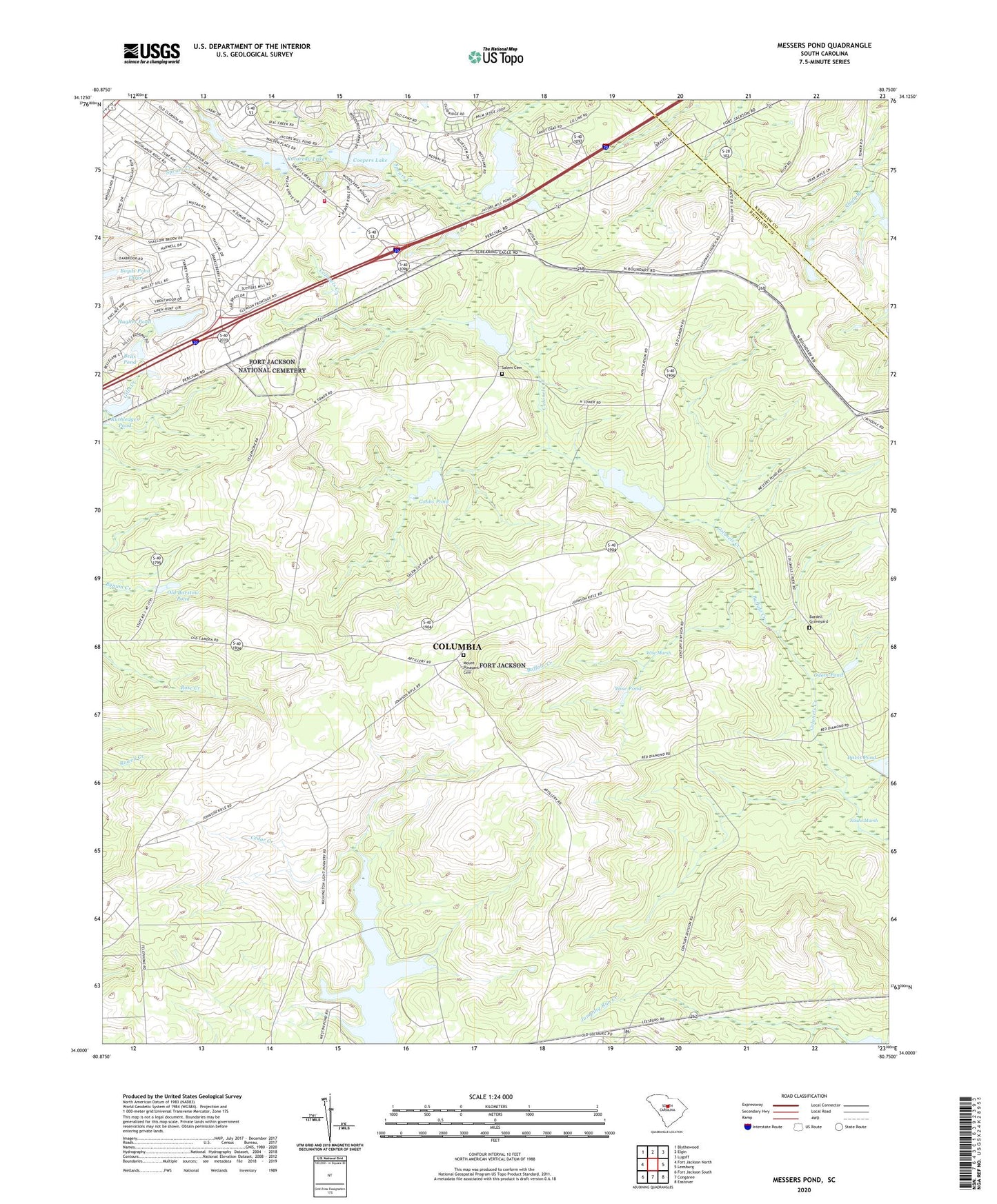
2020 topographic map quadrangle Messers Pond in the state of South Carolina. Scale: 1:24000. Based on the newly updated USGS 7.5' US Topo map series, this map is in the following counties: Richland, Kershaw. The map contains contour data, water features, and other items you are used to seeing on USGS maps, but also has updated roads and other features. This is the next generation of topographic maps. Printed on high-quality waterproof paper with UV fade-resistant inks.
Quads adjacent to this one:
West: Fort Jackson North
Northwest: Blythewood
North: Elgin
Northeast: Lugoff
East: Leesburg
Southeast: Eastover
South: Congaree
Southwest: Fort Jackson South
Contains the following named places: Bardell Graveyard, Bells Camp, Bells Pond, Berkeley Endoscopy Center, Buffalo Church, Buffalo Creek, Camp Barstow, Carlisle School, Chimney Ridge, Cobbs Pond, Cobbs Pond Dam D-1675, Columbia - Richland Fire Department Northeast Columbia, Coopers Lake, Coopers Lake D-0574 Dam, Dupre Pond, Dupre Pond Dam D-1674, F Coopers Pond, Fort Jackson, Fort Jackson Division, Fort Jackson National Cemetery, Gills Creek School, Gray Shadow Farm, Hughes Pond, Hughes Pond D-0573 Dam, Lisbon, Messer School, Messers Pond, Messers Pond Dam D-1676, Mount Pleasant Cemetery, Mount Pleasant Church, Mount Pleasant School, Noahs Marsh, Odom Pond, Old Barstow Pond, Pontiac Division, Powell Pond, Richland Northeast Industrial Park, Rotureau Lake, Rotureau Lake Dam D-0572, Royal Pines Estates, Ruthledges Pond, Rutledges Pond D-0137 Dam, Salem Cemetery, Salem Church, South Carolina Noname 28045 D-2521 Dam, South Carolina Noname 40089 D-0575 Dam, Spears Creek Church, Spears Creek School, Upper Davis Pond Dam D-1677, Weir Tower, Westons Pond, Wise Marsh, Wise Pond, WIS-TV (Columbia), WLTX-TV (Columbia), ZIP Code: 29207