
MyTopo
Neyles South Carolina US Topo Map
Couldn't load pickup availability
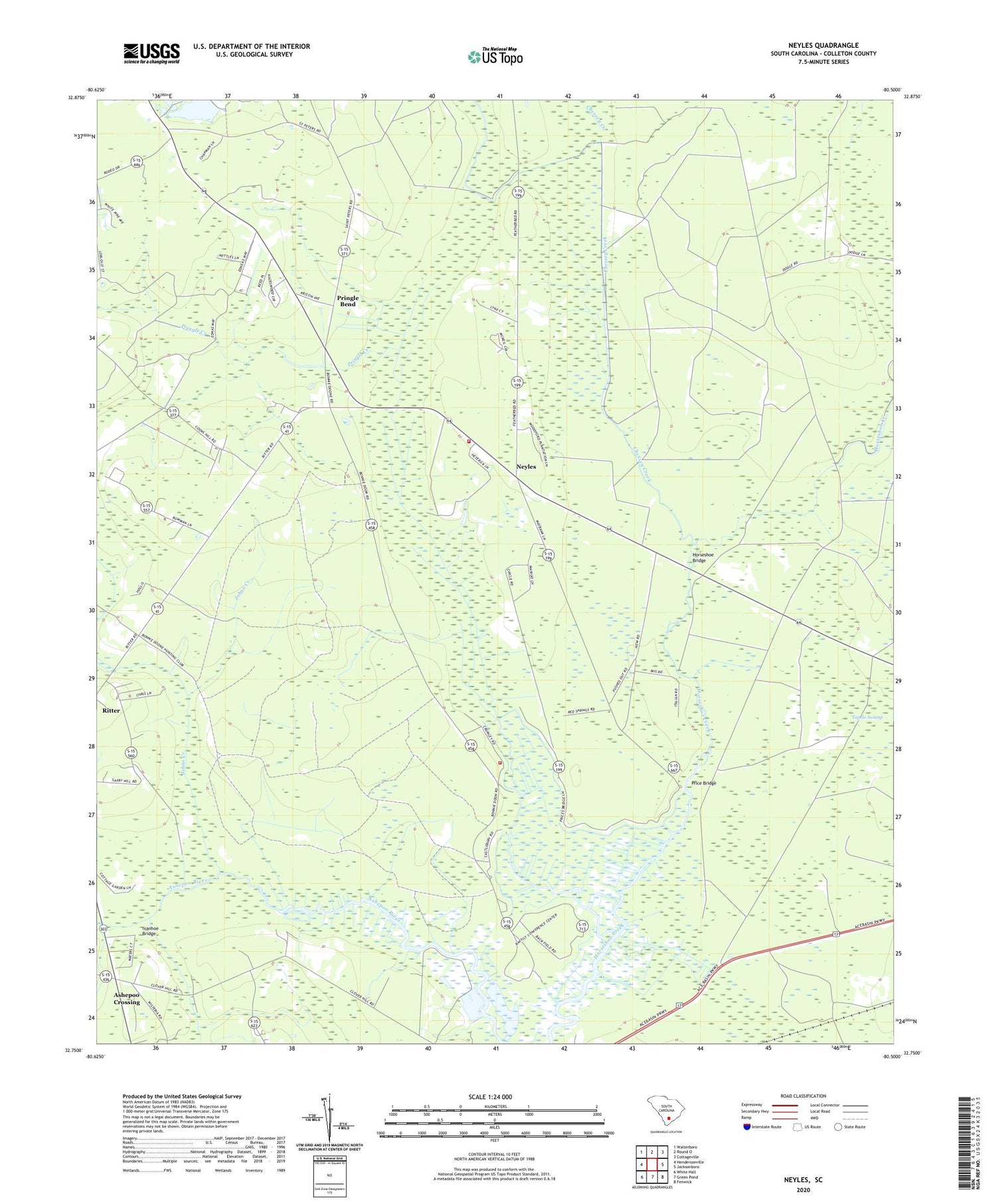
2020 topographic map quadrangle Neyles in the state of South Carolina. Scale: 1:24000. Based on the newly updated USGS 7.5' US Topo map series, this map is in the following counties: Colleton. The map contains contour data, water features, and other items you are used to seeing on USGS maps, but also has updated roads and other features. This is the next generation of topographic maps. Printed on high-quality waterproof paper with UV fade-resistant inks.
Quads adjacent to this one:
West: Hendersonville
Northwest: Walterboro
North: Round O
Northeast: Cottageville
East: Jacksonboro
Southeast: Fenwick
South: Green Pond
Southwest: White Hall
Contains the following named places: Aimwell Church, Ashepoo Crossing, Chessey Creek, Colleton Fire Department Station 12, Colleton Fire Department Station 30, Cumberland Church, Drawdy, Horseshoe Bridge, Isaiah Church, Ivanhoe Bridge, Johno Creek, Mashawville School, Neyles, Neyles School, Pendergrass Cross Roads, Price Bridge, Pringle Bend, Pringle Creek, Saint Johns Church, Saint Marks Church, Saint Pauls Church, Saint Peters Church, Saint Peters School, Salem Church, Sandy Dam Branch, Tupelo Swamp, Wards Cross School, Whitehouse Plantation


