MyTopo
Nixonville South Carolina US Topo Map
Couldn't load pickup availability
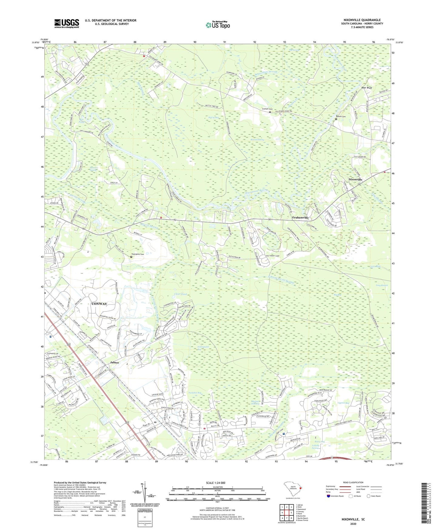
2024 topographic map quadrangle Nixonville in the state of South Carolina. Scale: 1:24000. Based on the newly updated USGS 7.5' US Topo map series, this map is in the following counties: Horry. The map contains contour data, water features, and other items you are used to seeing on USGS maps, but also has updated roads and other features. This is the next generation of topographic maps. Printed on high-quality waterproof paper with UV fade-resistant inks.
Quads adjacent to this one:
West: Conway
Northwest: Adrian
North: Shell
Northeast: Hammond
East: Hand
Southeast: Ocean Forest
South: Myrtle Beach
Southwest: Bucksville
This map covers the same area as the classic USGS quad with code o33078g8.
Contains the following named places: Atlantic Center Industrial Park, Bear Bluff, Bear Bluff Lodge, Beaverdam Swamp, Big Bay, Big Swamp, Black Water Middle School, Briery Bay, Camp Inpaco, Carolina Bone and Joint Surgery Center, Carolina Forest Census Designated Place, Carolina Forest Elementary School, Carolina Forest High School, Carolina Forest Middle School, Carolina Forest Post Office, Celebration Presbyterian Church, Clear Pond, Community Church, Conway East Division, Cottonpatch Bay, Cox Park, Cypress Bay, Dam Swamp, East Prong Steritt Swamp, Evans Lodge, Fairtraid, Graham Cemetery, Grahamville, Grissett Lake, Hardees Ferry, Harpers Lodge, Hickory Grove Church, Horry County Education Center, Horry County Fire Department Carolina Forest Station 39, Horry County Fire Department Lees Landing, Horry County Fire Department Station 12, Horry County Fire Department Station 40, Jaluco, Jones Big Swamp, Lees Landing, Lighthouse Care Center of Conway Acute Care - Hospital, Loblolly Swamp, Long Branch, McCoy Bay, Meadowchase Farm, Michael Hole Bay, Mill Creek, Murrells Lodge, Myrtle Beach National Golf Course, Myrtle Beach National Golf Number 10 Pond, Myrtle Beach National North Pond, Myrtle Beach National North Pond Dam D-3627, Myrtle Trace, Nixonville, Oak Grove School, Pine Grove Church, Pine Grove School, Pine Tree Lodge, Reaves Cemetery, Reaves Landing, Roe Pond, Round Swamp, Royal Oak Lake, Salem Church, Salem School, Sessions Lake, Sessions Lodge, Skinners Swamp, South Carolina Noname 26037 D-3626 Dam, South Prong Steritt Swamp, Stanley Creek, The Wild Horse, Thompkins Cemetery, Tilly Lake, Tilly Swamp, Tilly Swamp Church, Timberdock Lodge, True Vine Church, Tuckahoe Bay, Union Lake, Vina, ZIP Codes: 29526, 29579