MyTopo
Norway East South Carolina US Topo Map
Couldn't load pickup availability
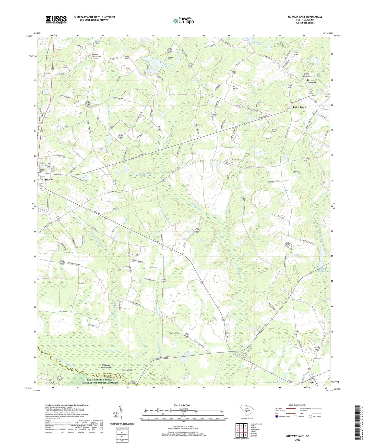
2024 topographic map quadrangle Norway East in the state of South Carolina. Scale: 1:24000. Based on the newly updated USGS 7.5' US Topo map series, this map is in the following counties: Orangeburg, Bamberg. The map contains contour data, water features, and other items you are used to seeing on USGS maps, but also has updated roads and other features. This is the next generation of topographic maps. Printed on high-quality waterproof paper with UV fade-resistant inks.
Quads adjacent to this one:
West: Norway West
Northwest: Harleys Millpond
North: North
Northeast: Wolfton
East: Cordova
Southeast: Midway
South: Bamberg
Southwest: Denmark
This map covers the same area as the classic USGS quad with code o33081d1.
Contains the following named places: Bethany Baptist Church Cemetery, Bethany Church, Bethany Church Cemetery, Bethel Church, Bolen Town, Bolentown Fire Department, Canaan Church, Canaan School, Chapell School, Cherry Hill Cemetery, Cherry Hill Church, Cherry Hill School, Cope, Cope Baptist Church, Cope Post Office, Copes Pond, Deadfall Swamp, Edisto Fire Department, Fairview School, Fogle Mill Pond, Good Hope Church, Good Hope School, Hayes Mill Creek, Hutto Landing, John Fogle Pond, Julius B Ness Bridge, Lebanon Church, Lebanon Church Cemetery, Lewis Davis Pond Dam D-3730, Macedonia Church, Middle Willow School, Mount Zion Church, Mount Zion School, North Willow School, Norway Baptist Church, Norway Division, Old Forty Acre Island, Old Pearson Cemetery, Old Union Cemetery, Old Union Church, Popular Hill School, R P Bonnette Pond Dam D-3753, Red Branch, Rocky Swamp Church, Saint Johns United Methodist Church, Sanctified Church, Scratchnose Swamp, Snow Island, South Carolina Noname 38014 D-3732 Dam, South Carolina Noname 38045 D-3731 Dam, South Carolina Noname 38046 D-3775 Dam, South Carolina Noname 38053 D-3766 Dam, South Carolina Noname 38071 D-3777 Dam, South Carolina Noname 38079 D-3751 Dam, South Willow School, Spires Church, Spires School, Town of Cope, Twelvemile Pond, Twin Lakes, Two Mile Cemetery, Two Mile School, Two Mile Swamp Baptist Church, Twomile Swamp, Vallentine Pond Dam D-3767, Whetstone Fishing Lake Dam D-3765, Williams Pond Dam D-3749, Williamsons Pond Dam D-3750