MyTopo
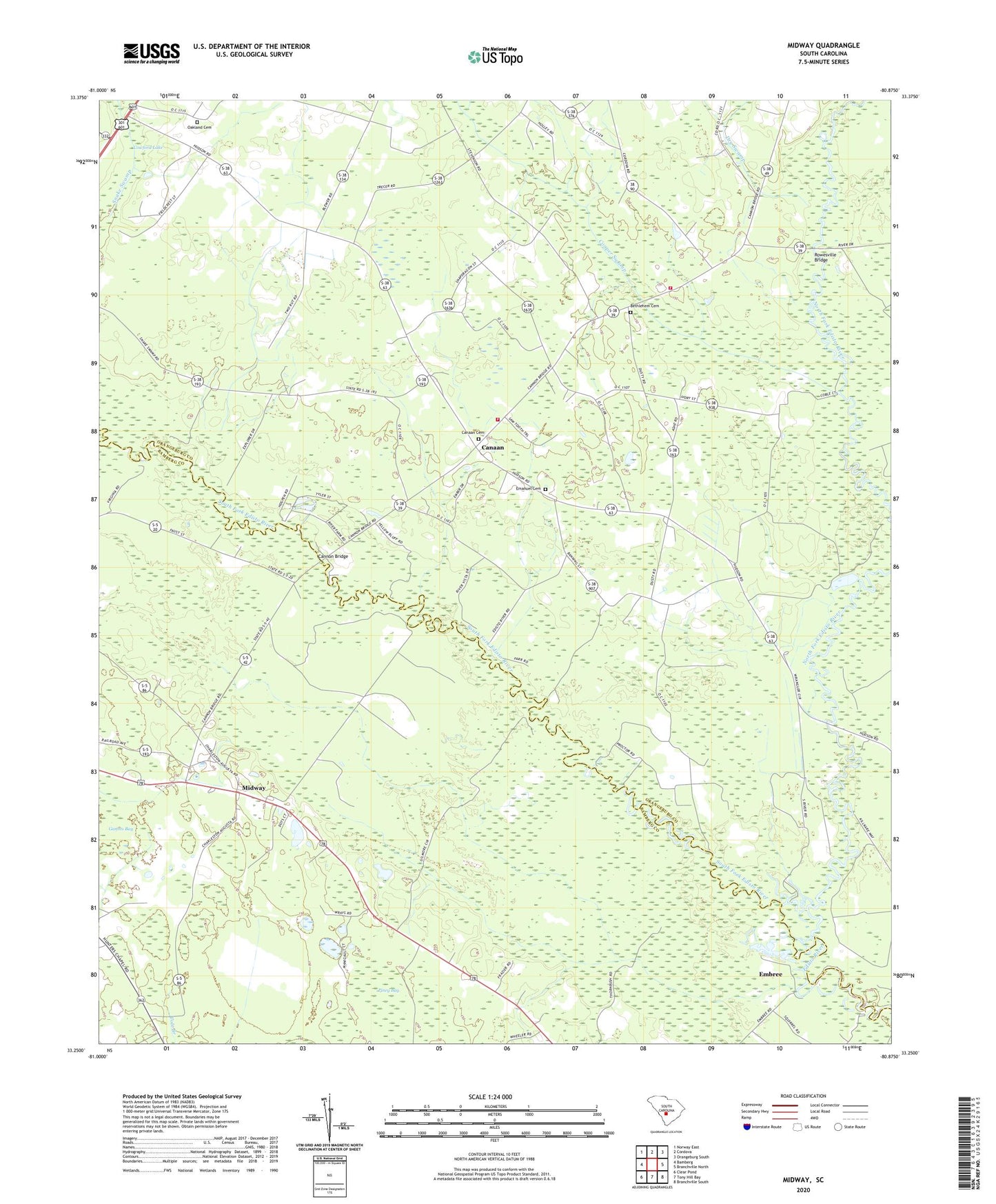
Midway South Carolina US Topo Map
Couldn't load pickup availability
2024 topographic map quadrangle Midway in the state of South Carolina. Scale: 1:24000. Based on the newly updated USGS 7.5' US Topo map series, this map is in the following counties: Orangeburg, Bamberg. The map contains contour data, water features, and other items you are used to seeing on USGS maps, but also has updated roads and other features. This is the next generation of topographic maps. Printed on high-quality waterproof paper with UV fade-resistant inks.
Quads adjacent to this one:
West: Bamberg
Northwest: Norway East
North: Cordova
Northeast: Orangeburg South
East: Branchville North
Southeast: Branchville South
South: Tony Hill Bay
Southwest: Clear Pond
This map covers the same area as the classic USGS quad with code o33080c8.
Contains the following named places: Bethel Church, Bethlehem Cemetery, Bethlehem Church, Cana of Galilee Church, Canaan, Canaan Cemetery, Canaan Church, Canaan Fire Department Station 1, Canaan Fire Department Station 2, Canaan School, Cannon Bridge, Cedar Grove Church, Cedar Grove School, Cooper Swamp, Cope Division, Corner School, Dry Swamp, Edisto School, Emanuel Cemetery, Emanuel Church, Emanuel School, Embree, Fork Bridges, Gannts Bay, Isaac Jennings Canal, McMillan School, Midway, Mount Pisgah Church, Mount Pisgah School, Mount Zion Church, North Fork Edisto River, Oakland Cemetery, Pilgrim Baptist Church, Rowesville Bridge, South Fork Edisto River, Tatums Pond Dam D-2823, ZIP Code: 29038