MyTopo
Blackville South Carolina US Topo Map
Couldn't load pickup availability
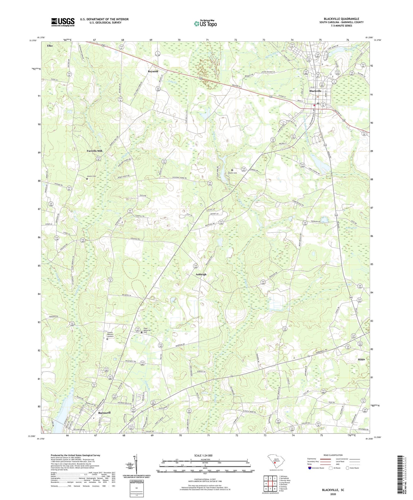
2024 topographic map quadrangle Blackville in the state of South Carolina. Scale: 1:24000. Based on the newly updated USGS 7.5' US Topo map series, this map is in the following counties: Barnwell. The map contains contour data, water features, and other items you are used to seeing on USGS maps, but also has updated roads and other features. This is the next generation of topographic maps. Printed on high-quality waterproof paper with UV fade-resistant inks.
Quads adjacent to this one:
West: Long Branch
Northwest: Williston
North: Springfield
Northeast: Norway West
East: Denmark
Southeast: Olar
South: Barnwell
Southwest: Snelling
This map covers the same area as the classic USGS quad with code o33081c3.
Contains the following named places: Ashleigh, Ashleigh Baptist Church, Ashleigh Church, Ashleigh School, Barnwell County Hospital, Barnwell State Park, Blackville, Blackville Church, Blackville Division, Blackville Fire Department, Blackville High School, Blackville Middle School, Blackville Post Office, Blackville School, Blackville United Methodist Church, Booker Pond, Browns Church, Browns School, Church of God, County Memory Gardens, Double Pond Baptist Church, Double Pond School, Edgar A Brown Lake, Edisto Experimental Station, Edisto Pond Dam D-3061, Farrells Mill, First Baptist Church, Friendship Baptist Church, Guess Pond, Hope Memorial Park, Jefferson Davis Academy, Jowers Cemetery, Lake Brown, Lake Cynthia, Lake Cynthia Dam D-3068, Long Branch, Macedonia Baptist Church, Macedonia Middle School, McLains Pond D-3058 Dam, Peters Pond, Reedy Branch Baptist Church, Reedy Branch School, Reynold, Sacred Heart Church, Saint Albans Church, Shiloh Church, Shrub Branch, Shrub Branch Church, Shrub Branch School, Temple Baptist Church, Town of Blackville, Yale, ZIP Code: 29817