MyTopo
Saint Phillips Island South Carolina US Topo Map
Couldn't load pickup availability
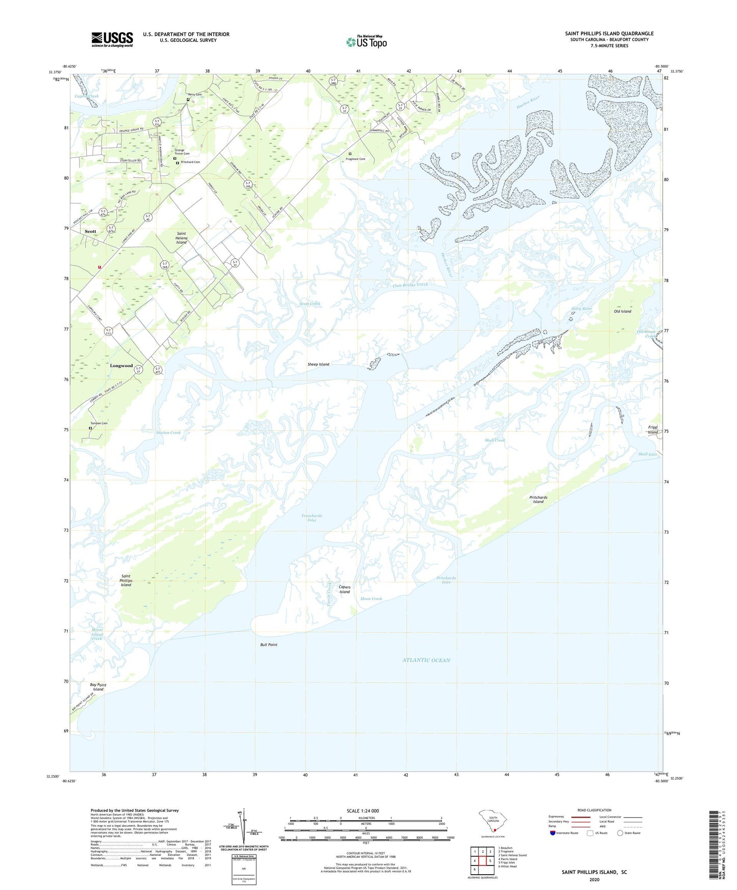
2020 topographic map quadrangle Saint Phillips Island in the state of South Carolina. Scale: 1:24000. Based on the newly updated USGS 7.5' US Topo map series, this map is in the following counties: Beaufort. The map contains contour data, water features, and other items you are used to seeing on USGS maps, but also has updated roads and other features. This is the next generation of topographic maps. Printed on high-quality waterproof paper with UV fade-resistant inks.
Quads adjacent to this one:
West: Parris Island
Northwest: Beaufort
North: Frogmore
Northeast: Saint Helena Sound
East: Fripp Inlet
Southwest: Hilton Head
Contains the following named places: Beaufort County Landing, Bull Point, Capers Island, Club Bridge Creek, County Landing, Frogmore Cemetery, Harbor River, Lady's - Saint Helena Island Fire Department Station 23, Lands End School, Longwood, Moon Creek, Morse Island Creek, Old Island, Orange Grove Cemetery, Orange Grove Church, Orange Grove Plantation, Perry Cemetery, Pritchard Cemetery, Pritchards Inlet, Pritchards Island, Saint Helena Island Division, Saint Phillips Island, Scott, Scott Creek, Sheep Island, Skull Creek, Skull Inlet, Station Creek, Story River, Tombee Cemetery, Towne-McDonald School, Trenchards Inlet, Turtle Creek, WOCW-FM (Parris Island), ZIP Code: 29920