MyTopo
Parris Island South Carolina US Topo Map
Couldn't load pickup availability
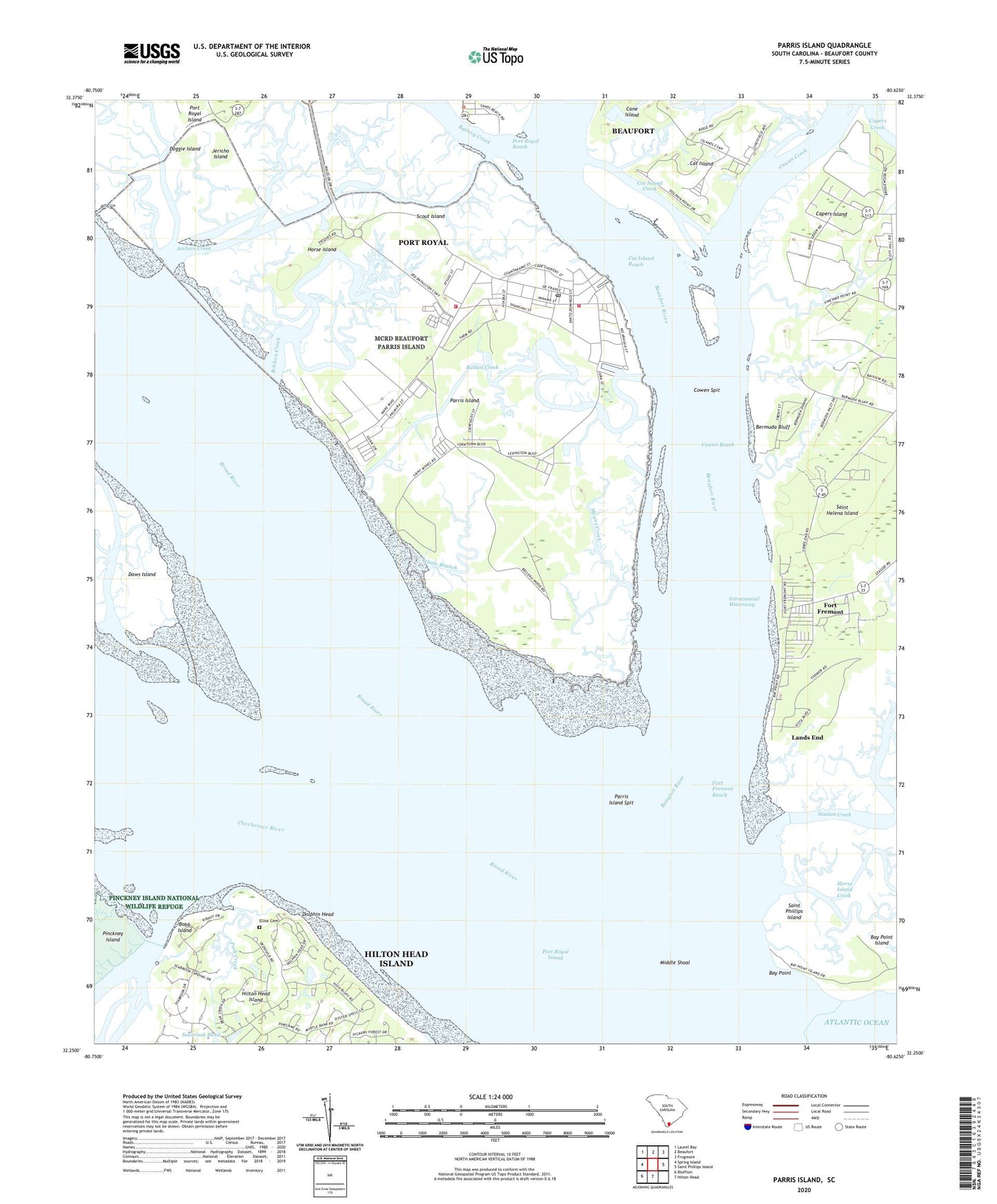
2024 topographic map quadrangle Parris Island in the state of South Carolina. Scale: 1:24000. Based on the newly updated USGS 7.5' US Topo map series, this map is in the following counties: Beaufort. The map contains contour data, water features, and other items you are used to seeing on USGS maps, but also has updated roads and other features. This is the next generation of topographic maps. Printed on high-quality waterproof paper with UV fade-resistant inks.
Quads adjacent to this one:
West: Spring Island
Northwest: Laurel Bay
North: Beaufort
Northeast: Frogmore
East: Saint Phillips Island
South: Hilton Head
Southwest: Bluffton
This map covers the same area as the classic USGS quad with code o32080c6.
Contains the following named places: Adam Street Church, Archers Creek, Ballast Creek, Battery Creek, Bay Point, Bay Point Island, Beaufort County, Beaufort River, Bermuda Bluff, Bobb Island, Broad River, Cane Island, Capers Creek, Capers Island, Cat Island, Cat Island Creek, Cat Island Reach, Charlesfort, Chechessee River, Cowen Creek, Cowen Reach, Cowen Spit, Doggie Island, Dolphin Head, Dolphin Head Golf Club, Elliot Cemetery, Elting School, Fort Beauregard, Fort Fremont, Fort Fremont Reach, Fort San Felipe, Fort San Marcos, Hilton Head Plantation, Horse Island, Jericho Island, Lands End, Marine Corp Recruit Depot Parris Island, Marine Corps Recruit Depot Fire Department, Means Creek, Middle Shoal, Park Creek, Parris Island, Parris Island Census Designated Place, Parris Island Fire Department, Parris Island Museum, Parris Island Post Office, Parris Island Spit, Port Royal Reach, Port Royal Sound, Ribaut Monument, Ribbon Creek, Santa Elena, Scout Island, Seabrook Landing, Seabrook Pond, South Pine School, Town of Port Royal, Whale Branch, ZIP Codes: 29902, 29905