MyTopo
Frogmore South Carolina US Topo Map
Couldn't load pickup availability
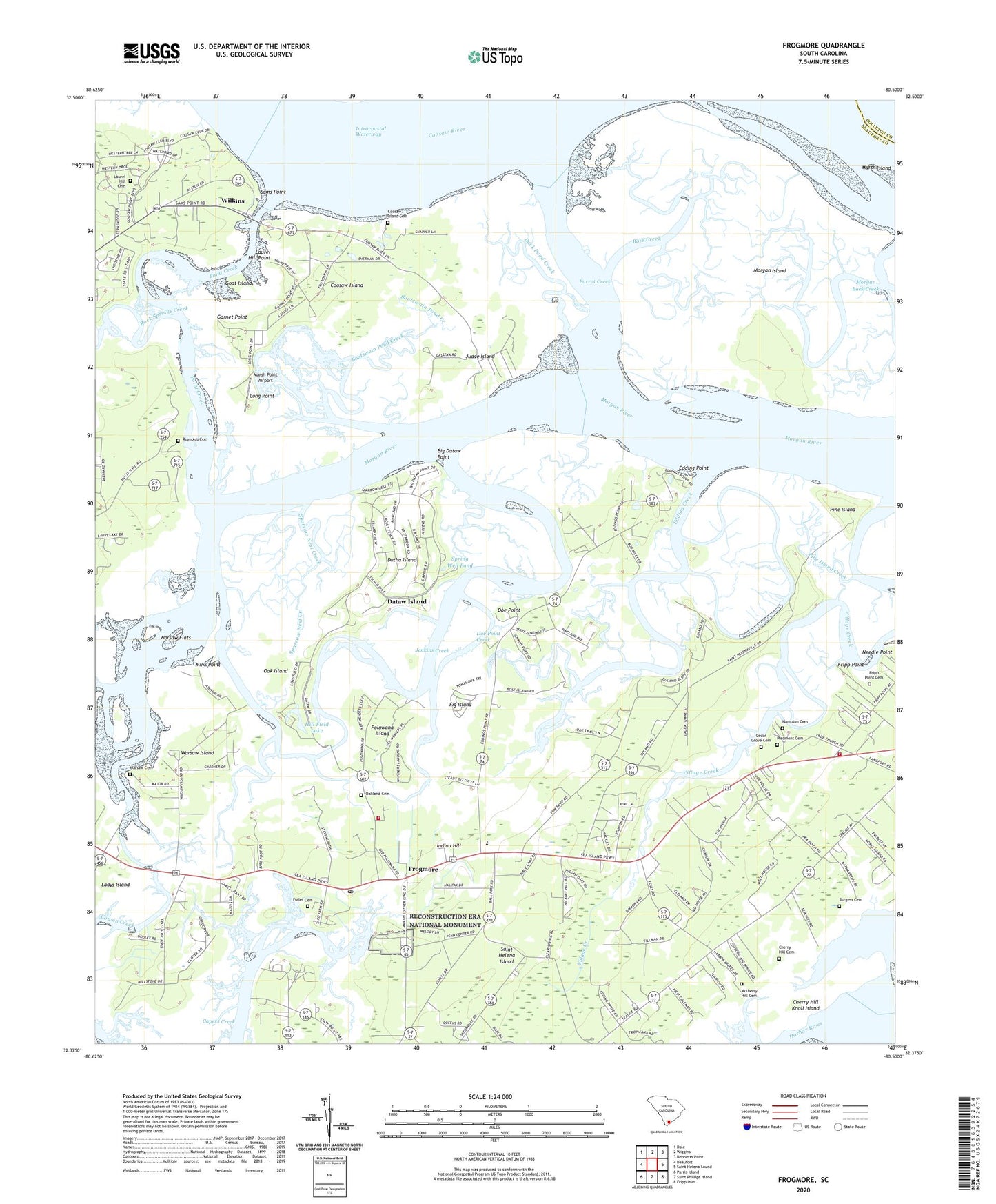
2024 topographic map quadrangle Frogmore in the state of South Carolina. Scale: 1:24000. Based on the newly updated USGS 7.5' US Topo map series, this map is in the following counties: Beaufort, Colleton. The map contains contour data, water features, and other items you are used to seeing on USGS maps, but also has updated roads and other features. This is the next generation of topographic maps. Printed on high-quality waterproof paper with UV fade-resistant inks.
Quads adjacent to this one:
West: Beaufort
Northwest: Dale
North: Wiggins
Northeast: Bennetts Point
East: Saint Helena Sound
Southeast: Fripp Inlet
South: Saint Phillips Island
Southwest: Parris Island
This map covers the same area as the classic USGS quad with code o32080d5.
Contains the following named places: Ashdale, Atteza Church, Bass Creek, Beaufort County Library Saint Helena Branch, Bethel Church, Big Dataw Point, Boatswain Pond Creek, Brick Church, Burgess Cemetery, Cedar Grove Cemetery, Cherry Hill Cemetery, Cherry Hill Knoll Island, Coosaw Island, Coosaw Island Cemetery, Coosaw Island School, Coosaw School, Dataw Island, Dataw Island Marina, Datha Island, Doe Point, Doe Point Creek, Duck Pond Creek, Ebenezer Church, Edding Creek, Edding Point, Edding Point School, Elding School, Fig Island, Fripp Point, Fripp Point Cemetery, Frogmore, Fuller Cemetery, Garnet Point, Gleasons Landing, Goat Island, Hampton Cemetery, Hill Field Lake, Indian Hill, Jenkins Creek, Judge Island, Lady's Island - St. Helena Fire District Station 24, Lady's Island Saint Helena Fire District Station 22, Laurel Hill Cemetery, Laurel Hill Plantation Airport, Laurel Hill Point, Little Gem Tree Farm, Long Point, Marsh Island, Marsh Point Airport, Mink Point, Morgan Back Creek, Morgan Island, Mulberry Hill Cemetery, Needle Point, Oak Island, Oak School, Oakland Cemetery, Parrot Creek, Peace Church, Penn Community Services, Piedmont Cemetery, Pinckney Church, Pine Island, Pine Island Creek, Pine Landing, Point Creek, Polawana Island, Reynolds Cemetery, Rock Springs Creek, Saint Helena Elementary School, Saint Helena Island, Saint Helena Island Post Office, Saint Helena Parish Chapel of Ease Ruins, Saint Joseph Church, Samaritan Church, Sams Point, Sams Point School, Scottsville Church, Sparrow Nest Creek, Spring Well Pond, Village Creek, Warsaw Cemetery, Warsaw Church, Warsaw Flats, Warsaw Island, Wassa School, Wilkins, ZIP Code: 29907