
MyTopo
Saluda South South Carolina US Topo Map
Couldn't load pickup availability
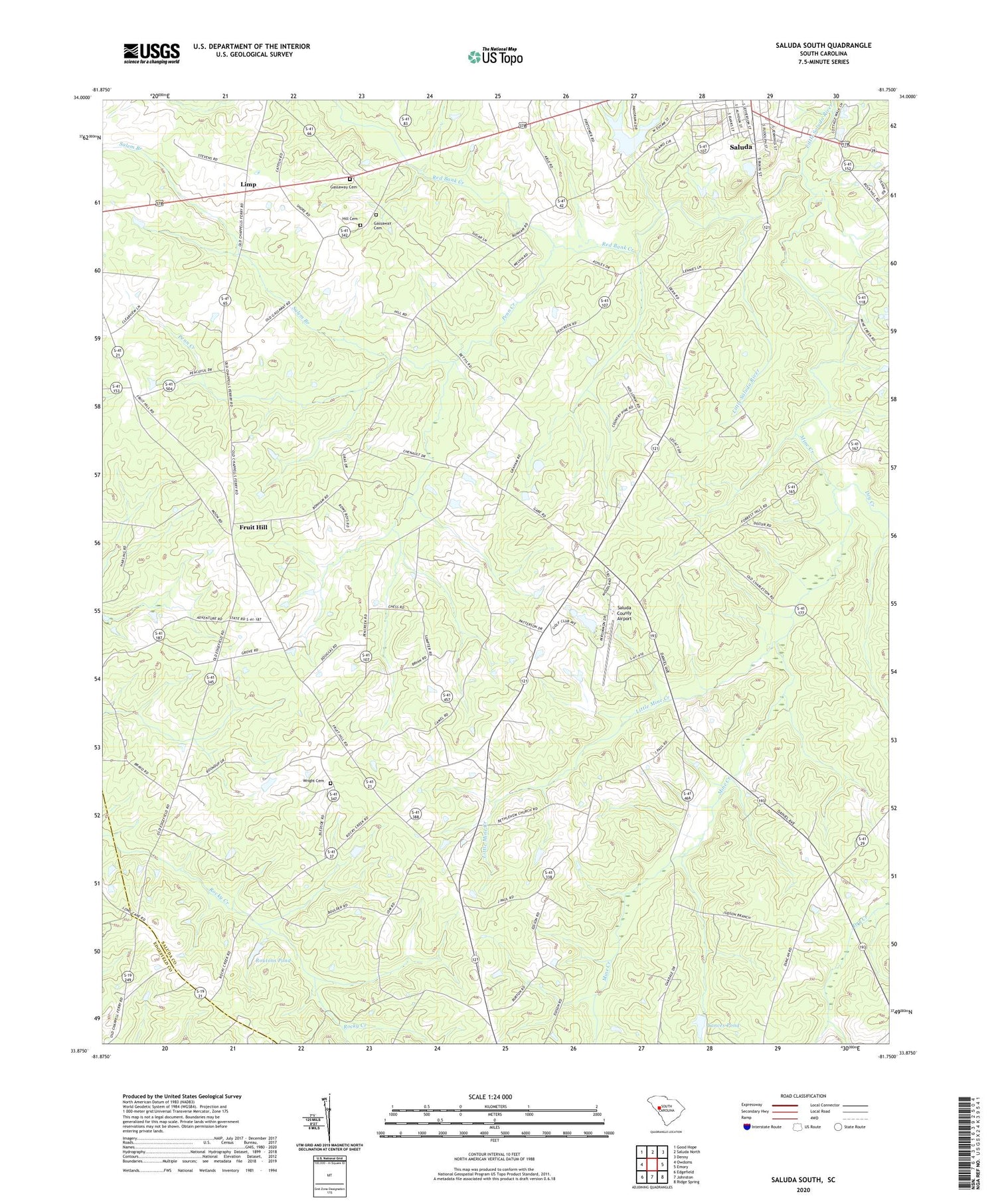
2020 topographic map quadrangle Saluda South in the state of South Carolina. Scale: 1:24000. Based on the newly updated USGS 7.5' US Topo map series, this map is in the following counties: Saluda, Edgefield. The map contains contour data, water features, and other items you are used to seeing on USGS maps, but also has updated roads and other features. This is the next generation of topographic maps. Printed on high-quality waterproof paper with UV fade-resistant inks.
Quads adjacent to this one:
West: Owdoms
Northwest: Good Hope
North: Saluda North
Northeast: Denny
East: Emory
Southeast: Ridge Spring
South: Johnston
Southwest: Edgefield
Contains the following named places: Bethlehem Church, Bethlehem School, Cedar Grove Church, Dry Creek, Etheredge Plantation Airport, Fruit Hill, Fruit Hill Community Center, Fruit Hill School, Gassaway Cemetery, Gassaway Church, Hill Cemetery, Limp, Little Mine Creek, Lockhart Church, Lockhart School, Mathais Crossroads, Mine Creek, Mine Creek Church, Mine Creek School, Mount Calvary Church, Mount Calvary School, New Saluda Reservoir, Oak Grove Church, Oak Grove School, Old Saluda Reservoir, Old Saluda Reservoir Dam D-0031, Penn Creek, Penn Creek Church, Penn Creek School, Persimmon Hill Country Club, Plum Branch School, Red Bank Creek, Rock Hill Church, Rocky Creek Church, Routons Pond, Routons Pond Dam D-1201, Salem Branch, Salem Church, Saluda County Airport, Saluda Division, South Carolina Noname 41001 D-1196 Dam, South Carolina Noname 41011 D-1202 Dam, Suddath School, Sumter School, Wright Cemetery, Yances Pond, Yances Pond Dam D-1596


