MyTopo
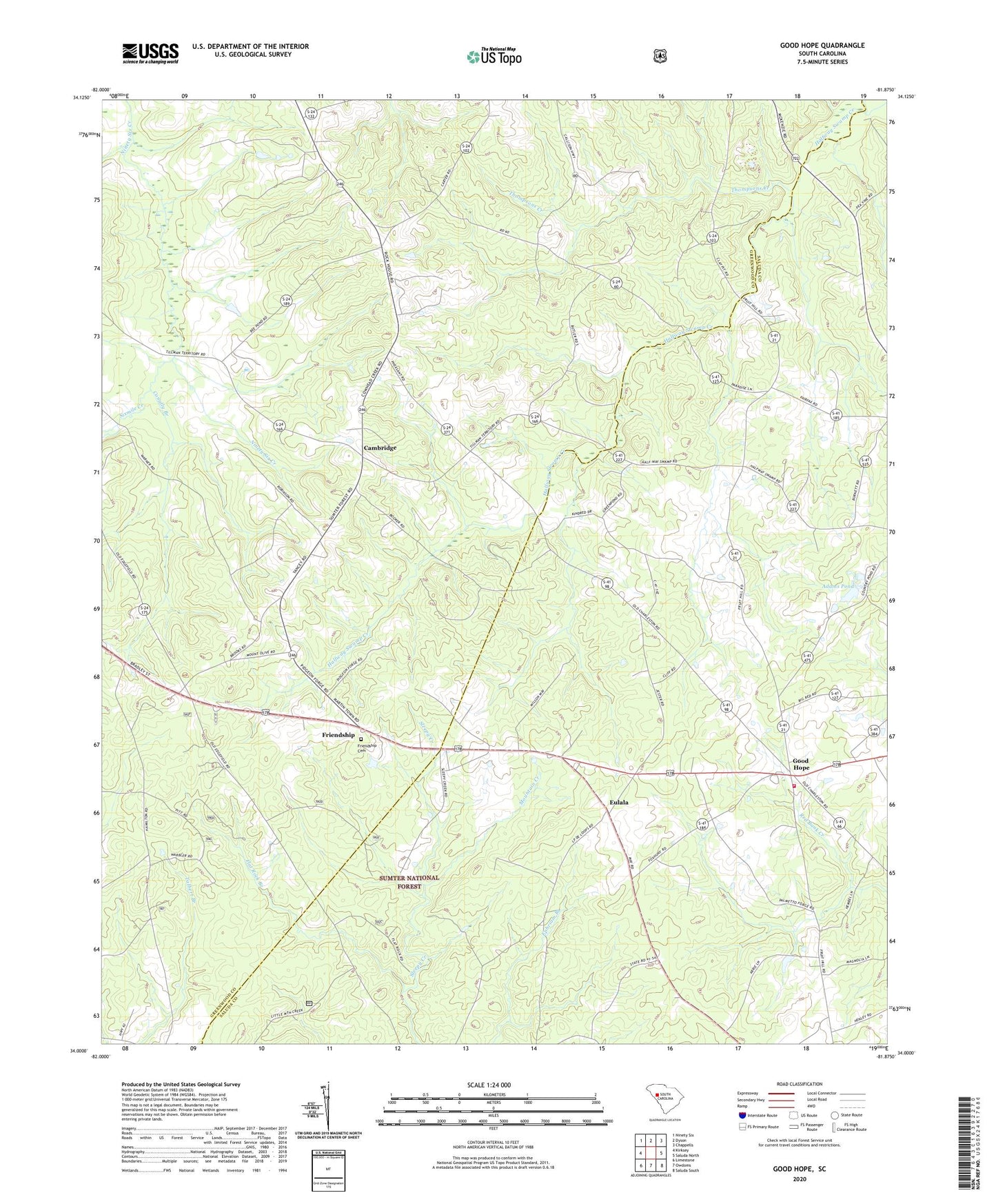
Good Hope South Carolina US Topo Map
Couldn't load pickup availability
Also explore the Good Hope Forest Service Topo of this same quad for updated USFS data
2024 topographic map quadrangle Good Hope in the state of South Carolina. Scale: 1:24000. Based on the newly updated USGS 7.5' US Topo map series, this map is in the following counties: Greenwood, Saluda. The map contains contour data, water features, and other items you are used to seeing on USGS maps, but also has updated roads and other features. This is the next generation of topographic maps. Printed on high-quality waterproof paper with UV fade-resistant inks.
Quads adjacent to this one:
West: Kirksey
Northwest: Ninety Six
North: Dyson
Northeast: Chappells
East: Saluda North
Southeast: Saluda South
South: Owdoms
Southwest: Limestone
This map covers the same area as the classic USGS quad with code o34081a8.
Contains the following named places: Adams Pond, Adams Pond Dam D-1593, Antioch Church, Brooks School, Butler Memorial Church, Cambridge, Cedar Grove School, Celestia, Conally Branch, Cooper Church, Eulala, Eulala School, Fairfax School, Fairview School, Flat Rock Branch, Friendship, Friendship Cemetery, Friendship Church, Good Hope, Good Hope Church, Mayson Fire and Rescue Number 300, Mount Greer School, Mount Olive Church, Mount Olive School, Mountain Creek, Oak Grove School, Sixmile Creek, Thompsons Creek, Traywick Church, Trinity Rosenwald School, Trinity School, White Rock Church, ZIP Code: 29666