MyTopo
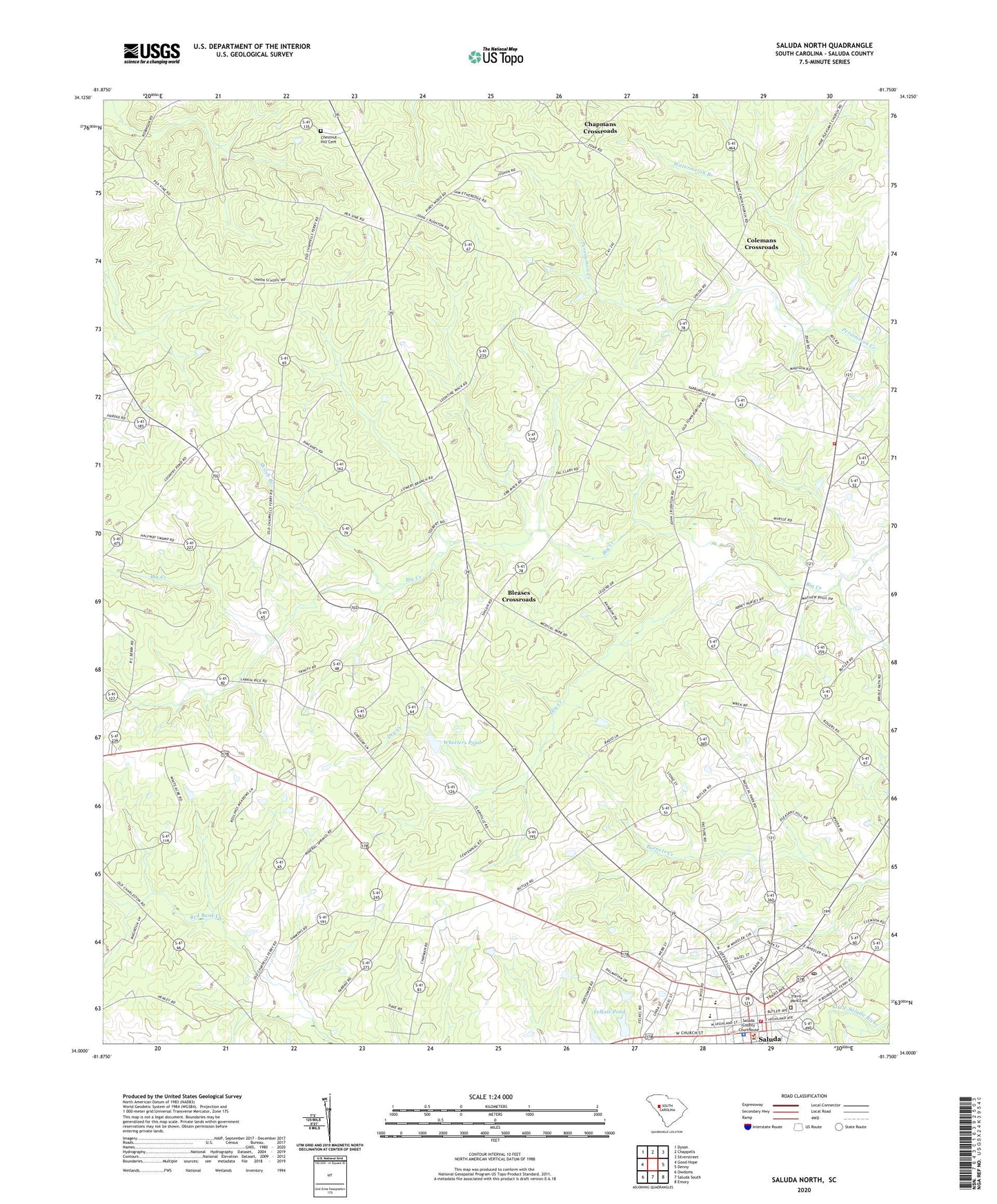
Saluda North South Carolina US Topo Map
Couldn't load pickup availability
2024 topographic map quadrangle Saluda North in the state of South Carolina. Scale: 1:24000. Based on the newly updated USGS 7.5' US Topo map series, this map is in the following counties: Saluda. The map contains contour data, water features, and other items you are used to seeing on USGS maps, but also has updated roads and other features. This is the next generation of topographic maps. Printed on high-quality waterproof paper with UV fade-resistant inks.
Quads adjacent to this one:
West: Good Hope
Northwest: Dyson
North: Chappells
Northeast: Silverstreet
East: Denny
Southeast: Emory
South: Saluda South
Southwest: Owdoms
This map covers the same area as the classic USGS quad with code o34081a7.
Contains the following named places: Big Creek, Bleases Crossroads, Centennial School, Chapmans Crossroads, Chestnut Hill Cemetery, Chestnut Hill Church, Colemans Crossroads, Corner Stone Christian Church, Dry Creek, Eva School, Faith Temple, Felkels Pond, Felkels Pond Dam D-1149, Hopewell Church, Mount Pleasant Lutheran Church, Old Town Fire Department Station Number 600, Persimmon Creek School, Pleasant Hill Church, Red Bank Church, Red Hill School, Riverside High School, Saint Pauls Church, Saluda, Saluda County Ambulance Service, Saluda County Courthouse, Saluda Elementary School, Saluda Fire Department Number 400, Saluda High School, Saluda Lookout Tower, Saluda Police Department, Saluda Post Office, Saluda Presbyterian Church, Scurry Airport, Shiloh Branch, Shiloh Church, Shiloh School, Town of Saluda, Travis Park Cemetery, Trinity Evangelical Lutheran Church, Universal Church, Watermelon Branch, Wheelers Pond, Wheelers Pond Dam D-1594, White Acres Farm, WJRQ-FM (Saluda), Zoar Church, Zoar School, ZIP Code: 29138