MyTopo
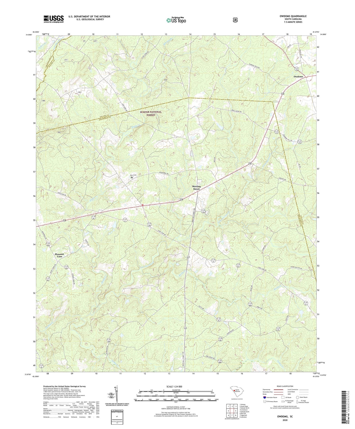
Owdoms South Carolina US Topo Map
Couldn't load pickup availability
Also explore the Owdoms Forest Service Topo of this same quad for updated USFS data
2024 topographic map quadrangle Owdoms in the state of South Carolina. Scale: 1:24000. Based on the newly updated USGS 7.5' US Topo map series, this map is in the following counties: Edgefield, Saluda, Greenwood. The map contains contour data, water features, and other items you are used to seeing on USGS maps, but also has updated roads and other features. This is the next generation of topographic maps. Printed on high-quality waterproof paper with UV fade-resistant inks.
Quads adjacent to this one:
West: Limestone
Northwest: Kirksey
North: Good Hope
Northeast: Saluda North
East: Saluda South
Southeast: Johnston
South: Edgefield
Southwest: Red Hill
This map covers the same area as the classic USGS quad with code o33081h8.
Contains the following named places: Dorn Cemetery, Ephriam Branch, Faulkner Mountain Lookout Tower, Faulkner Mountain School, Johnson School, Little Stevens Creek, Little Stevens Creek Church, Long Cane School, McKendree Church, Meeting Street, Northside Volunteer Fire Department, Oak Grove School, Owdoms, Pine Grove Church, Pittsburg School, Pleasant Lane, Rocky Creek, Sleepy Creek, Southern Gold Mine, Spring Branch Church, Tompkins Community House, Tompkins Cross Roads, Tompkins School, Willow Springs Church, Willow Springs School