MyTopo
Shulerville South Carolina US Topo Map
Couldn't load pickup availability
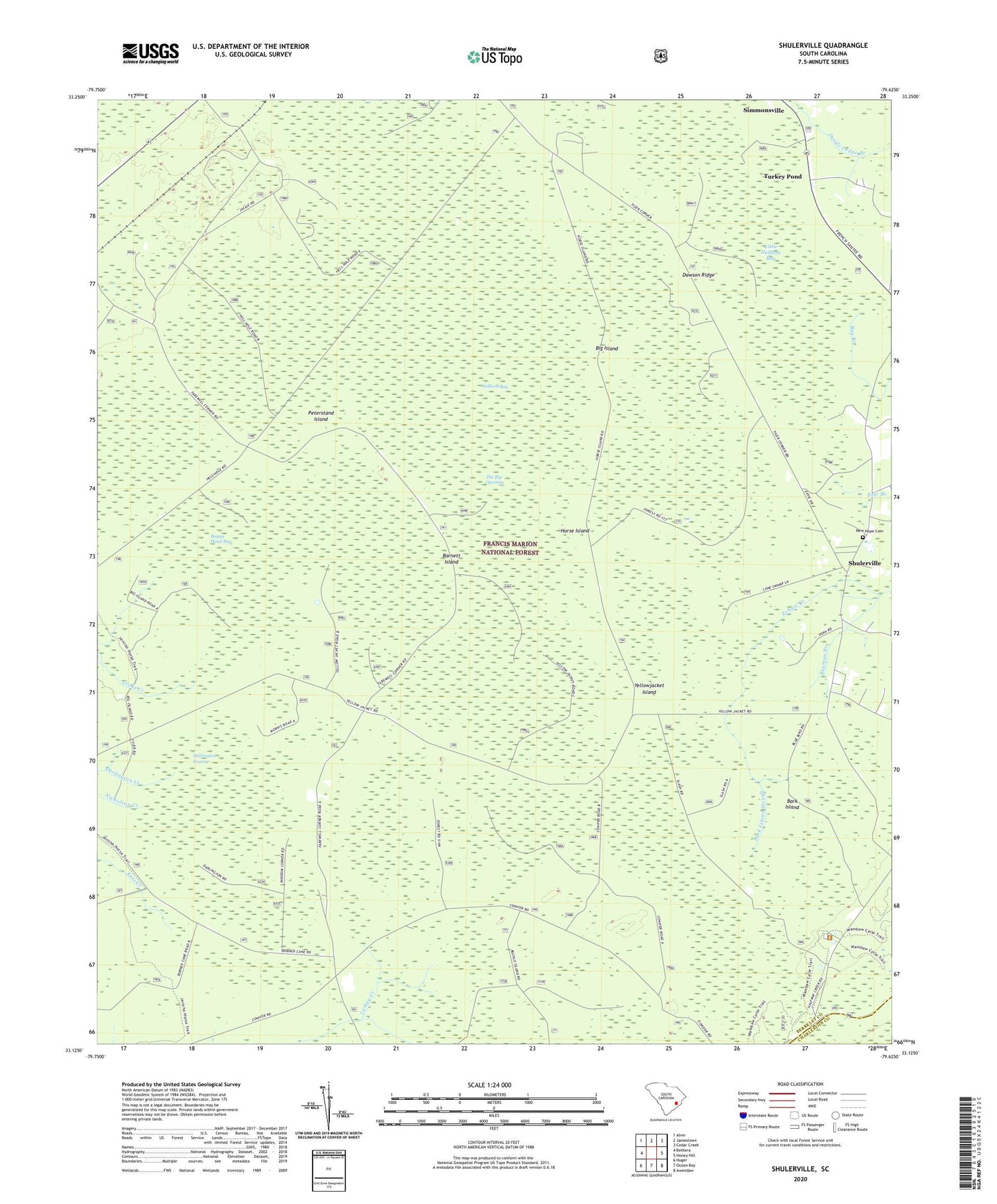
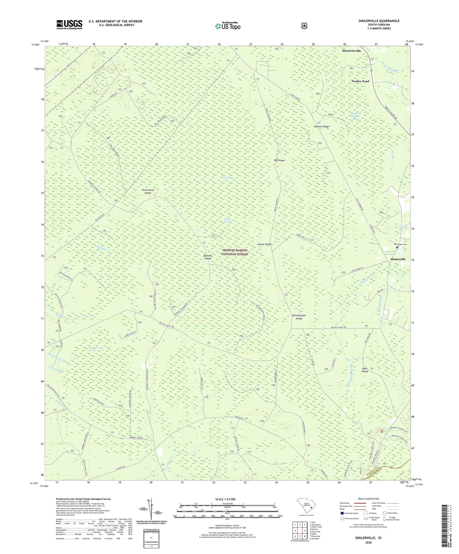
2020 topographic map quadrangle Shulerville in the state of South Carolina. Scale: 1:24000. Based on the newly updated USGS 7.5' US Topo map series, this map is in the following counties: Berkeley, Charleston. The map contains contour data, water features, and other items you are used to seeing on USGS maps, but also has updated roads and other features. This is the next generation of topographic maps. Printed on high-quality waterproof paper with UV fade-resistant inks.
Quads adjacent to this one:
West: Bethera
Northwest: Alvin
North: Jamestown
Northeast: Cedar Creek
East: Honey Hill
Southeast: Awendaw
South: Ocean Bay
Southwest: Huger
Contains the following named places: Bark Island, Bark Island Slough, Barnett Island, Beaman Branch, Bethany Church, Big Island, Boggy Head Bay, Cordesville Division, Darlington Swamp, Dawson Ridge, Farewell Corner, Francis Marion National Forest, Gum Branch, Hell Hole Bay Wilderness, Hellhole Bay, Hellhole Bay Wilderness, Horse Island, Little Hellhole Bay, New Hope Cemetery, New Hope School, Newhope Church, Oak Corner, Peterstand Island, Round Pond Trailhead, Shulerville, Shulerville Post Office, Simmonsville, The Big Opening, Thomas Corner, Turkey Pond, Windom Corner, Yellowjacket Island, ZIP Code: 29453