MyTopo
Jamestown South Carolina US Topo Map
Couldn't load pickup availability
Also explore the Jamestown Forest Service Topo of this same quad for updated USFS data
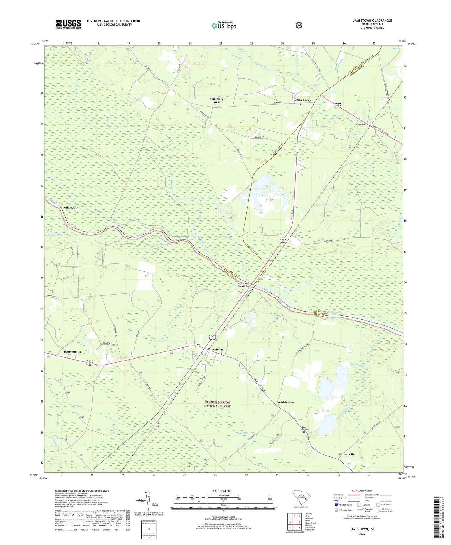
2024 topographic map quadrangle Jamestown in the state of South Carolina. Scale: 1:24000. Based on the newly updated USGS 7.5' US Topo map series, this map is in the following counties: Berkeley, Williamsburg, Georgetown. The map contains contour data, water features, and other items you are used to seeing on USGS maps, but also has updated roads and other features. This is the next generation of topographic maps. Printed on high-quality waterproof paper with UV fade-resistant inks.
Quads adjacent to this one:
West: Alvin
Northwest: Blakely
North: Trio
Northeast: Andrews
East: Cedar Creek
Southeast: Honey Hill
South: Shulerville
Southwest: Bethera
This map covers the same area as the classic USGS quad with code o33079c6.
Contains the following named places: Beufordtown, Brunson Branch, Byno Creek, Cedar Creek, Cedar Creek Church, Devils Lodge Branch, Dorien Station, Dutart Creek, Ferry Lake, Flanders Hole, Georgetown Quarry, Gravel Run, Gregler Swamp, Gridiron Chapel, Guillard Lake Scenic Area, Jamestown, Jamestown City Fire Department, Jamestown Post Office, Jamestown Rural Fire Department Company 24, Leneuds Ferry, Leneuds Ferry Bridge, Leneuds School, Liberty Church, Liberty School, Long Branch, Oceda, Palmerville, Persimmon Branch, Pine Grove School, Saint James Cemetery, Saint Marys Church, Sarah Drain, Savanna Creek, Singletary Forks, Tiger Corner, Town of Jamestown, Washington, Williamsburg Fire Department Station 14, Wittee Branch, Wittee Island, Wittee Lake, Zion Church