
MyTopo
Union West South Carolina US Topo Map
Couldn't load pickup availability
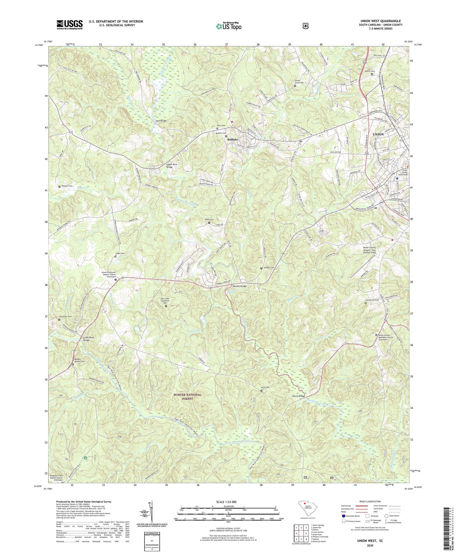
2020 topographic map quadrangle Union West in the state of South Carolina. Scale: 1:24000. Based on the newly updated USGS 7.5' US Topo map series, this map is in the following counties: Union. The map contains contour data, water features, and other items you are used to seeing on USGS maps, but also has updated roads and other features. This is the next generation of topographic maps. Printed on high-quality waterproof paper with UV fade-resistant inks.
Quads adjacent to this one:
West: Cross Anchor
Northwest: Glenn Springs
North: Jonesville
Northeast: Kelton
East: Union East
Southeast: Whitmire North
South: Sedalia
Southwest: Philson Crossroads
Contains the following named places: Antioch Church, Bishop School, Bishop Town, Bishops Church, Bobos Ford, Buffalo, Buffalo Baptist Church, Buffalo Cemetery, Buffalo Census Designated Place, Buffalo Creek, Buffalo Elementary School, Buffalo Mill Fire Department, Buffalo Mill Historic District, Buffalo Post Office, Buffalo United Methodist Church, Buffalo Volunteer Fire Department, Calhoun Experimental Forest, Cedar Bluff Bridge, Cedar Hill School, Clinton Chapel Methodist Church, Corinth Baptist Church, Dining Creek, Duncan Acres United Methodist Church, E M M D Plant Heliport, Fair Forest Hunt Camp, Fair Forest Rifle Range, Fairforest Shoal, Gage School, Gibbs Cemetery, Goat Alley, Harris Bridge, Holcombe Branch, Holcombe Cemetery, Humphries Cemetery, Isaacs Creek, Lower Fairforest Baptist Church, Lower Fairforest Baptist Church Graveyard, Macbeth Church, Metro Care, Minter Bridge, Mitchell Creek, Morris Branch, Mud Bridge, Murphy - Duncan Cemetery, Murphy Bridge, Murphys Mill, New Chapel Church, Old Lower Fairforest Cemetery, Padgetts Creek Baptist Church Graveyard, Palmer Cemetery, Parks Cemetery, Rice Cemetery, Rice Chapel African Methodist Episcopal Zion Church Graveyard, Rices Chapel, Saint Luke Baptist Church Graveyard, Saint Lukes Church, Saint Lukes School, Sand Creek, Sanders Cemetery, Sardis, Sardis School, Sardis United Methodist Church, Sardis United Methodist Church Graveyard, Sedalia Hunt Camp, Shoal Creek, South Street-South Church Street Historic District, Southside Fire Department, Sparks Creek, Sugar Creek, Swink - Little Cemetery, Tempie Hill, Union Academy, Union City Hall, Union Community Hospital, Union Country Club, Union County Airport Troy Shelton Field, Union County Courthouse, Union County Fairgrounds, Union County Jail, Union Medical Center, Union Public Safety Department, Union Public Safety Department - Police, Union Square Shopping Center, Upper Rice Bridge, Wallace Cemetery, WBCU-AM (Union), Weleyan Methodist Episcopal Church, West End School, West Springs Division, Westside Baptist Church, Wilburns School, ZIP Code: 29321


