MyTopo
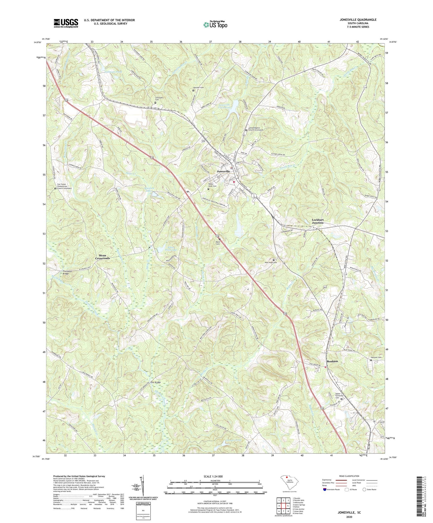
Jonesville South Carolina US Topo Map
Couldn't load pickup availability
2024 topographic map quadrangle Jonesville in the state of South Carolina. Scale: 1:24000. Based on the newly updated USGS 7.5' US Topo map series, this map is in the following counties: Union, Cherokee, Spartanburg. The map contains contour data, water features, and other items you are used to seeing on USGS maps, but also has updated roads and other features. This is the next generation of topographic maps. Printed on high-quality waterproof paper with UV fade-resistant inks.
Quads adjacent to this one:
West: Glenn Springs
Northwest: Pacolet
North: Pacolet Mills
Northeast: Wilkinsville
East: Kelton
Southeast: Union East
South: Union West
Southwest: Cross Anchor
This map covers the same area as the classic USGS quad with code o34081g6.
Contains the following named places: Barkham School, Beaverdam Creek, Bethany Baptist Church Cemetery, Bishop Branch, Bogan Pond, Bogan Pond Dam D-2304, Bonham, Bonham Fire Department, Cedar Grove Baptist Church Graveyard, Cedar Grove Church, Cedar Grove School, Church of God, Eison Branch, Elford Grove School, Fair Forest Presbyterian Church Graveyard, Fairforest Baptist Church, Fosters Chapel, Fosters School, Gallmans Pond, Gallmans Pond Dam D-2148, Gardin Family Cemetery, Gault School, Gilead Baptist Church, Gilead Baptist Church Graveyard, Gist Bridge, Hancock Cemetery, Jonesville, Jonesville Baptist Church, Jonesville Division, Jonesville Elementary School, Jonesville Fire Department, Jonesville High School, Jonesville Memorial Gardens, Jonesville Police Department, Jonesville Town Pond, Jonesville Town Pond Dam D-2161, Littlejohn Cemetery, Lockhart Junction, Longs Chapel, Mark Hill Baptist Church Graveyard, McClure Creek, Mean Crossroads, Mitchell Cemetery, New Hope Cemetery, New Hope United Methodist Church, Rocky Creek, Rocky Creek School, Rogansville, Spear Creek, Swink Creek, Thompson Bridge, Town of Jonesville, Turners Pond, Turners Pond Dam D-2150, Union County Home, Union County Pond D-2151 Dam, Upper Fairforest Baptist Church, Upper Fairforest Cemetery, Ward Cemetery, Weber - Haile Cemetery, White Pines Lake, White Pines Lake Dam D-2149, Whitlock Lakes, Woodson Baptist Church, Woodson School, ZIP Code: 29353