MyTopo
White Oak Creek South Carolina US Topo Map
Couldn't load pickup availability
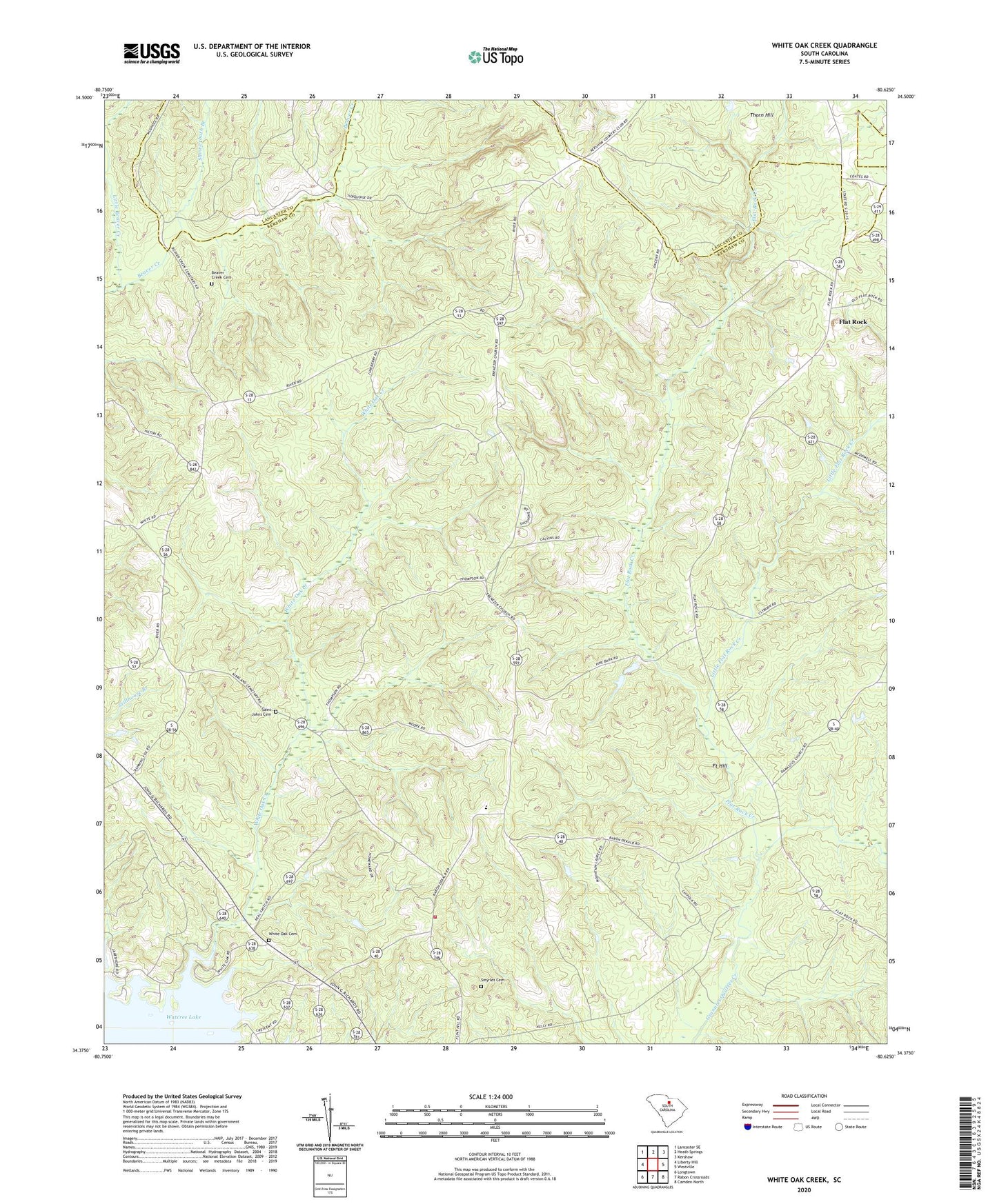
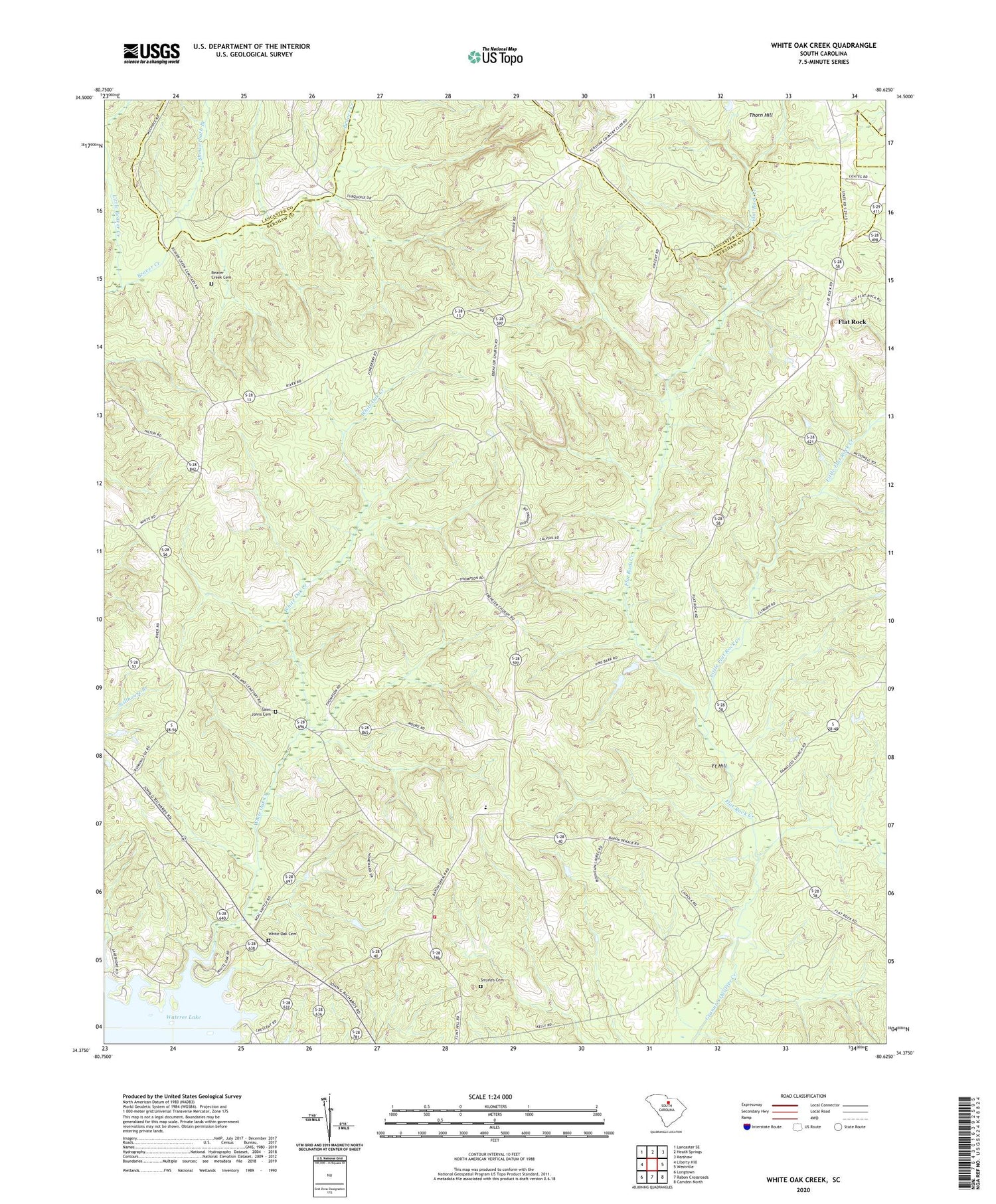
2020 topographic map quadrangle White Oak Creek in the state of South Carolina. Scale: 1:24000. Based on the newly updated USGS 7.5' US Topo map series, this map is in the following counties: Kershaw, Lancaster. The map contains contour data, water features, and other items you are used to seeing on USGS maps, but also has updated roads and other features. This is the next generation of topographic maps. Printed on high-quality waterproof paper with UV fade-resistant inks.
Quads adjacent to this one:
West: Liberty Hill
Northwest: Lancaster SE
North: Heath Springs
Northeast: Kershaw
East: Westville
Southeast: Camden North
South: Rabon Crossroads
Southwest: Longtown
Contains the following named places: Beaver Creek Cemetery, Beaver Creek Meeting House, Bethel Church, Clermont Plantation, Dry Branch, Ebenezer Church, Ebenezer School, Flat Rock, Flat Rock Church, Flat Rock Creek, Flat Rock School, Fort Hill, Grannys Quarter, Kershaw County Fire Station 21 Baron DeKalb, Kirkland Church, Kirkland School, Little Barfield Millpond, Little Beaver Creek, Little Flat Rock Creek, Macedonia Church, McDowell Plantation, Mount Calvary Church, Red Hill, Red Hill Plantation, Red Hill School, Rock Spring Church, Saint Johns Cemetery, Saint Johns Church, Showerbath Branch, Smyrles Cemetery, Smyrles Plantation, Squire Jims Plantation, Thorn Hill, Thornhill School, Tom Jones Ford, Westville Division, White Oak Cemetery, White Oak Church, White Oak Creek, White Oak Plantation, Whiteoak Church