MyTopo
Workman South Carolina US Topo Map
Couldn't load pickup availability
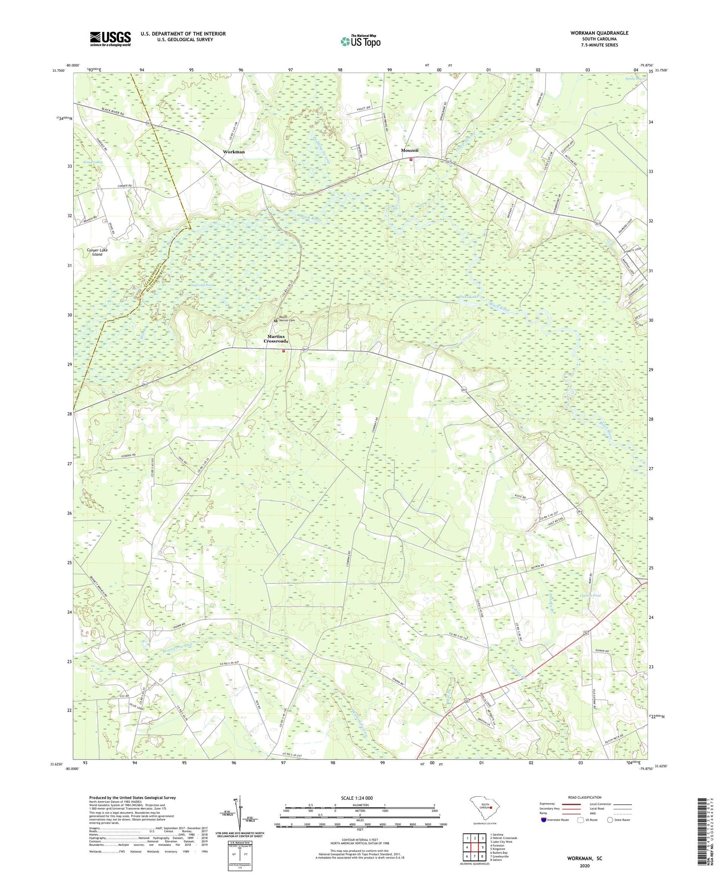
2020 topographic map quadrangle Workman in the state of South Carolina. Scale: 1:24000. Based on the newly updated USGS 7.5' US Topo map series, this map is in the following counties: Williamsburg, Clarendon. The map contains contour data, water features, and other items you are used to seeing on USGS maps, but also has updated roads and other features. This is the next generation of topographic maps. Printed on high-quality waterproof paper with UV fade-resistant inks.
Quads adjacent to this one:
West: Foreston
Northwest: Sardinia
North: Hebron Crossroads
Northeast: Lake City West
East: Kingstree
Southeast: Salters
South: Greeleyville
Southwest: Butlers Bay
Contains the following named places: Belsers Crossroads, Bethlehem Church, Bethlehem School, Beulah Church, Black River Church, Clapp Swamp, Conyer Lake, Conyer Lake Island, Cypress Pond, Duke Lake, First Care Medical Transport, Green School, Jordan Pond, Kingstree Golf Course, Martins Crossroads, Mary School, Mill Branch, Mount Vernon Cemetery, Mount Vernon Church, Mount Vernon School, Mouzon, Mouzon Church, Mouzon School, New Bethel Church, Oak Grove Church, Oak Grove School, Oakdale School, Pine Grove Church, Pudding Swamp, Pushing Branch, Retreat School, Saint James Church, Saint James School, Saint Johns Church, Saint Lukes Church, Saint Marys Church, Snow Hill School, Swamp Fox Golf Club, Wee Nee School, Williamsburg County Fire Department Station 1, Williamsburg County Fire Department Station 2, Workman, Workman Methodist Episcopal Church South