MyTopo
Alexandria South Dakota US Topo Map
Couldn't load pickup availability
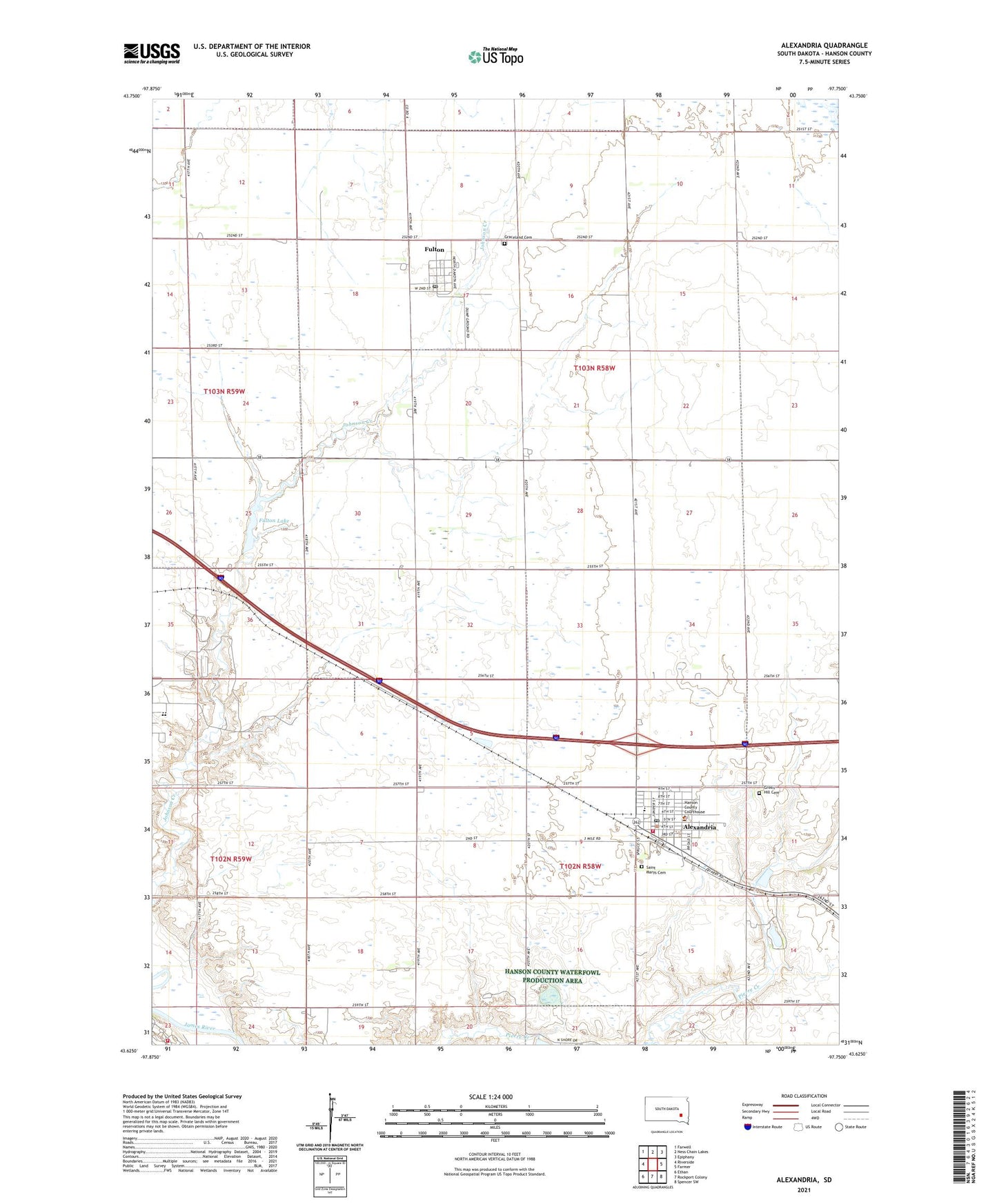
2021 topographic map quadrangle Alexandria in the state of South Dakota. Scale: 1:24000. Based on the newly updated USGS 7.5' US Topo map series, this map is in the following counties: Hanson. The map contains contour data, water features, and other items you are used to seeing on USGS maps, but also has updated roads and other features. This is the next generation of topographic maps. Printed on high-quality waterproof paper with UV fade-resistant inks.
Quads adjacent to this one:
West: Riverside
Northwest: Farwell
North: Ness Chain Lakes
Northeast: Epiphany
East: Farmer
Southeast: Spencer SW
South: Rockport Colony
Southwest: Ethan
This map covers the same area as the classic USGS quad with code o43097f7.
Contains the following named places: Alexandria, Alexandria City Hall, Alexandria Fire Department and First Responders, Alexandria Post Office, Alexandria Public Library, City of Alexandria, Fulton, Fulton Dam, Fulton Lake, Fulton Post Office, Graceland Cemetery, Green Hill Cemetery, Hanson County, Hanson County Courthouse, Hanson County Sheriff, Hanson Dam, Hanson Elementary School, Hanson High School, Hanson Middle School, Millbrook Colony, Millbrook Colony Census Designated Place, Millbrook Colony Elementary School, Rosedale Colony, Rosedale Fire Department, Saint Marys Cemetery, School Number 3, School Number 4, Town of Fulton, Township of Jasper, Township of Wayne, ZIP Code: 57311