MyTopo
Riverside South Dakota US Topo Map
Couldn't load pickup availability
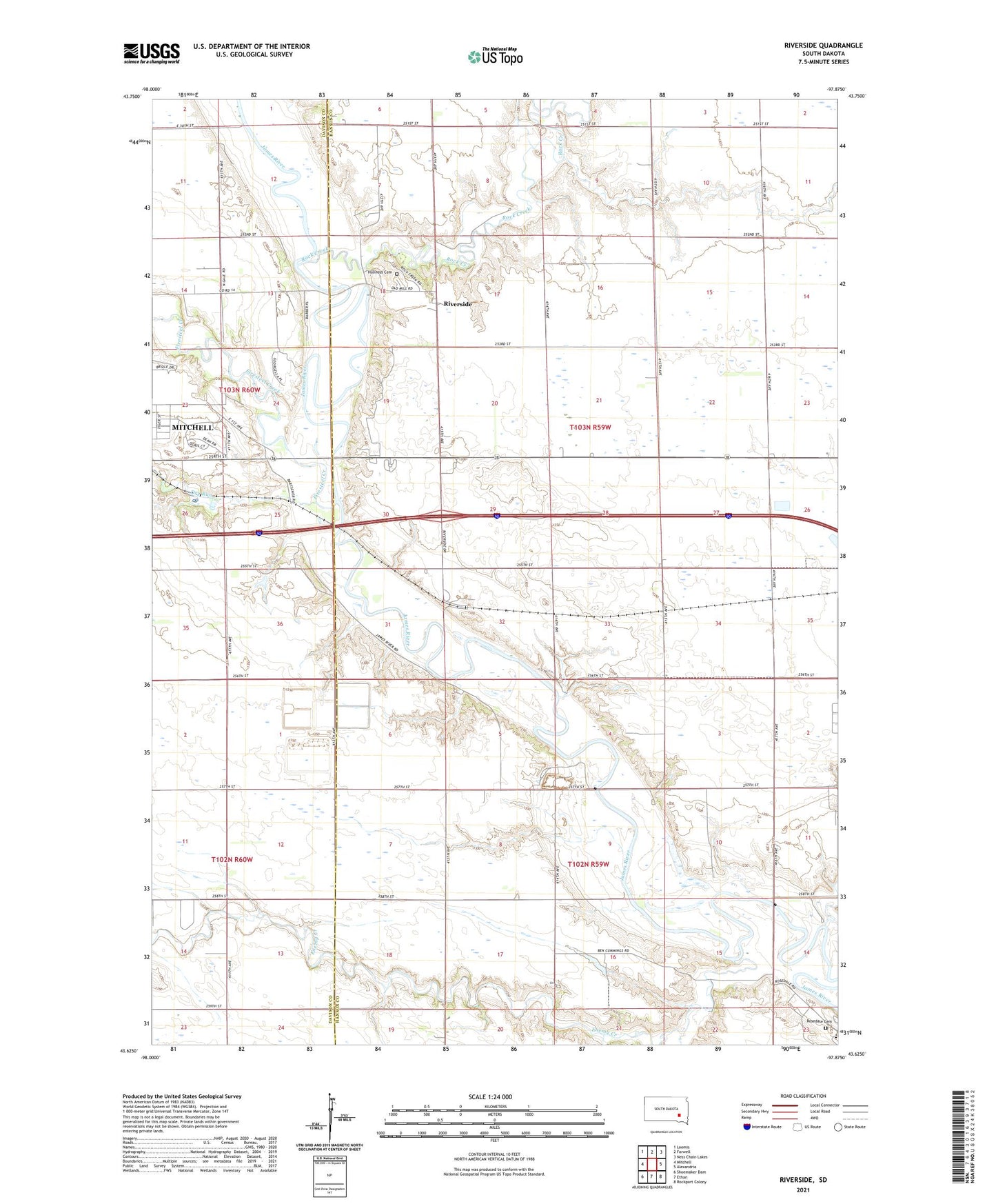
2021 topographic map quadrangle Riverside in the state of South Dakota. Scale: 1:24000. Based on the newly updated USGS 7.5' US Topo map series, this map is in the following counties: Hanson, Davison. The map contains contour data, water features, and other items you are used to seeing on USGS maps, but also has updated roads and other features. This is the next generation of topographic maps. Printed on high-quality waterproof paper with UV fade-resistant inks.
Quads adjacent to this one:
West: Mitchell
Northwest: Loomis
North: Farwell
Northeast: Ness Chain Lakes
East: Alexandria
Southeast: Rockport Colony
South: Ethan
Southwest: Shoemaker Dam
This map covers the same area as the classic USGS quad with code o43097f8.
Contains the following named places: Bard, Bard School, Dry Run, Enemy Creek, Firesteel Creek, Holiness Cemetery, Johnson Creek, KORN-AM (Mitchell), KQRN-FM (Mitchell), Medicine Butte, Riverside, Riverside Camp, Riverside School, Rock Creek, Rosedale Cemetery, Rosedale Colony Census Designated Place, Rosedale Colony Elementary School, School Number 2, School Number 3, School Number 5, School Number 7, Township of Hanson, Township of Rosedale, Wild Oak Golf Club