MyTopo
Ethan South Dakota US Topo Map
Couldn't load pickup availability
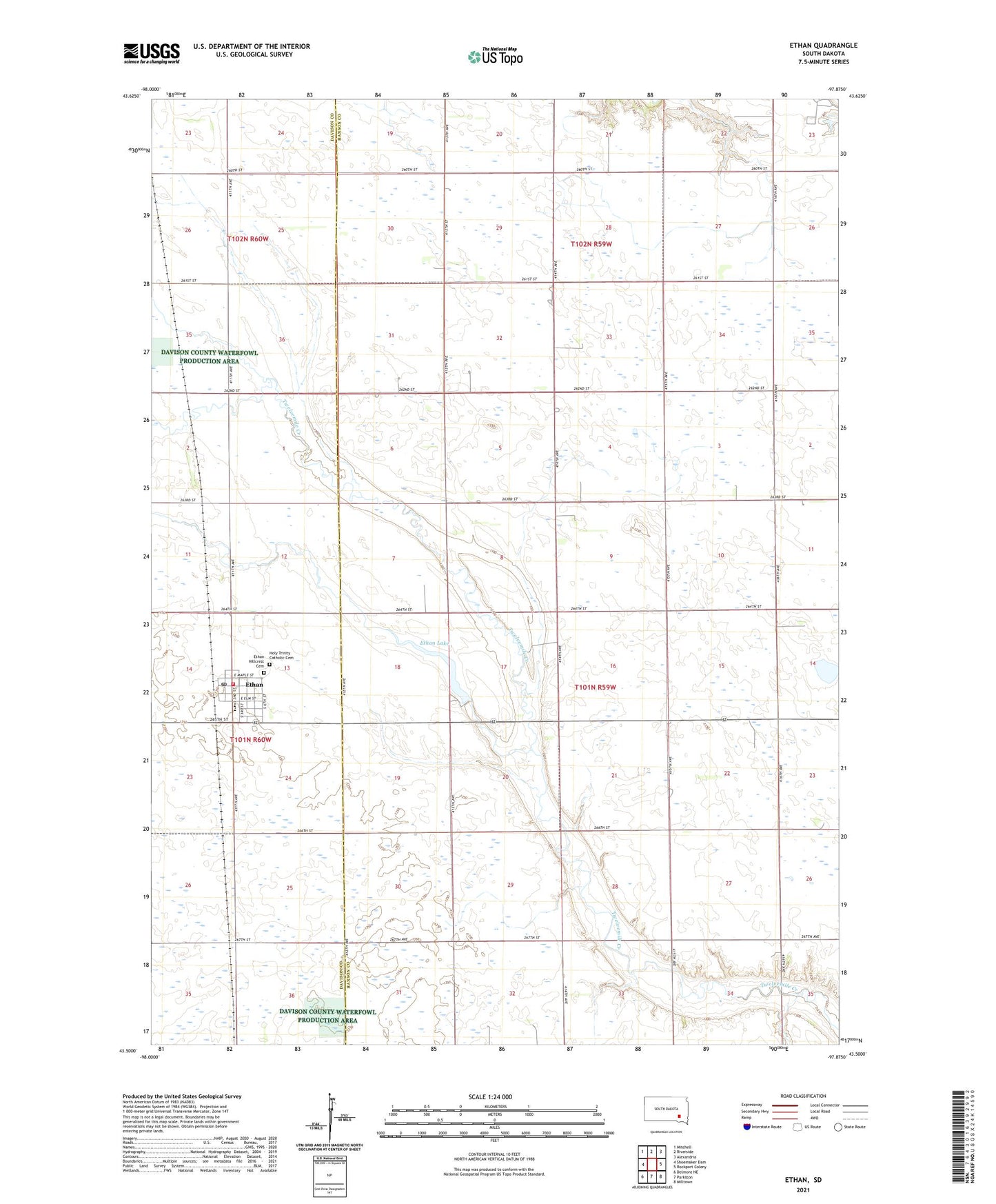
2021 topographic map quadrangle Ethan in the state of South Dakota. Scale: 1:24000. Based on the newly updated USGS 7.5' US Topo map series, this map is in the following counties: Hanson, Davison. The map contains contour data, water features, and other items you are used to seeing on USGS maps, but also has updated roads and other features. This is the next generation of topographic maps. Printed on high-quality waterproof paper with UV fade-resistant inks.
Quads adjacent to this one:
West: Shoemaker Dam
Northwest: Mitchell
North: Riverside
Northeast: Alexandria
East: Rockport Colony
Southeast: Milltown
South: Parkston
Southwest: Delmont NE
This map covers the same area as the classic USGS quad with code o43097e8.
Contains the following named places: Clark School, Coyne School, Ethan, Ethan Dam, Ethan Elementary School, Ethan Fire Department, Ethan High School, Ethan Hillcrest Cemetery, Ethan Junior High School, Ethan Lake, Ethan Post Office, Holy Trinity Catholic Cemetery, Maywood, School Number 1, School Number 2, School Number 4, Town of Ethan, Township of Worthen, Tyler School, ZIP Code: 57334