MyTopo
Alsen South Dakota US Topo Map
Couldn't load pickup availability
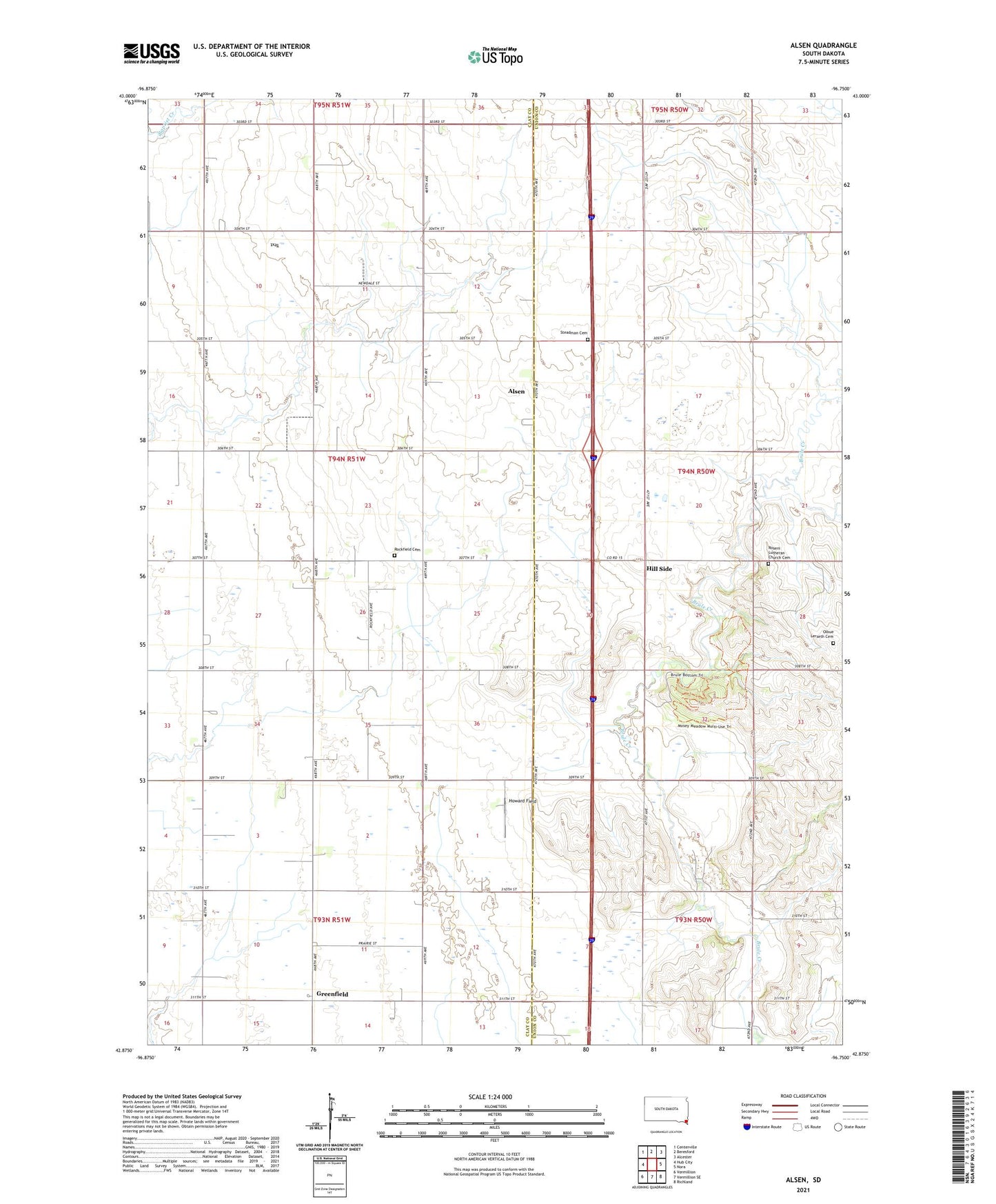
2021 topographic map quadrangle Alsen in the state of South Dakota. Scale: 1:24000. Based on the newly updated USGS 7.5' US Topo map series, this map is in the following counties: Clay, Union. The map contains contour data, water features, and other items you are used to seeing on USGS maps, but also has updated roads and other features. This is the next generation of topographic maps. Printed on high-quality waterproof paper with UV fade-resistant inks.
Quads adjacent to this one:
West: Hub City
Northwest: Centerville
North: Beresford
Northeast: Alcester
East: Nora
Southeast: Richland
South: Vermillion SE
Southwest: Vermillion
Contains the following named places: Alsen, Brule School, Cleveland School, Greenfield, Greenfield School, Hill Side, Howard Field, Newdale School, Olbue Lerseth Cemetery, Rockfield Cemetery, Rosen Church, Roseni Lutheran Church Cemetery, Saint Paul Evangelical Lutheran Church, School Number 43, Steadman Cemetery, Township of Garfield, Union County State Park