MyTopo
Aurora Center South Dakota US Topo Map
Couldn't load pickup availability
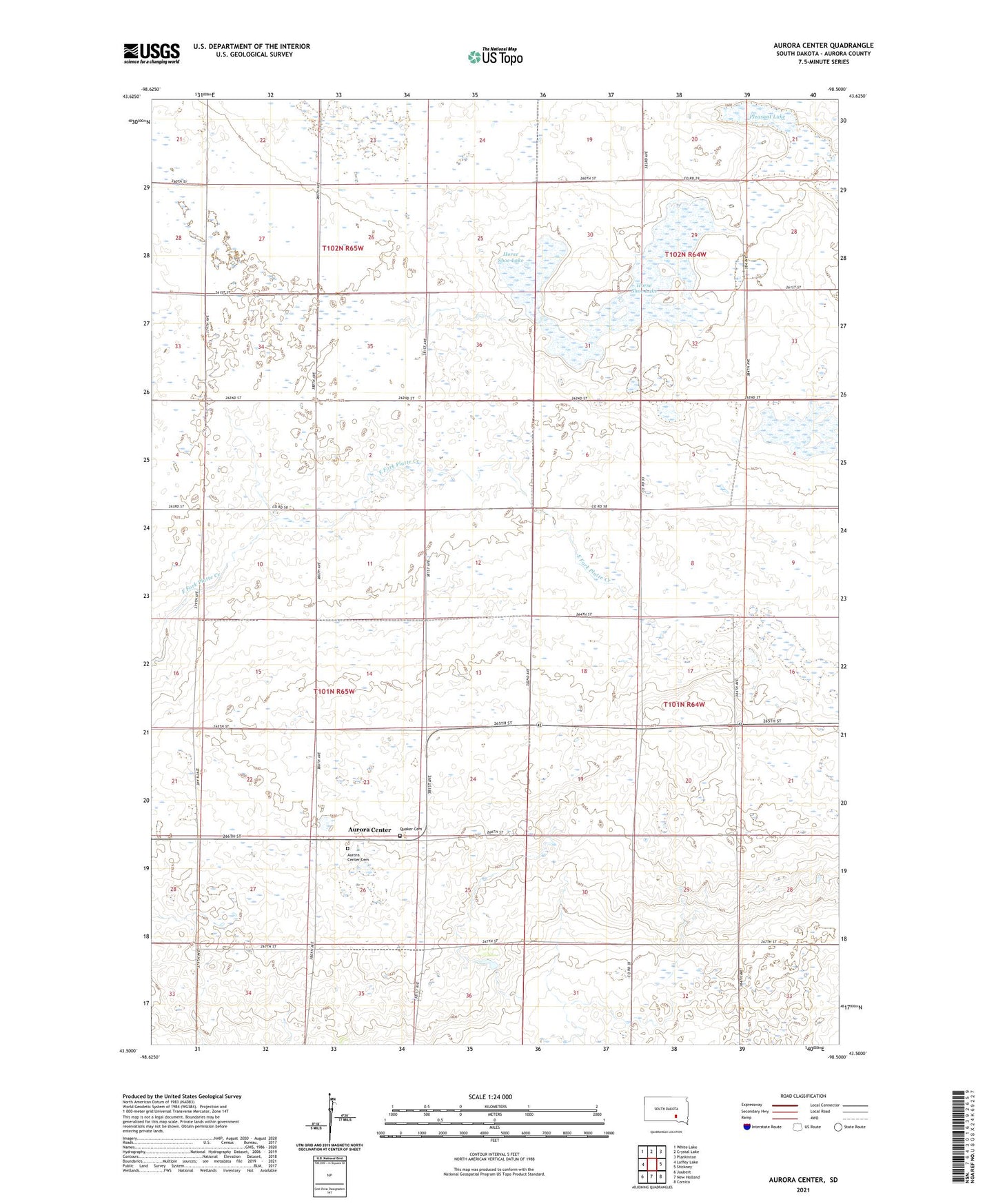
2021 topographic map quadrangle Aurora Center in the state of South Dakota. Scale: 1:24000. Based on the newly updated USGS 7.5' US Topo map series, this map is in the following counties: Aurora. The map contains contour data, water features, and other items you are used to seeing on USGS maps, but also has updated roads and other features. This is the next generation of topographic maps. Printed on high-quality waterproof paper with UV fade-resistant inks.
Quads adjacent to this one:
West: Laffey Lake
Northwest: White Lake
North: Crystal Lake
Northeast: Plankinton
East: Stickney
Southeast: Corsica
South: New Holland
Southwest: Joubert
This map covers the same area as the classic USGS quad with code o43098e5.
Contains the following named places: Aurora Center, Aurora Center Cemetery, Aurora Center Census Designated Place, Canty, Friends Church, Hanson Lake State Public Shooting Area, Horse Shoe Lake, Horseshoe Park, Pleasant Lake, Pleasant Lake State Public Shooting Area, Quaker Cemetery, Township of Center