MyTopo
Corsica South Dakota US Topo Map
Couldn't load pickup availability
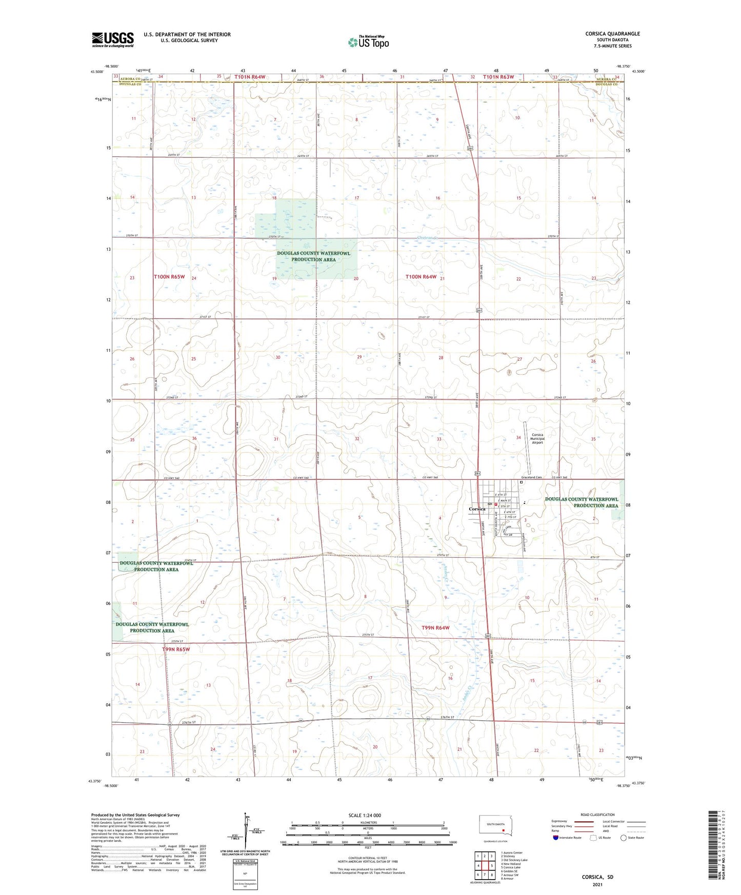
2021 topographic map quadrangle Corsica in the state of South Dakota. Scale: 1:24000. Based on the newly updated USGS 7.5' US Topo map series, this map is in the following counties: Douglas, Aurora. The map contains contour data, water features, and other items you are used to seeing on USGS maps, but also has updated roads and other features. This is the next generation of topographic maps. Printed on high-quality waterproof paper with UV fade-resistant inks.
Quads adjacent to this one:
West: New Holland
Northwest: Aurora Center
North: Stickney
Northeast: Old Stickney Lake
East: Corsica Lake
Southeast: Armour
South: Armour SW
Southwest: Geddes SE
This map covers the same area as the classic USGS quad with code o43098d4.
Contains the following named places: Anderson School, Beulah, City of Corsica, Clark School, Corsica, Corsica City Hall, Corsica Community Fire Department, Corsica Elementary School, Corsica High School, Corsica Middle School, Corsica Municipal Airport, Corsica Police Department, Corsica Post Office, Douglas County Ambulance Service Corsica, Garden Valley School, Graceland Cemetery, Grandview Townhall, Kunefke School, Messing School, Plainview School, Priscilla Club Library, Simpson Lake, Township of Grandview, Township of Walnut Grove, Van Vuren School, Vanden Hoek School, Walnut Grove Townhall, ZIP Code: 57328