MyTopo
Herrick South Dakota US Topo Map
Couldn't load pickup availability
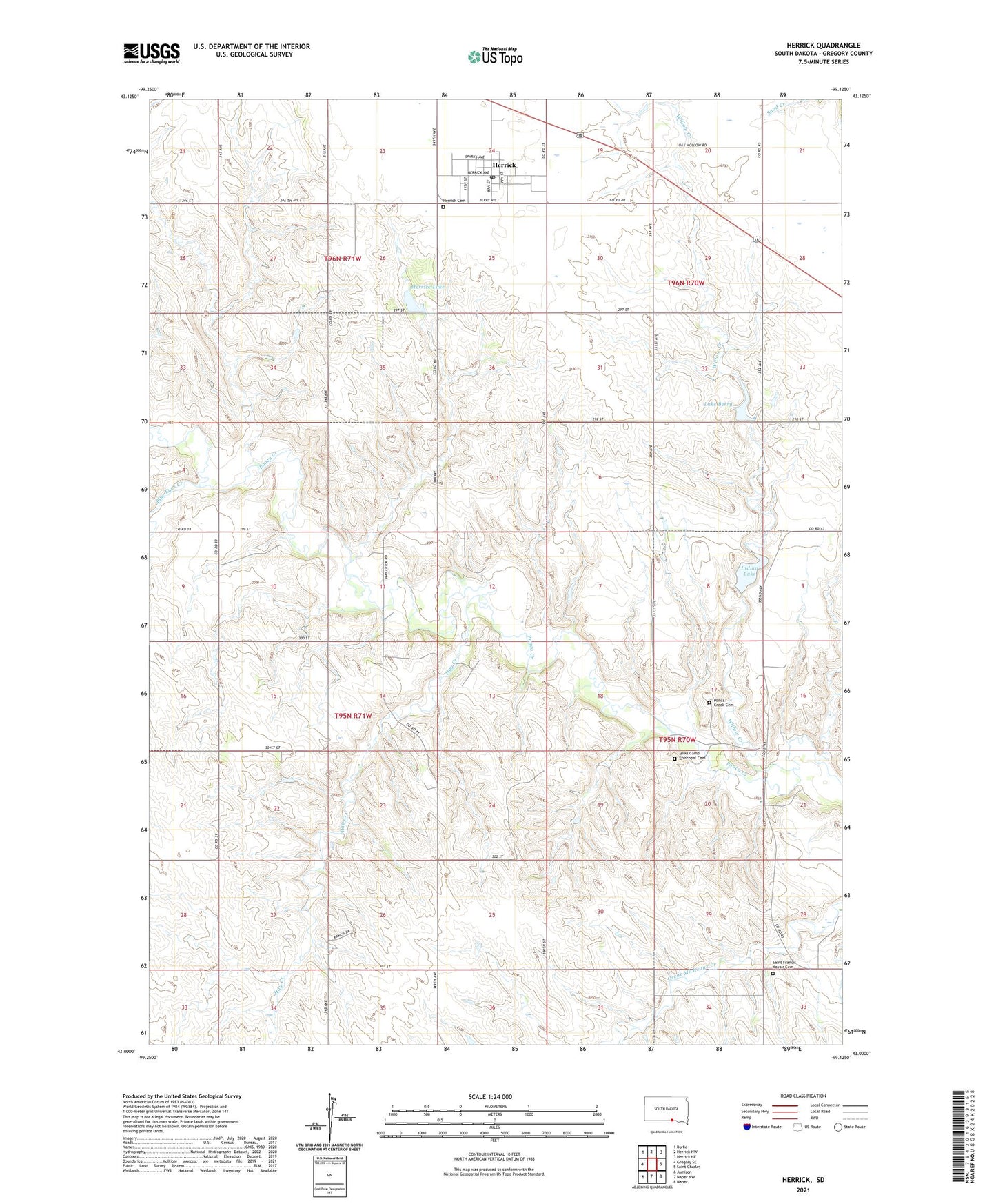
2021 topographic map quadrangle Herrick in the state of South Dakota. Scale: 1:24000. Based on the newly updated USGS 7.5' US Topo map series, this map is in the following counties: Gregory. The map contains contour data, water features, and other items you are used to seeing on USGS maps, but also has updated roads and other features. This is the next generation of topographic maps. Printed on high-quality waterproof paper with UV fade-resistant inks.
Quads adjacent to this one:
West: Gregory SE
Northwest: Burke
North: Herrick NW
Northeast: Herrick NE
East: Saint Charles
Southeast: Naper
South: Naper NW
Southwest: Jamison
This map covers the same area as the classic USGS quad with code o43099a2.
Contains the following named places: Berry Lake Dam, Blue Eyes Creek, Goodman School, Hay Creek, Herrick, Herrick Cemetery, Herrick Lake, Herrick Lake Dam, Herrick Post Office, Indian Lake, Lake Berry, Leonard Ziesler Number 2 Dam, Milks Camp, Milks Camp Episcopal Cemetery, Milks Camp Park, Milk's Camp Segment, Miller School, Ponca Creek Cemetery, Ponca Creek Church, Ponca Lake Dam, Saint Francis of Xavier Church, Saint Francis Xavair Cemetery, Spring Valley Township Hall, Town of Herrick, Township of Spring Valley, Township of Union, Unorganized Territory of Spring Valley, Willow Creek